Make Enhanced Satellite AIS work for you
 Written by
George Facaeru
Maritime Sales Director at Spire Global
Enhanced Satellite AIS provides easy to use, customizable data without any gaps in coverage – even in the busiest shipping lanes.
At Spire Maritime, we provide you with several data options and one of our solutions to common industry challenges, Enhanced Satellite AIS, has been receiving great reviews. As the maritime industry faces a challenging year of growth and climate change, solution providers are looking at new and innovative ways to use data sets to help ship operators, brokers, and port officials optimize their operations. Data and predictive analytics have become an important part of day-to-day maritime operations. From companies looking to bolster profit margins and safeguard cargo to port operators scheduling open port times.
Address Growth and Profitability
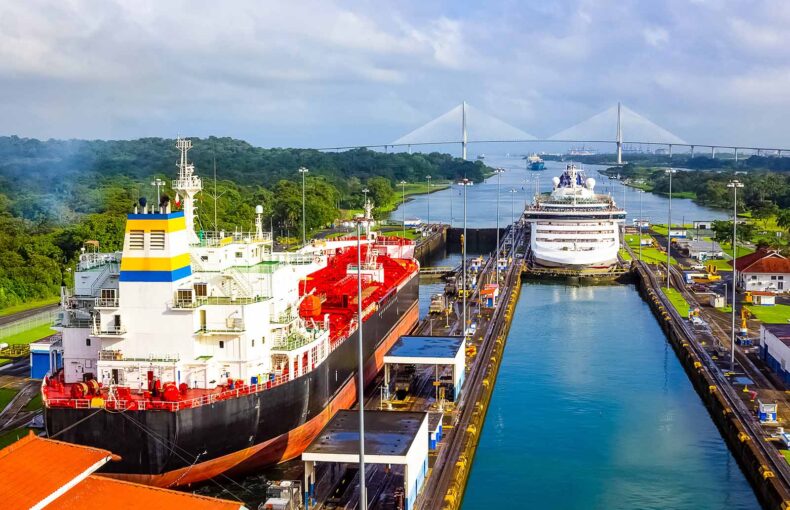
Enhanced Satellite AIS uses thousands of satellite-enabled AIS receivers traveling throughout the busiest shipping lanes in the world. It provides an unprecedented frequency of position updates in areas that are out of the reach of terrestrial collection and overwhelm other satellite AIS providers. This means more AIS messages, more unique MMSIs, and greater control of ship operations. From mapping the most efficient routes for fuel economy to plotting supply and demand based on ship location, ship operators can fine-tune logistics and port arrivals to optimize revenue.
Gain a Competitive Edge
As growth and competition heat up, maritime executives sought a way to gain an advantage over competitors but also required data to help them manage and improve their profitability. Many maritime products can be difficult to use or they provide a template of information that isn’t tailored to the special needs of the maritime industry. A common challenge for the industry is gaps in position updates in high Traffic Zones (HTZ), this leads to a lack of transparency and can disrupt many operations from commodity tracking to port management and safety at sea. Enhanced Satellite AIS is key to resolving these issues and get one-step-ahead of the competition.
The South China Sea is the most dynamic area in global maritime trade. Having gaps in data in this area has been a huge problem for all stakeholders in the maritime sector.
John Lusk
General Manager, Spire Maritime
Share on Facebook Share on Twitter Share on LinkedIn

Easy to Use and Customizable
We offer maritime data that is easy to access, completely customized for each customer, and comes with technical support to create the right data set for a company’s individualized needs. We are very excited about the positive impact Enhanced Satellite AIS will have for our customers. Enhanced Satellite AIS provides updates every 15 minutes with no gaps in coverage and is delivered through an easy-to-use API, which makes it an early industry leader in this segment.
Spire Maritime reported overwhelmingly positive feedback from customers using Enhanced Satellite AIS.
“A huge improvement has been made with Spire’s Enhanced Satellite AIS, with visibility in South China Sea now over 200% since the introduction of Spire Maritime’s Enhanced Satellite AIS”
Share on Facebook Share on Twitter Share on LinkedIn
Enhanced Satellite AIS combined with S-AIS and T-AIS delivered a 17% average increase in global position updates which helped ship operators gain a competitive advantage in terms of fuel efficiency and route allocation.
Download a free sample
See Enhanced Satellite AIS in action in the South China Sea.