We fine-tuned our solutions to help you save you time
 Written by
Maureen Thom
Contributing editor
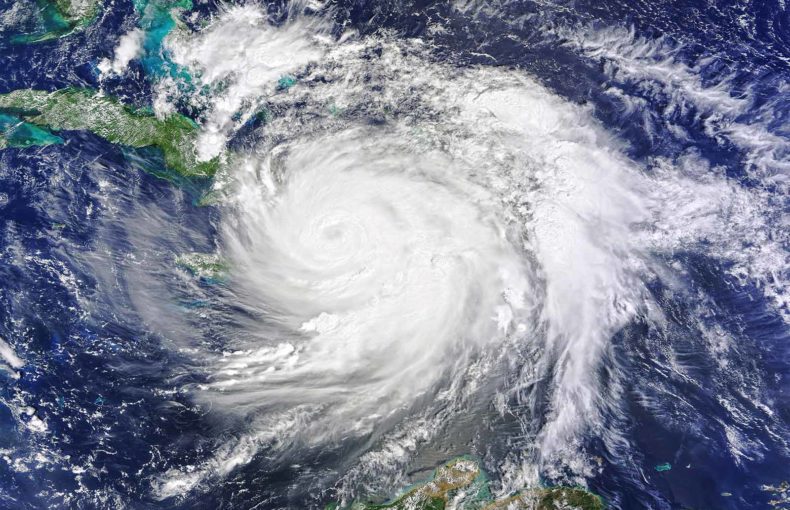
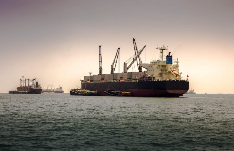
As climate change alters navigable sea routes in the Arctic and shipping companies scramble to maintain tight schedules to meet supply chain demand, container shippers, insurance investigators, and international traders face different challenges to ensure crew and cargo safety, manage fuel efficiency, and deliver improved customer service. We sat down with our resident maritime weather solutions expert Erez Arye to discuss why Spire is changing its maritime weather solutions and what this new direction means to the industry as a whole.
At Spire, we take a customer-first approach and after analyzing the challenges the maritime industry tackled in 2020, we thought the time was right to create industry-specific data solutions using real-time and historical weather. Tight profit margins, environmental regulations, and ever-changing pandemic processes created different challenges for maritime enterprises. Our industry-specific solutions are designed to help solve these challenges by identifying the factors that impact your business objectives.
Customized weather packages adapted to your needs
“When you consider how many industries rely on effective use of the ocean for their success, you realize the challenge with the ocean is it’s not a highway and there are so many dynamic attributes to take into consideration and these elements are constantly changing.”
Erez Arye
Head of Maritime Weather Product at Spire
Share on Facebook Share on Twitter Share on LinkedIn

Spire’s weather 2.0 solutions are easy to use, ready from day one, and tailored to meet the needs of your unique business challenges. Shipping companies operate on rigid schedules and others rely on certain types of weather to load and unload cargo, so we differentiated the needs of specific types of operations and identified their common uses. Our data solutions collect, analyze, and calculate the elements from a forecast that impact what you’re trying to accomplish. Smart data can be used to optimize fuel economy, estimate port arrival times, plan more efficient routes, estimate risk, claims and incident investigations, and more. We examined underlying factors that impact these types of planning and pulled the data that matters. Spire Weather 2.0 delivers data packaged for industries. This industry-specific data helps you manage the challenges that maritime companies deal with every day.
It’s the historical data you need for planning and the current forecast data you need to fine-tune your operations.
Better predict the future using our historical data.
We’ve collected multiple years of historical maritime and maritime weather data to help you identify weather patterns in specific regions and fuel your AI and predictive analytics models.
Here’s what’s different
“We mapped a series of questions that would be interesting for a maritime vessel crew to answer,” said Arye. “We thought this through as we know what maritime operations need and why they need it. So the hard work is done and customers can ingest the data.” With 10 years of historical forecasts across the entire planet plus Spire’s forecast data, the depth of the data is powerful. The operational usage-based set of attributes highlights exactly what each customer needs and creates a smart collection of data that is tailored-made for the challenges each industry faces. It completely eliminates scattered weather attributes and supports what you need from a maritime perspective.
Why do you need both historical and forecast data? Historical data is vital to predicting the weather, planning voyages, retroactive investigations, and daily marine activities. Current forecast data helps you fine tune your operations. Current forecast data has seen vast improvements in accuracy in only a few years. Open ocean Forecasts used to be laden with errors, but now thanks to gridded observation and radio occultation technology, forecasts are far more accurate. “The level of accuracy and the way we are pulling it is different,” said Arye. “It’s common to get a so-so forecast and you work with that. This is different; we are getting better forecasts.”
Satellite collection adds big value in terms of weather data accuracy as it can collect data from places that are hard to send a weather balloon or have a ground station, like remote open oceans areas for example. Satellites provide global atmospheric measurements and these measurements help strengthen regional weather forecasts.The atmosphere is connected and changes in conditions in one location impact conditions around the planet, propelling weather systems worldwide. Without satellites it was difficult to monitor such vast conditions as they travel vertically through the atmosphere. Conditions in the stratosphere, for example, from about 8 to 50 kilometers above the Earth’s surface turn into the events we experience on the ground. Our maritime weather data comes from both atmospheric insights and oceanographic insights. A condition halfway around the world that is currently developing will eventually impact the weather outside of your front door and at the port of call that a vessel is travelling to as well. These conditions impact global operations in major ways.
Changing climates and new business models push Maritime to lean on digitalization, what’s next?
Digitalization continues to move quickly across maritime as the challenges of managing changing weather patterns and the COVID-19 pandemic have swept across the globe. Data-driven decision making is more accessible now for non-data users through customized APIs that are flexible, intelligent, and easy-to-use.
Sorting through large volumes of data to isolate the data points that impact your optimal travel speed, route selection, or plan your port ETA however, make using data laborious and time consuming.
“There is a move towards weather routing and the main purpose is identifying the best or ideal navigation route. Whether that means the safest or most efficient route is up to you. We are looking at how many elements are vital for a routing recommendation system. We are considering things like vessel type, the commodity involved, equipment type and volume, and how full the vessel is for stability and safety and we’re ranking each element for risk, performance, and ETA accuracy.”
Erez Arye
Head of Maritime Weather Product at Spire
Share on Facebook Share on Twitter Share on LinkedIn