Leveraging global space-powered weather data to scale voluntary carbon markets
 Written by
Jon Pierre
Geotree CEO & Mantle Labs President
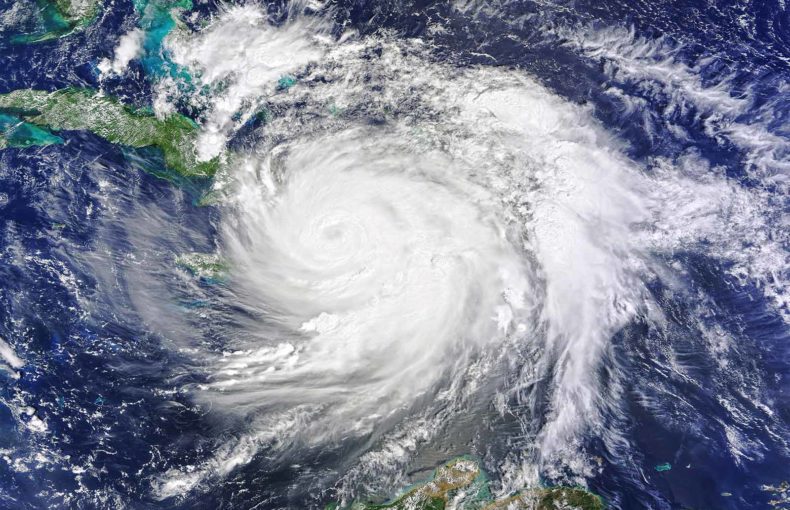
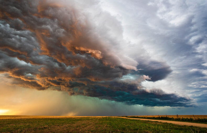
As climate change causes an increase in the intensity and frequency of storms, wildfires, droughts and other extreme weather events, the permanence of nature-based mitigation projects is increasingly threatened.
These projects can span forest conservation, tree-planting and sustainable agriculture. The urgency to act and understand risks is only growing, bringing together like-minded companies such as Spire Global, Mantle Labs and Geotree to harness the power of remote technology to maximise impact.
Nature based projects are not only vital for emission reduction or avoidance, but also hold the power to simultaneously improve food and water security, and the livelihoods of local communities. Projects with reliable monitoring, reporting and verification enable biological climate solutions to connect with international carbon markets, providing essential climate finance to those who need it most.
Non-permanence refers to the risk that emissions avoided or removed by a project do not remain so for the duration of the committed period. The permanence of a project may be jeopardised as a result of natural hazards such as wildfires, disease or droughts. In order to mitigate this risk, a self-insurance mechanism known as a buffer pool is typically used. Contributions per risk factor for forest offset projects typically contribute between 15% and 20% of their total credits to the buffer pool.
Using Spire’s weather data, Geotree is building a revolutionary weather risk assessment and monitoring product to support nature-based carbon projects. The product will provide carbon project developers, farmers, local communities, governments and other actors with valuable historical, real-time information and predictions to assess and mitigate natural hazard risk by utilising appropriate project design and land management strategies.
Research has shown that with insufficient data and calculations, buffer pools may be severely underestimated. According to a new report led by CarbonPlan, wildfires have depleted nearly one-fifth of the total California buffer pool intended for a 100-year period. As a result of these fires, six forest projects in California’s carbon trading system have released between 5.7mn and 6.8mn tonnes of carbon since 2015.
Robust historic assessment of hazards, future predictions and continuous monitoring of a project area are essential. Utilising Spire’s historical weather insights and location-specific weather patterns, Geotree’s pioneering remote risk mapping and warning system provides the reliable and thorough overview of project risk necessary to scale high-quality carbon projects, dramatically improve the accuracy of non-permanence risk predictions and aiding stakeholders in making projects as effective as possible.
Whilst certain corners of the globe can generate a consistent supply of accurate weather and observational data, many regions do not have the necessary traditional on-ground infrastructure. This is particularly the case in the locations with the greatest potential for large-scale carbon projects. Geotree and Mantle Labs provide a solution to this and are particularly passionate about empowering land owners and farming communities in places such as in Brazil, Sub-Saharan Africa and India.
Spire has one of the world’s largest constellations of nano satellites orbiting in close proximity to Earth. Using an innovative technique called radio occultation to collect thousands of atmospheric readings a day, Spire monitors pressure, humidity and temperature 24/7 across all points of the globe from the most remote regions to open oceans. Putting this data in the right hands of cutting-edge and innovative entities such as Geotree ensures that benefits are maximised in the journey to tackle climate change.