Marine AIS Data
Maritime AIS Data for vessel tracking
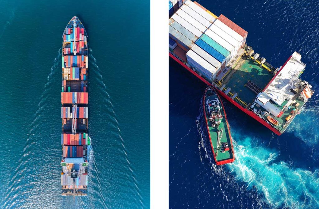
Your trusted source of data powering the most innovative organizations in the maritime industry.
What we do at Spire Maritime
Spire is the unrivaled open ocean and shore coverage provider revolutionizing how maritime data is collected, analyzed, and delivered, to improve supply chain tracking and route optimization, insurance and compliance, commodity intelligence, environmental monitoring, etc.
We aim to lead the maritime industry’s digital transformation by expanding our open ocean and shore coverage, delivering the most accurate and comprehensive vessel tracking data through cutting-edge technology, and enabling unprecedented insights that empower maritime stakeholders to make the best-informed decisions.
Why choose Spire Maritime?
Most complete source of AIS data
Spire Maritime has the largest proprietary constellation and highest volume of messages tracked by satellite, Detecting over 600K vessels and 250K active vessels per day. We offer the most complete picture of AIS data on the market with data dating back to 2010.
Only constellation providing real-time AIS on the market with latency of less than 1 minute
This offers up-to-date and accurate view of the world’s shipping activities with 24/7 global coverage.
Track vessels anywhere and at any moment in time
Increase your situational awareness by accessing vessel positions worldwide or in areas of interest.
Leverage accurate and actionable data
Make better‑informed decisions, even in highly congested traffic areas, with enhanced vessel detection.
Accessible through modern APIs
Designed by developers, for developers.
Best in class support including:
- Continuous Support (live technical and customer support, including onboarding and developer documentation)
- Accessible through Modern APIs designed by developers, for developers
- Easy integration with support from dedicated Spire engineers
- 24/7 global satellite coverage
- Wide array of digital resources
Configure your AIS data solution
What is AIS vessel tracking data?
Are you a developer? Start here
How are our customers using AIS?

Our range of Maritime AIS data solutions for vessel tracking
![]()
Standard AIS
Unrivaled ocean coverage, data quality, and developer-friendly AIS APIs with Standard AIS.
![]()
Real-time AIS data
The highest-frequency AIS data empowers you to track in real-time the world’s shipping activities.
![]()
Historical AIS data
Historical AIS vessel tracking data going back to 2011, delivered via fast APIs or one-time downloads.

AIS Position Validation
Advanced RF signal-based vessel detection & tracking to validate vessels’ positions.
Our range of Maritime AIS data solutions for vessel tracking
![]()
Standard AIS
Unrivaled ocean coverage, data quality, and developer-friendly AIS APIs with Standard AIS.
![]()
Real-time AIS data
The highest-frequency AIS data empowers you to track in real-time the world’s shipping activities.
![]()
Historical AIS data
Historical AIS vessel tracking data going back to 2011, delivered via fast APIs or one-time downloads.
AIS Position Validation
Advanced RF signal-based vessel detection & tracking to validate vessels’ positions.
Optional features available
Enhanced AIS
Fill in the gaps in global AIS ship tracking data, especially in high traffic zones with Enhanced AIS

Vessel to Port ETA
Reliable, machine-learning powered port ETAs and route predictions for specific vessels with Vessel to Port ETA
Port Events
Get access to worldwide Port Events, including terminal and anchorage events, in a convenient API

Vessel Characteristics
Detailed vessel data including ownership, build, technical information, registration & capacity with Vessel Characteristics
Optional premium features available
![]()
Enhanced Satellite AIS
Enhanced Satellite AIS fills in the gaps in global AIS ship tracking data, especially in High Traffic Zones.
![]()
Vessel to Port ETA
Get more reliable, machine-learning powered port ETAs and route predictions for specific vessels.
![]()
Port Events
Get access to worldwide port events, including terminal and anchorage events, in a convenient API.
![]()
Vessel Characteristics
Detailed vessel data: ownership, build, technical information, registration, capacity.
Why Spire Maritime data?
![]()
Data collected from multiple sources
We combine Satellite AIS, Terrestrial AIS, and Enhanced Satellite AIS, to provide wide coverage and give our customers a serious competitive edge.
![]()
Unique coverage in high‑traffic zones
Enhanced Satellite AIS collects data in busy shipping lanes, providing unprecedented coverage, especially in the most congested areas.
![]()
Convenient delivery methods
We deliver live maritime tracking data through easy-to-use APIs or live feeds (TCP raw NMEA), as well as custom historical data file delivery.
![]()
Continuously improving data
New satellites added to our constellation each year means a constant increase in quantity and quality of data delivered and reduced latency.
![]()
Documentation and
live support
Get started quickly with our global technical and customer support, customer-centric on-boarding, and detailed documentation.
Use cases
What is Spire AIS Data useful for?
Application Development
Our maritime data is ideal to develop applications that integrate vessel tracking and maritime information.
Defense & Security
Reliable, real-time maritime data for enhanced situational awareness and smarter decision-making when every second counts.
Financial Services
Global data on the world’s shipping and cargo location is essential to get an accurate pulse of global commodities.
Fleet Management
AIS data is essential in running an efficient, compliant and profitable fleet, and ensuring the safety of crew and vessel.
Logistics & Supply Chain
Access data that minimizes the impact of supply chain disruptions, as well as reliable ETAs to optimize port resources.
Oil and Gas
Make remote asset tracking and protection easier with our data, and significantly mitigate risk in remote regions.
Port Operations
Get access to accurate data to optimize short- and long-term port operations and allocate resources effectively.
Illegal Fishing
Our data helps to establish and monitor fishery protection measures against overfishing or illegal fishing.
Environmental Protection
Preserve ecossystems using data by identifying breaches into protected or sensitive areas.
Search and Rescue
Maritime data empowers shore-side authorities in risk and vulnerability analysis and resource planning.


Customer testimonials
“The accuracy, the availability, and the redundancy of the data feeds we get from Spire Maritime, these elements are really critical in Starboard’s ability to provide a robust and trusted service.”
Trent Fulcher
CEO, Starboard Maritime Intelligence
“What I like about working with Spire is that we get data from a lot of different sources. I can definitely recommend working with Spire for anyone who is looking for fast innovation and accurate data.”
Michiel Valee
Co-founder and Tech Lead, Dockflow
“It’s been really fantastic how flexible Spire has been, and how they have been able to work with us on an individual basis to make sure that the data fits our needs.”
David Kroodsma
Director of research and innovation, Global Fishing Watch
“Partnering with Spire was a great decision for our team, it’s given us the highest quality AIS data that we could find, which is fundamental to the platform that we’re building.”
Gary Lloyd
Chief of Architecture and Strategy, 90POE
“Getting the Spire information allowed us to develop a predictive tool with a hight degree of situational awareness.”
Art Salindong
Founder and CEO, Trabus Technologies
“The customer focus has really been what keeps us within Spire.”
Ingvi Georgsson
Co-Founder, Styrid