Using the power of weather data to drive local wildfire awareness
Free wildfire use case
Wildfires average 7 million acres of burnt land annually
Wildfires can either crackle and hiss out quickly or can extend their damages within a heartbeat to thousands of acres of land.
Download your free customer use case to understand how accurate weather data can help save countless lives and spread awareness.
Download now:
Free wildfire use case
Wildfires average 7 million acres of burnt land annually
Wildfires can either crackle and hiss out quickly or can extend their damages within a heartbeat to thousands of acres of land.
Download your free customer use case to understand how accurate weather data can help save countless lives and spread awareness.
The past twenty years have seen an average of 7 million acres of land burning annually due to wildfires. With a yearly average of 70,000 wildfires, 2022 will be no exception with over 54,000 wildfires to date (October 2022). Companies such as the Analytical Moose are using Spire’s satellite-powered weather data to drive real-time wildfire awareness so as to minimize its catastrophic impact.
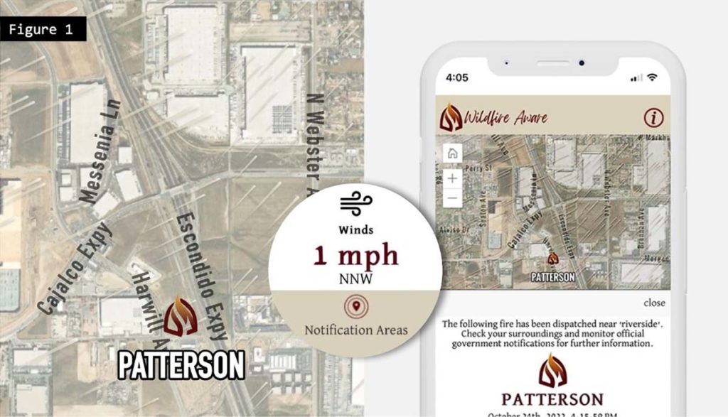
The figure above highlights a newly formed wildfire where the boundary is either unknown or so small that an individual point is used to represent the current location, while Spire current weather conditions are overlaid onto the map to give an indication of which direction the fire may spread. Further down the page, the application provides the user with additional weather information that contributes to the volatility of a wildfire.
Download the wildfire use case now to see Spire Weather’s data in action now in fighting wildfires!