Four Misconceptions About Ocean Weather Forecasts
- You can't sum up ocean weather conditions with an emoji
- Remote ocean data is plentiful and if it is very remote, it doesn't impact the weather near me
- If Meteorology is a science, it should be accurate
- Modern data collecting techniques gather enough data to build solid prediction models, so errors shouldn’t happen
- Better predict the future using our historical data
 Written by
Maureen Thom
Contributing editor
Water never sits still. Earth’s water cycle keeps water moving from place to place and from one form to another – it’s constant motion and because of this simple fact, it is challenging to forecast these ever-changing conditions.
In this blog, we’re taking a deep dive into the misconceptions about ocean weather forecasts from the challenges of collecting data in remote locations to climate change and its growing impact on accurate forecasting. Here are four common misconceptions about ocean weather forecasting:
1. You can’t sum up ocean weather conditions with an emoji
We all do it, we grab our smartphones and summon the weather app to decide when to go somewhere, what to wear, and what to bring. The weather is volatile, complicated, and rapidly changing which makes it nearly impossible to sum up in one emoji. Ocean weather is often more complicated to forecast than weather in suburban America for example, because ocean forecasts are the sum of many moving parts: ocean currents, wave height, and wind speed to name a few. All of these factors all impact ocean forecasts. Combining these factors and estimating their evolution amounts to a perfect storm of conditions that influence the weather around the planet. To get an accurate view of sea conditions, you need to combine atmospheric forecast data (temperature, pressure, and humidity) and oceanographic forecast models ( currents, waves, etc). In other words, what is happening in the air and what is happening on the ocean’s surface and how each is affected by the other.
2. Remote ocean data is plentiful and if it is very remote, it doesn’t impact the weather near me
A storm brewing in a remote ocean area travels and changes weather conditions far from the remote area where the inclement weather first formed. Weather, like water, is always moving and always changing. So it makes sense that warmer than usual weather in the Arctic, directly impacts weather patterns from the United States to Europe and everywhere in between. Weather data in remote areas is challenging to collect. You can’t rely on weather stations and widespread sensors that make data collection easy. For remote ocean data, remote sensing techniques like satellite radio occultation have become essential for atmospheric data collection.
Radio Occultation (RO) captures detailed temperature, humidity, and pressure information across the entire planet, including vast oceans and under-observed corners. This results in better forecast accuracy everywhere. Before Radio Occultation, maritime models depended on a combination of buoys, sensors on ships, offshore structures, aviation sensors flying overhead, and weather balloons for ocean data. All of these techniques are not accessible in remote ocean locations. RO is quickly becoming the go-to solution for open ocean forecast data.
3. If Meteorology is a science, it should be accurate
This is partly true, but there is an art/science approach to forecasting and meteorology that is essential because of the degree of complication and the constantly changing conditions. There isn’t one exact method of forecasting that works in all situations. Forecasting relies on the science of equations and these equations are what meteorologists use to explain the physical processes occurring in the atmosphere. Yet, what is occurring in the atmosphere is impacted by these physical processes. So you need to understand how certain conditions change certain patterns. And since we’re focusing on ocean forecasts, you need to consider changing ocean temperatures, precipitation, water vapor, wind speed, and more to determine how an incoming weather condition impacts these elements.
Climate change, too, makes these predictions more challenging, as it represents unchartered waters when calculating weather conditions not typically found during certain seasons. The Polar Vortex in November of 2020 for example set into motion strong surface winds from upper atmospheric phenomena that pushed sea ice across the central Arctic Ocean. Arctic wind speed and direction create changing weather patterns and when combined with stratospheric warming events, can result in what is referred to as “atmospheric waves” that create an imbalanced polar vortex. This imbalanced polar vortex can lead to blizzard conditions similar to those seen in 2013 and 2014 across the United States. Forecasters rely on historical data to predict these types of conditions. Before climate change, these incidents didn’t occur as often. The onset of climate change created a renewed demand for historic data because it allowed meteorologists to go back and study patterns from 10 years ago and longer and chart changes and patterns that help identify weather patterns today.
4. Modern data collecting techniques gather enough data to build solid prediction models, so errors shouldn’t happen
Yes, sort of. All weather models are wrong to some extent. Technologies, like Machine Learning, are applied to forecasting to reduce errors, and they are having a big impact on accuracy, but they don’t deliver 100% accuracy. The reality of forecasting is that it isn’t perfect and it isn’t perfect because ocean data is complex and oftentime there isn’t enough ocean data available to build a perfect forecasting model. One way to rectify this data shortage is to diversify the data you’re using. If you pull data from a variety of sources that contribute to weather patterns, you can feed machine learning models to reduce errors. For example, if you incorporate wave data into your forecasting model you can begin building a numerical weather model that digests different variables for weather prediction. Ocean waves affect coastal dynamics and ocean activities and they are indicators of other surface conditions, like high winds. Using data from multiple sources has been shown to lead to better, more accurate weather models. Optimizing your weather data to smaller, data-dense areas is another strategy for building better forecasting models.
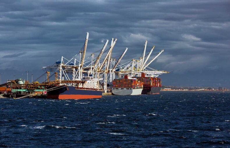
Weather forecasts optimized for seaports, for example, is one such scenario that is proving popular among maritime operations. Port weather impacts a variety of port services around the globe and the forecasts need to be accurate to time grain unloading and other types of cargo that are weather sensitive. By focusing on a small area where data is abundant, you can measure many factors to determine a short term weather forecast with greater accuracy.
Better predict the future using our historical data.
We have a 10 year reanalysis archive of historical maritime weather data to help you identify weather patterns in specific regions and fuel your AI and predictive analytics models. Customized to business needs.