Rounds of stormy weather to bring holiday travel headaches to western United States
 Written by
Nicole LoBiondo
Meteorologist and Weather Risk Communicator
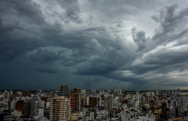
Thanksgiving and the upcoming winter holiday season may have a stormy beginning.
Thanksgiving and the upcoming winter holiday season may have a stormy beginning. An active storm train is gearing up over the western United States, spelling potential travel delays for those planning to visit the region in the days leading up to Thanksgiving.
A succession of storms is foreseen to traverse the area, delivering precipitation in the form of rain and mountain snow from the Pacific Northwest to California over the upcoming weekend and extending into late November. The first storm, currently under the watchful eye of Spire meteorologists, is set to impact the Pacific Northwest through Saturday night.
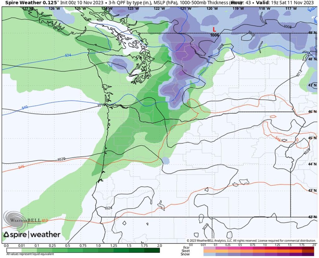
Moisture from the Pacific Ocean, in the form of an atmospheric river, will lead to intermittent heavy rainfall along the Washington and Oregon coasts. Snow mixed with rain may fall as low as 5,000 feet, creating slippery conditions in major passes across the Cascades, including Snoqualmie and Stevens Pass. The peak impact from heavy rain and mountain snow is expected on Saturday morning.
Accompanying atmospheric river events are often gusty winds, and rough, dangerous seas. Coastal areas and higher terrain will likely experience windy conditions. A brief respite is anticipated on Sunday for the Pacific Northwest before another round of rain and mountain snow hits Sunday night into Monday. Rain is forecasted to extend farther south across portions of Northern California, with mountain snow anticipated in the highest peaks of the Oregon Cascades.
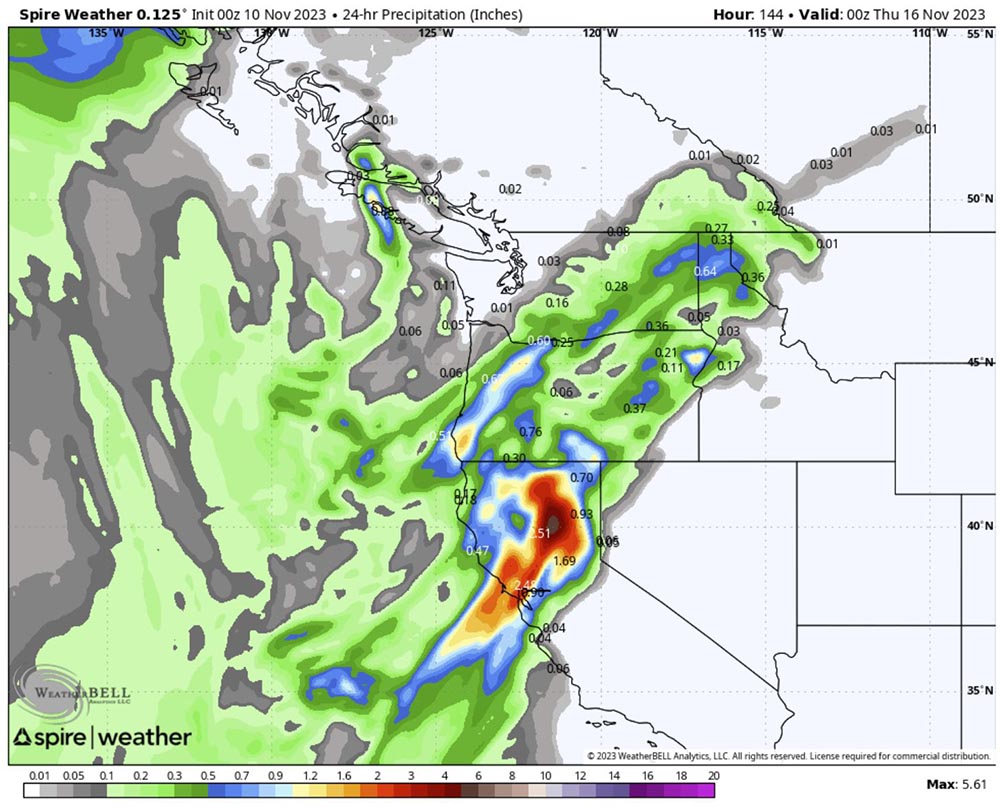
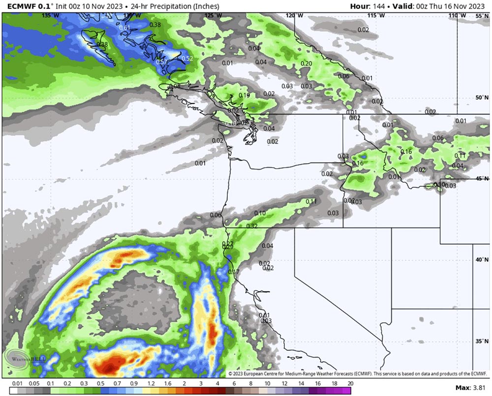
Cloudy skies and occasional showers will be the rule through the early to middle parts of next week as another storm eyes the Northern Californian coast. This storm is expected to be more potent and has the potential to bring inches of rain to areas around and north of San Fransico. Although the storm’s track is not yet definitive, residents and travelers are advised to stay vigilant and monitor the forecast closely.
This same storm is expected to swirl just off the California coast until late next week and may bring a few showers to Big Sur along the central coast to Santa Barbra, California. For context, Santa Barbara reported a trace of rainfall on September 22nd and saw no rain throughout October, despite the usual average of nearly an inch for the month.
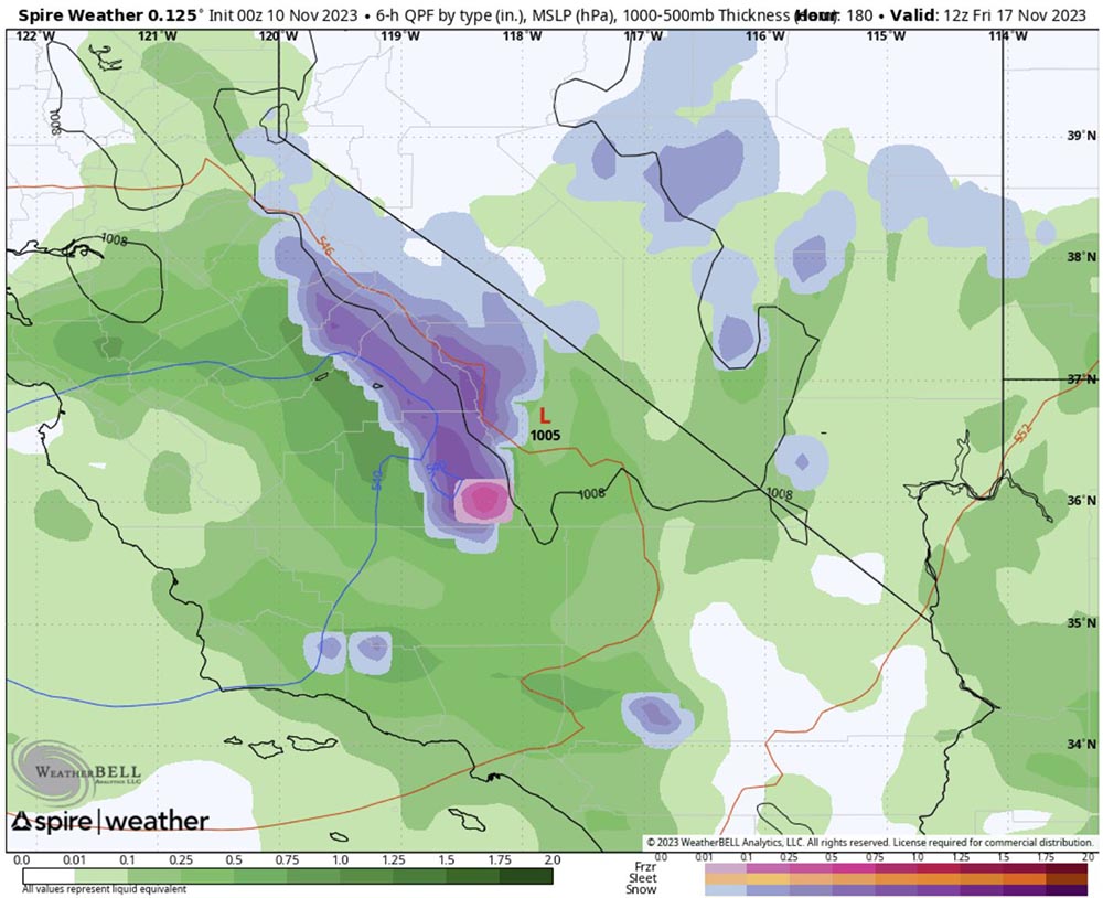
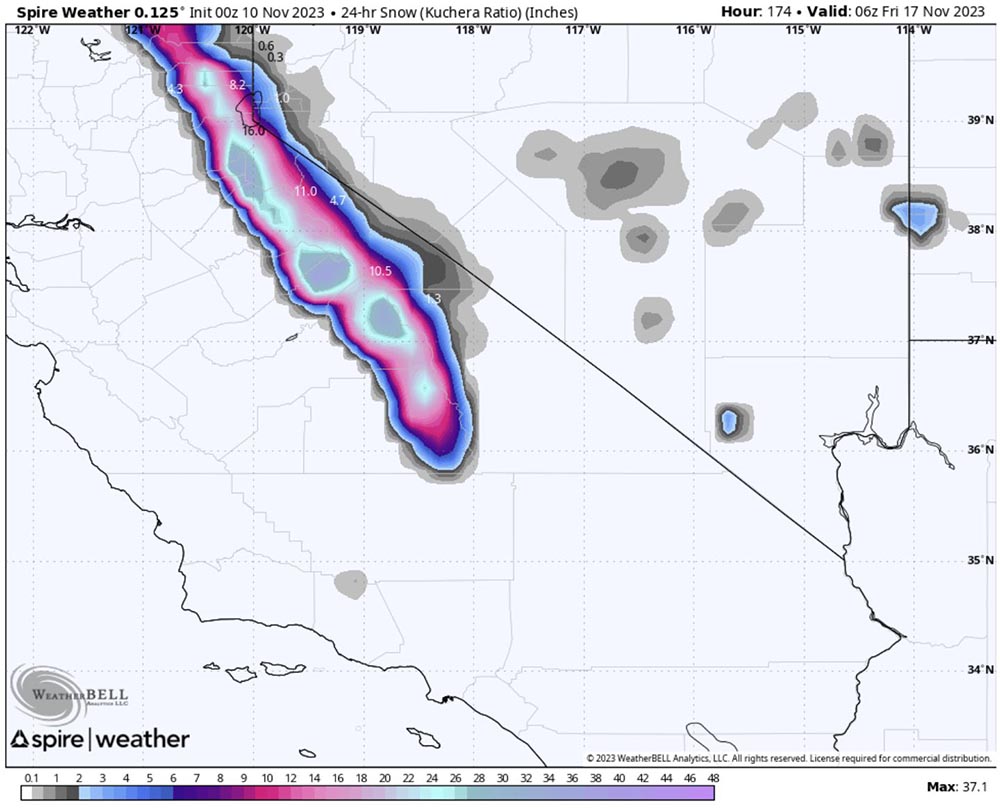
The stormy pattern is set to persist across California and the Pacific Northwest into the following weekend. A significant surge of Pacific moisture could heighten the risk of mudslides, flash flooding, and heavy mountain snow across major passes. This storm has the potential to be Southern California’s first major rainmaker in months and could mark the first significant snowfall for the Sierra Nevada. Travelers and residents are urged to stay informed and exercise caution in the face of potentially challenging weather conditions.