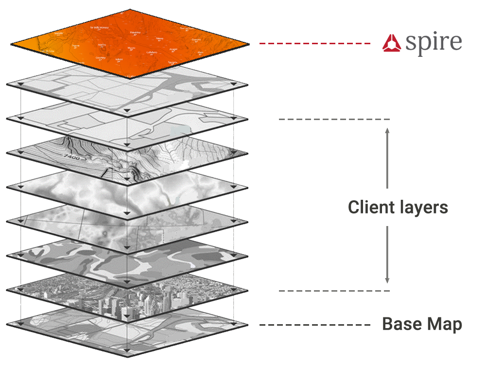
Spire Weather Web Map Service
WMS (Web Map Services) is a turnkey solution to visualize weather forecast data into base maps and applications.
What is WMS?
WMS (Web Map Services) is a standard created by the Open Geospatial Consortium to deliver map layers (images) through the internet.
Request a free trial
Please fill in the form below, and one of our representatives will be in touch shortly.
Easy to use
Choose from several different styles for each WMS layer to compose multiple views of the same information. These two images are both visualizing the same exact forecast data styled in 2 different ways.
Quickly integrate weather forecast visualizations into your GIS platform, web-site, or mobile application in just a few minutes.
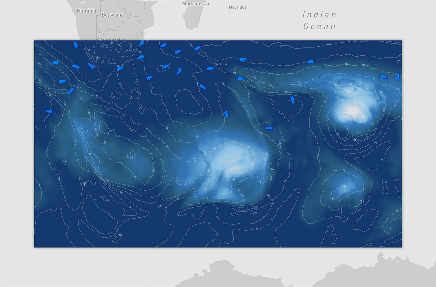 Wind Gusts contour lines
over
10‑Meter Wind Speed in color
over
Wind Gusts in color
Powerful
Spire Weather provides multiple Web Mapping Service (WMS) visualizations for each weather forecast, and users can choose which time to show or play through all of them sequentially.
Choose from a variety of weather variables and visual styles to enhance your platform.
Available styles
Temperature values are provided in Celsius, Fahrenheit, and Kelvin.
Wind and ocean current speed values are provided in knots and meters/second.
Wave height values are provided in meters and feet.
Basic bundle
- 2-Meter Air Temperature
- Color
- Contour Lines
- 2-Meter Dewpoint Temperature
- Color
- Contour Lines
- Mean Sea-Level Pressure (hPa)
- Color
- Contour Lines
- 2-Meter Relative Humidity
- Color
- Contour Lines
- Total Precipitation (mm)
- Color
- Contour Lines
- 10-Meter U-Wind Component
- Color
- Contour Lines
- 10-Meter V-Wind Component
- Color
- Contour Lines
- 10-Meter Wind
- Color
- Contour Lines
- Vectors
- Wind Barbs
- Wind Gust
- Color
- Contour Lines
Maritime Bundle
- Significant Wave Height (combined wind waves + swell)
- Color
- Contour Lines
- Mean Wave Direction (combined wind waves + swell)
- Color
- Contour Lines
- Mean Wave Period (combined wind waves + swell)
- Color
- Contour Lines
- Sea-Surface Temperature
- Color
- Contour Lines
- Ocean current eastward component
- Color
- Contour Lines
- Ocean current northward component
- Color
- Contour Lines
- Ocean Current
- Color
- Contour Lines
- Vectors