A guide to maritime weather data for shipping
 Written by
Rami Deeb
Marketing Campaign Specialist
Spire provides global businesses with maritime weather data APIs to guide their ships, mitigate risks, enhance efficiencies, and streamline decisions.
Maritime weather data is information related to the state of the seas,oceans and the atmosphere aloft, such as ocean currents, wave height, wind speed, air pressure, and visibility. This information can be used for navigation and planning purposes by seafarers and is critical for the safety and efficiency of global shipping operations.
Maritime weather data enables ships to navigate safely and to make informed decisions, such as altering course to avoid bad weather or choosing the best route to take advantage of favorable winds, waves and ocean currents.
Maritime related use cases are not restricted to locations over sea only. For instance, on land, hyper-local weather forecast data is used by ports to ensure safe docking and unloading of cargo, all while predicting when vessels are going to arrive. In this blog post, we will discuss the importance of maritime weather data, the different types of data available, and how they can be used to improve shipping operations.
The importance of maritime weather data
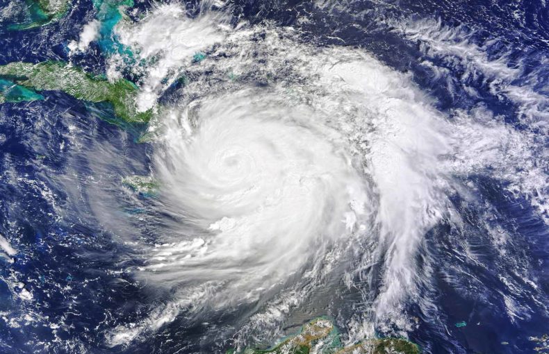
Maritime weather data is used to provide information about the current and forecasted weather conditions in the oceans and coastal areas. These insights can be used to plan safe and efficient routes for ships, as well as to make decisions about cargo and ship loading. Additionally, accurate weather data can help ships avoid dangerous conditions such as tropical cyclones, severe thunderstorms, and rough seas, which can lead to damage to the vessel or cargo and even loss of life.
According to Allianz’s Safety and Shipping Review 2022 report, around 90% of global trade is transported by the maritime transportation sector, making vessel safety essential. The global shipping fleet was losing 200+ ships a year in the early 1990s. During the past four years, the number of ship losses has decreased to about 50-75 vessels a year. This statistic is impressive especially as there are an estimated 130,000 ships in the world’s fleet (over 100 gross tonnage), up from around 80,000 thirty years ago.
In 2021, the maritime industry maintained its positive safety trend with 54 reported total losses as opposed to 65 losses the year before. Annual shipping losses have decreased by 57% (127) since 2012, and 2021 saw a significant improvement over the rolling 10-year loss average (89). The decrease in shipping-related accidents is a direct impact of the implementation of safety measures in recent times. Regulations, improved ship design and technology, and developments in risk management and mitigation have all contributed to increasing the safety of the industry.
Plus, using maritime weather data has several hidden cost savings for shipping companies. For example, shipping companies might be able to benefit from lower insurance premiums, saving on crew overtime pay due to inefficiencies, and avoiding penalty fees from port operators due to delays in arrival and schedule.
Most importantly, leveraging accurate and reliable maritime weather data helps the shipping industry become more environmentally friendly and compliant with regulations. It has become mandatory for all maritime operators to calculate their attained Energy Efficiency Existing Ship Index (EEXI) and to initiate the collection of data for the reporting of their annual operational Carbon Intensity Indicator (CII).
The reason for these regulations is to ‘reduce the carbon footprint of ships by 40% by 2030 compared to the 2008 baseline‘. Decarbonizing the shipping industry requires a holistic approach involving data-driven efficiencies, policies, automation, smart ports, and cleaner fuels, to name a few.
Reach your compliance goals with our maritime weather forecast API
Types of maritime weather data
There are several types of maritime weather data available, including data on sea winds, waves, currents, temperature, and precipitation.
Wind data
Most vessels would like to avoid windy conditions as it, depending on the direction, often negatively impacts the ship’s efficiency or the safety of crew and cargo. Wind data is therefore an important ingredient in any voyage optimization algorithm.
Wave data
Just like wind, most ships would like to avoid rough sea conditions as it negatively impacts the ship’s efficiency or the safety of crew and cargo. Wave data is strongly correlated with the wind data. However, both data sets are needed because not all waves are generated by the local wind conditions. A ship can experience treacherous waves that were generated many days ago and thousands of miles away. Wave data is a critical component in any voyage optimization algorithm.
Ocean currents
Although often not dangerous by themselves, insight into ocean currents is crucial for any ship optimization calculation. It can also be used to predict the movement of floating debris, including icebergs.
Temperature and precipitation
These two weather parameters are used to forecast weather conditions that may affect the transport of bulk cargo and reefer containers
Maritime weather data can also be used to improve shipping operations. For example, wind data can be used to optimize the speed and fuel consumption of ships. Wave height data can be used to ensure that ships are not at risk of capsizing. Additionally, weather data can be used to optimize the scheduling of ship maintenance and repairs, which can help to minimize downtime and increase efficiency in the long run.
How to collect and use maritime weather data
Maritime weather data can be obtained from various sources such as satellites, buoys, vessels and ground stations. Once collected, the data is then distributed through commercial companies or government agencies like NOAA (National Oceanic and Atmospheric Administration) or the Maritime & Coastguard Agency (MCA) branch of the Met Office in the UK which provides maritime weather forecasts and alerts to the general public.
Many private companies also provide weather data, often with a focus on specific regions or shipping routes. Some ships also have their own weather monitoring equipment, which can be used to provide real-time data.
Climate change is increasing the need for complex and accurate weather forecasting data. As a result, maritime shipping companies’ needs have evolved to require a single source of information that is reliable, accurate, robust, and centralized.
Spire has one of the largest private constellations of nano-satellites in orbit, comprising more than 100 Low Earth Multi-Use Receiver (LEMUR) satellites and collecting a vast amount of weather observations. The LEMUR measures key parameters like temperature, humidity, and pressure through a technique called radio occultation.
Radio occultation is the process of measuring the amount of bending that radio signals undergo while traversing between the ionosphere and Earth’s surface as a result of the temperature, atmospheric pressure and humidity.
Once the data is collected, it is then incorporated into Spire’s proprietary weather forecasting model which goes out up to 15 days into the future. The forecast is delivered to Spire’s clients through an API that offers multiple types of weather data in various formats.
This flexibility ensures that our customers are able to leverage Spire weather data depending on their needs. For example, a user can download current wind speed data for the entire Pacific Ocean in Grib2 format. Via that same API, another user can retrieve the ocean temperature of predefined points in a planned route of its vessel. Even more, a user can receive maritime weather data for specific destinations such as ports.
Some of the use cases for maritime weather data include:
- Optimizing shipping routes to avoid extreme weather events and become more environmentally friendly and cost-effective
- Optimizing port operations and other points of interest
- Gaining a competitive advantage over other shipping companies
- Complying with environmental regulations in regards to the Carbon Intensity Indicator (CII)
To put this all into perspective, watch this webinar to learn more about why the shortest maritime route isn’t always the most fuel-efficient. Chris Manzeck, Meteorologist and Product Marketing Manager, had a discussion with Luc Terrral, cofounder of BluePulse, one of the global leaders in AI-powered predictive maintenance for the maritime industry. During their chat, Chris and Luc discussed how BluePulse takes advantage of Spire weather data to develop a routing algorithm for reefer container transport. Voyages for ships carrying refrigerated containers can be further optimized by looking at parameters like air temperature, cloudiness and precipitation.
After using Spire weather data combined with their in-house artificial intelligence algorithms, BluePulse was able to save 297 MWh reefer energy per crossing, reduce their carbon footprint by 90,000 tons eqCO2, and ultimately offer the world the potential to save €20M in operational costs.
Watch the webinar on demand now
To use maritime weather data, ships and shipping companies can employ weather analytics, routing, and voyage optimization software, which can help to make sense of the data and make informed decisions quickly and easily.
Maritime weather data adds a layer of safety in a world of uncertainty
In conclusion, maritime weather data is essential for the safe and efficient operation of ships. Accurate and up-to-date information about winds, waves, currents, temperature, and precipitation can be used to plan safe and efficient routes, make decisions about cargo and ship loading, and optimize the operation of ships. Shipping companies can take full advantage of the available weather data and technology to improve their operations and keep their ships and cargo safe.
Talk to one of our experts now to learn more about our maritime weather forecast API and solutions.