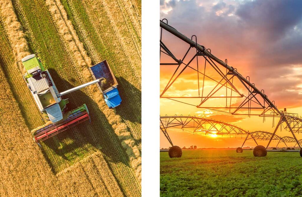
Smarter agriculture starts from space
Spire’s Soil Moisture Insights and advanced weather forecasts help optimize planting, irrigation, and harvest decisions. Improve yields, increase input efficiency, and manage climate risk with global satellite-derived data.
Request a live demo
The problem
Agricultural data gaps
Climate volatility is amplifying agriculture’s long-standing weather risks. More frequent droughts, floods, and heat are driving crop stress and economic losses, as shifting conditions intensify pest and disease pressure.
Yet the environmental data infrastructure supporting agriculture has fallen behind. Public soil moisture datasets lack the spatial and temporal resolution needed for timely agronomic decisions, and coarse public forecasts fail to capture localized impacts, leaving yields and capital exposed.
Compare data sources
Agriculture data sources at a glance
| Feature | Drones (camera sensors) | Radar satellites (SAR) | Public soil moisture data | In-field sensors | Spire’s unified soil + weather data |
|---|---|---|---|---|---|
| High spatial resolution (<100 m) | Yes | Yes | No | Yes | Yes |
| Affordability | No | No | Yes | No | Yes |
| All-weather/day-night/foliage penetrating | No | No | Yes | Yes | Yes |
| Near-real-time (24-hr latency) | Yes | No | Yes | Yes | Yes |
| Daily updates | Limited | No | Yes | Yes | Yes |
| Scalable (local → global) | No | No | No | No | Yes |
| Historical insights | No | No | Limited | No | Yes |
| Accurate forecast insights | No | No | No | No | Yes |
The solution
Spire’s integrated soil moisture data + weather forecasts
By combining GNSS-Reflectometry (GNSS-R) and Radio Occultation (GNSS-RO), we deliver global intelligence that enhances agronomic decision-making.
This integration enables more accurate and seamless monitoring of plant-available water, improves forecast reliability – even in remote regions – and supports better prediction of storm intensity. As a result, farmers and agronomists gain greater confidence in assessments of rainfall, frost risk, heat stress, and extreme weather events, allowing for smarter, more informed management of crops.
![]()
Soil Moisture Insights for agriculture
- Daily, global soil moisture observations, unaffected by cloud cover
- 40-year historical soil moisture data archive
- Spatial resolutions from 6 km to 500 m and 100 m
- Soil moisture anomalies relative to climatology
- Soil moisture forecasts extending to six weeks ahead
![]()
Weather forecasts for agriculture
- Rapid refresh, site-specific hourly forecasts out to 15 days
- High-resolution regional forecasts for operational planning
- Global forecasts for portfolio-level risk management
- AI-based forecasts out to six weeks to support agronomic decision making
Seamless
Harmonized soil moisture and weather data across regions and time scales, providing consistent environmental monitoring without reliance on in-field sensor hardware.
Actionable
Timely insights on the most critical agricultural input — plant water availability — enabling crop stress detection, yield risk mitigation, and operational scheduling.
Advanced
Powered by Spire’s space-based data, delivering cloud- and foliage-penetrating soil moisture insights integrated with advanced forecasts via developer-ready APIs or a visual dashboard.
Agricultural use cases
Yield optimization & crop stress detection
- Provide early warning of water stress prior to visible canopy damage
- Support agronomic decision-making across the crop lifecycle
- Improve crop and yield models
Planting, harvesting & field access
- Identify machinery access windows based on soil trafficability
- Monitor soil moisture and saturation to reduce compaction risk
- Minimize weather-related operational delays
- Support large distributed farmland portfolios
Precision input timing
- Optimize fertilizer and pesticide applications
- Reduce agrochemical losses
- Improve input-use efficiency
Climate risk & sustainability analytics
- Quantify drought, flood, heat, and frost stress exposure
- Support climate risk and resilience planning
- Improve sustainability reporting
- Enable data-driven policy decisions
Customer testimonials
Trusted by agriculture innovators
“At LatConnect 60, our mission is to close critical Earth data gaps in sectors such as agriculture, where sustainability and operational efficiency are essential. Through our collaboration with Spire, we have strengthened our ability to deliver data-driven insights that support smarter decision-making across farm management workflows. The integration of daily GNSS-R Soil Moisture Insights, capable of penetrating cloud cover and dense canopy, enhances early detection of crop stress signals and improves water-use optimisation strategies. This capability complements our broader analytics stack, enabling more precise, scalable, and timely insights across the region.”
Arvind Rampal
Head of Commercial Strategy (Global), LatConnect60 AI Ltd (LC60 AI)
![]()
“Spire’s soil moisture data has been instrumental in developing our agricultural analytics solutions for government agencies, insurance companies, and agribusiness clients. The data quality and reliability enable us to deliver accurate monitoring and predictive models that support critical policy, risk assessment, and production forecasting across Thailand.”
Teeratat Kerdchuoay
General Manager of Space Tech Product, Thaicom
![]()
Weather solutions
Our tailored weather solutions
All the solutions you need for better-informed decisions
DeepInsights™
Experience a comprehensive suite of weather forecasting tools and data visualization capabilities.
DeepVision™
Monitor your entire network of assets, both fixed and moving, in a single viewing application.
Our weather data making an impact in the real world

Validating Spire’s Soil Moisture product: A preview of the data behind the insights
Understanding and monitoring soil moisture is crucial across a wide range of industries, from precision agriculture to wildfire mitigation, environmental monitoring, and climate science.
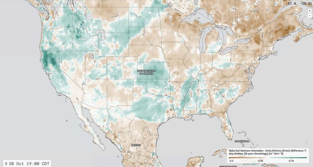
Introducing Spire’s Soil Moisture Insights Anomalies: Contextual intelligence for critical decisions
Soil moisture plays a pivotal role in agriculture, water management, financial risk markets, and disaster preparedness, serving as a foundation for understanding weather and climate impacts.

How Spire Global’s enhanced weather forecasting can revolutionize agriculture
We all know that agriculture is the backbone of the global economy, providing billions of people with food, jobs, and fulfilling livelihoods.