RF detection and geolocation
SATCOM, dark shipping & emergency beacons
Uncover covert activity across land, sea, and sky with real-time signal detection and geolocation using Low Earth Orbit satellites. From dark ships to rogue SATCOM links and emergency beacons, learn how Spire’s constellations help expose hidden transmissions.
RF frequencies
RF signal intelligence capabilities by frequency band
| Frequency Band | Frequency Range | Applications | Data Format | Signal Processing | Latency |
|---|---|---|---|---|---|
| VHF | 145-165Mhz | Maritime communications, push-to-talk radio | Raw IQ, geoJSON – shared securely through AWS Gov Cloud/ and S3 bucket | Post RF detection & Geolocating, enhance your signal intelligence with audio extraction, tipping & cueing correlation with high-res optical imagery. | Mission critical timelines |
| UHF | 360-430 Mhz | Emergency beacons, military comms, push-to-talk radio | Raw IQ, geoJSON – shared securely through AWS Gov Cloud/ and S3 bucket | Post RF detection & Geolocating, enhance your signal intelligence with audio extraction, tipping & cueing, correlation with high-res optical imagery. | Mission critical timelines |
| L-Band | 1–2 GHz | GNSS jammers, L-band satellite phones | Raw IQ, geoJSON – shared securely through AWS Gov Cloud/ and S3 bucket | Post RF detection & Geolocating, enhance your signal intelligence by correlating with SAR imagery. Add S- and X-band radar data for enhanced situational awareness. | Mission critical timelines |
| S-Band | 2–4 GHz | Maritime radar | Raw IQ, geoJSON – shared securely through AWS Gov Cloud/ and S3 bucket | Post RF detection & Geolocating, enhance your signal intelligence by correlating with SAR imagery (maritime); RF fingerprinting of radar emissions. | Mission critical timelines |
| X-Band | 8–12 GHz | Maritime radar | Raw IQ, geoJSON – shared securely through AWS Gov Cloud/ and S3 bucket | Post RF detection & Geolocating, enhance your signal intelligence by correlating SAR imagery (maritime); RF fingerprinting of radar emissions. | Mission critical timelines |
Spire’s ground station network covers UHF, S-Band, X-Band, Ku-Band, and Ka-Band frequencies. Our RF payloads can also detect and analyze emissions from DORIS beacons, which transmit on UHF and S-band frequencies, supporting internal calibration and geolocation model validation.
Real-world geolocation use-cases by frequency band
As we continue integrating GNSS and RF communications as core components of the global infrastructure, the threat of interference – through jamming, spoofing, or other GNSS disruptions – has escalated rapidly. These threats impact everything from aviation & maritime operations to military defense & critical infrastructure, making real-time interference detection a non-negotiable for those looking to mitigate the fallout.
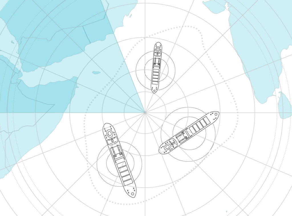
Dark ship detection
(VHF/UHF/S-/X-band)
Track vessels operating covertly by detecting emissions from VHF/UHF radios or maritime radar. Combine RF data with SAR imagery to identify illegal fishing activity, enforce maritime compliance, and monitor sanctions violations.
SATCOM surveillance
(L-band)
Monitor unauthorized satellite communications in regions where SATCOM misuse could indicate covert operations, geopolitical changes, or other security threats.
Border monitoring
(VHF/UHF/L-band)
Detect cross or near-border RF activity from handheld radios, vehicle communication systems, or SATCOM terminals, enhancing situational awareness and supporting efforts in hard-to-reach or high-risk regions.
Emergency beacon location
(UHF/L-band)
Quickly detect and locate emergency transmission signals from aircraft, maritime assets, or personal locators using UHF or L-band frequencies.
Signal intelligence from orbit: detection, geolocation and monitoring
Signal detection
Explore how Spire’s constellation supports end-to-end RF awareness, from signal detection and geolocation to persistent monitoring and historical analysis.
Seamless RF data delivery for mission-critical timelines
Once RF signals are detected, Spire ensures rapid and reliable data delivery through flexible formats designed for immediate analysis and long-term integration. Data can be accessed via Spire’s intuitive platform or seamlessly integrated into existing operational systems and workflows.
Delivery latency is tailored to the mission profile and access model, with near real-time availability supported for time-sensitive operations.
Note: Spire’s Low Earth Multi-Use Receiver (LEMUR) satellite constellation collects global RF data in near real-time, with data delivered through a robust network of ground stations of 55+, 35+ owned and operated by Spire, and a partner network for the rest.
Signal geolocation
We leverage multiple space-based techniques from LEO to geolocate RF emitters across a wide range of frequency bands vital for detecting and pinpointing signals of interest—even in complex, denied, or remote environments. Once acquired, raw IQ data is downlinked and processed via the cloud, enabling precise geolocation within mission-critical timeframes.
To further enrich target understanding, advanced capabilities such as voice signal enhancement, transcription and translation, tipping and cueing with high-resolution imagery, and device fingerprinting can be applied—delivering comprehensive situational awareness around the entity of interest.
RF monitoring
Spire enables persistent monitoring of low-frequency RF activity from LEO, offering global coverage across key regions and frequency bands. Unlike ground-based or localized systems, our space-based architecture reveals signals in denied or even the most remote areas. Data can be accessed on demand, scheduled via recurring tasking, or pulled from a historical database via secure API or platform integration.
How do Spire’s RF monitoring capabilities stand out?
Persistent coverage
Revisit any location multiple times daily to track persistent RF activity and detect long-term changes in signal behavior.
Taskable collections
Users can direct collections toward specific regions or windows of interest, which is ideal for mission planning, event response, or geopolitical monitoring.
Change detection & signal behavior analysis
View signal activity over time to identify patterns such as repeated beacon use, irregular SATCOM behavior, or the sudden appearance of unauthorized emitters.
Flexible access models
Tap into real-time data via scheduled collections or through Spire’s historical RF archive – whichever matches your mission needs best.
How does Spire geolocate RF signals from LEO?
TDOA (Time Difference of Arrival)
Measures signal arrival times across two or more satellites to triangulate the source.
FDOA (Frequency Difference of Arrival)
Uses Doppler shifts caused by satellite motion to calculate emitter location.
Angle of Arrival (AoA)
Determines signal directionality for precise localization when geometry allows
Doppler shift analysis
Matches collected frequency profiles to known signal behaviors (DORIS beacons) to validate emitter location.
Why choose Spire for RF signal detection and geolocation?
Spire owns and operates one of the most comprehensive, proven, and capable commercial RF geolocation solutions available – trusted by governments, military & defense organizations, and commercial intelligence teams in the US and abroad.

- Global constellation: Spire owns and operates one of the world’s largest commercial satellite constellations, enabling persistent monitoring of RF signals on land, at sea, and in the air.
- Proven capabilities: Focused on emitter detection and geolocation; Spire provides non-intrusive solutions that align with international compliance requirements.
- Rapid revisit & high precision: Multiple daily revisits enable near-real-time detection, while advanced TDOA/FDOA techniques ensure precise emitter geolocation.
- Tasking & integration flexibility: Task collections via API or Spire platform, ingesting RF data in standard formats including IQ, JSON, or CSV.
- Multi-source intelligence fusion: Enhance RF insights by combining Spire’s geolocation data with AIS, ADS-B, GNSS, and global weather intelligence from the same constellation or network.
Get in touch
Ready to gain a clearer picture of the signals around you?
Contact us today to discuss how Spire’s RF detection capabilities can help you detect, geolocate, and respond to interference threats before they get out of hand.