Protecting life on Earth from space: Fighting wildfires with space-enabled satellite data
Spire Space Services and OroraTech are helping battle increasing wildfires through real-time satellite imagery and data.

About OroraTech
OroraTech, based in Munich, are leaders in space-based thermal data intelligence, specializing in early wildfire detection and environmental monitoring. They are working with Spire Global to create a constellation of nanosatellites equipped with advanced thermal imaging. OroraTech provides real-time monitoring of high-risk areas worldwide. Their technology enables rapid response, helping to reduce wildfire impact and support sustainable forest management.
OroraTech approached Spire to develop their satellite network and improve wildfire detection services worldwide, driving together to improve life on Earth through space-enabled satellite data
Challenge
2023 saw a record-breaking number of wildfires worldwide and in Canada particularly, with almost 7.8 million hectares of tree cover burnt, or about 6 times the country’s annual average for 2001-2022. All end users now require advanced analytics and data derived from space, with growing needs for high resolution, global coverage, and actionable information reducing dependency on cloud coverage.
With this, OroraTech’s services continue to grow and so does their customer base. Working with governments to protect their citizens, businesses, and organizations against this growing threat, Spire provided the scalable and rapid expansion in capabilities. Enabling OroraTech to provide much-needed real-time strategic intelligence, reducing casualties and impacts on both the economy and organizations.

A visualization of how OroraTech works across society to help protect lives, businesses, and communities: detecting wildfires to protect communities using space-based technologies in a timely and efficient manner.
Solution
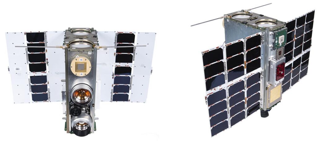
Partnering with Spire enabled OroraTech to enhance their established network of sensors and own constellation through Spire’s scalable space infrastructure and technologies. Spire’s “Space as a Service” solution provided rapid access to space without high upfront capital costs, building OroraTech’s space footprint with the launches of FOREST-1 and FOREST-2 thermal sensor satellites, providing their customers with rapid alerts to minimize human and financial losses.
With Spire set to launch eight more satellites in 2025 for OroraTech, this collaboration is demonstrating how space-enabled technology supports civil security during such crises and long-term, helping protect over 160 million hectares of forest worldwide.
Growing from a 2 to a 10 satellite strong constellation
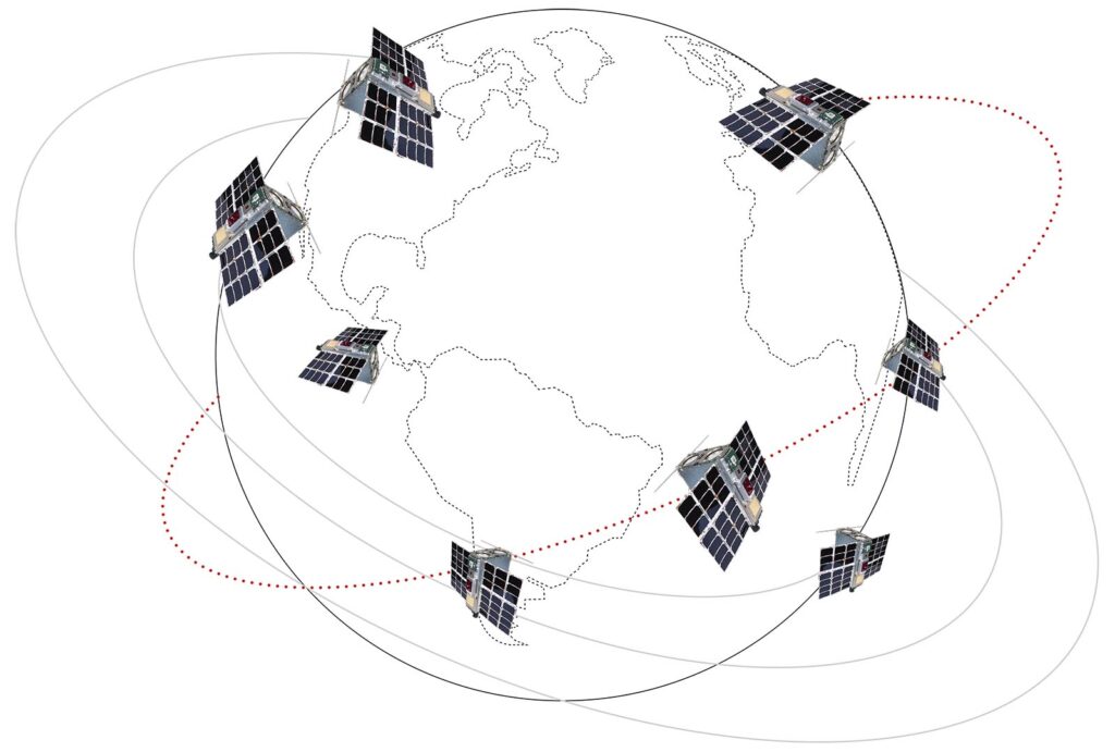
Spire is working with OroraTech to scale their satellite data solutions to provide rapid wildfire alerts within three minutes, to match the global need for their services and growing customer base.
Results
As OroraTech expands, so does their partnership with Spire leveraging their extensive experience with over 600+ years of flight heritage and nearly 200 successful satellite launches. By 2025, OroraTech’s ten-satellite constellation, equipped with their advanced payloads on Spire’s LEMUR satellites, will further strengthen OroraTech’s wildfire monitoring capabilities and become the world’s largest dedicated to thermal intelligence and wildfire monitoring, with plans to expand this to 100 satellites by 2028.