MV Wakashio crash in Mauritius reviewed with AIS data and Weather predictions
Interested in this FREE data set?
On July 25th, a ship ran aground off the coast of Mauritius. On Aug 6th, the ship spilled 1000s of tonnes of oil into the ocean. The investigation as to why this happened is still ongoing, however experts agree, this is the largest ecological disaster Mauritius has ever seen.
The MV Wakashio hit a coral reef, but little is known about how and why the accident occurred and that has us wondering where the ship had been prior to the incident and what led it to take the route it chose. We’ve partnered with Insight-NC to analyze our AIS data and wind and ocean current data to analyze the ships movements.
Download the free sample and see if you agree with our analysis.
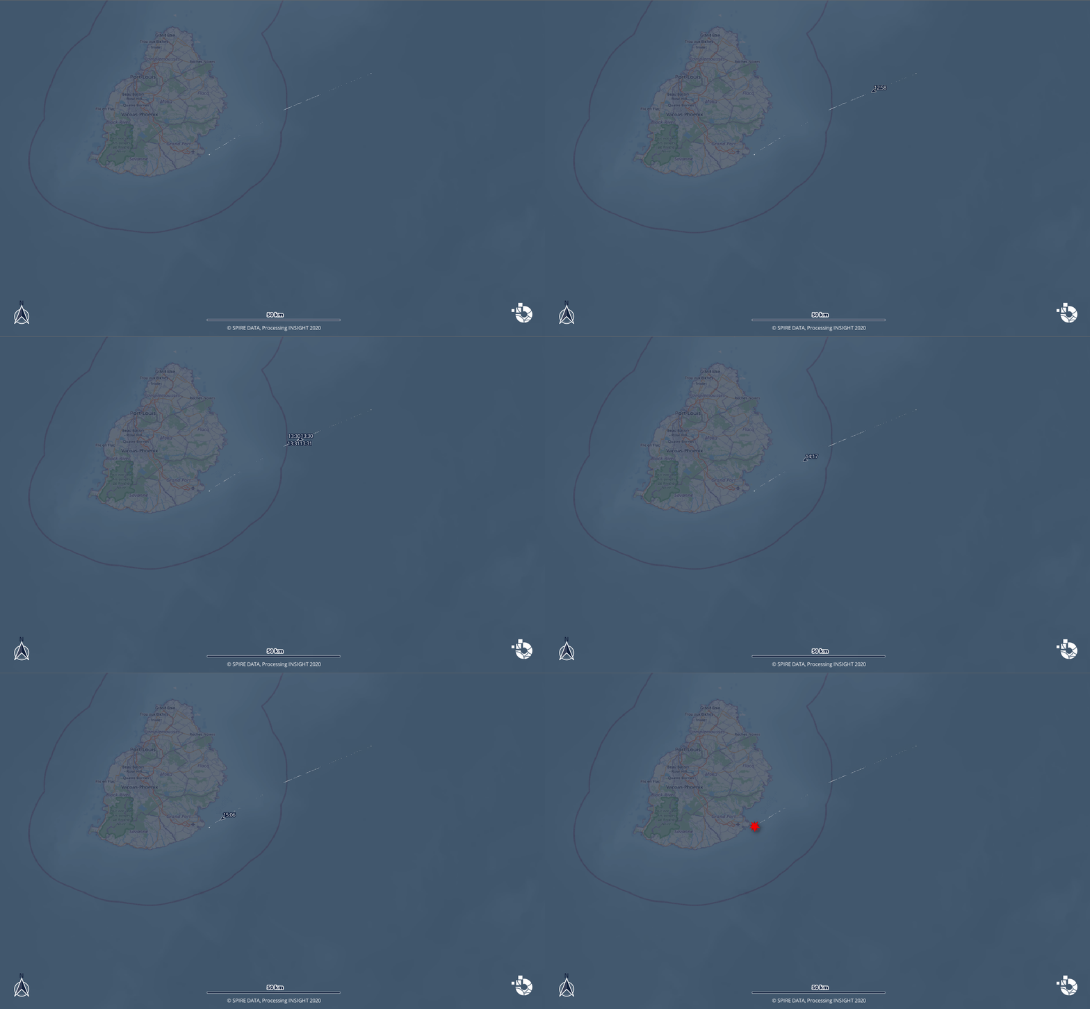
As you will see below the ship was headed on a collision route for 3 hours, the coastguard tried to reach out to warn of the dangerous path, but the captain insisted it was safe. This event raises questions about ship route predictions and whether a shore collision avoidance system could have prevented this accident. “Three years ago a cargo ship ran aground a remote pristine reef in New Caledonia, since then we have campaigned for the proper use of AIS for maritime awareness,” Sebastien Lagarde, a GIS expert at INSIGHT said. “AIS was designed as a ship to ship collision avoidance system, but thanks to the wider coverage allowed by satellites, we can easily predict vessel trajectories anywhere in the level of hours leaving time for anticipation. The technology is available, wise use of it can help us avoid catastrophes.”
Points co-analyzed by Spire Maritime and Insight:
The Voyage
- Port Louis on the Northern side of the island is the only port able to welcome the MV Wakashio and the ship’s route was not headed in that direction.
- The Destination message: WAKASHIO was en route to BRTUB = Tubarao Brazil (around the Cape)
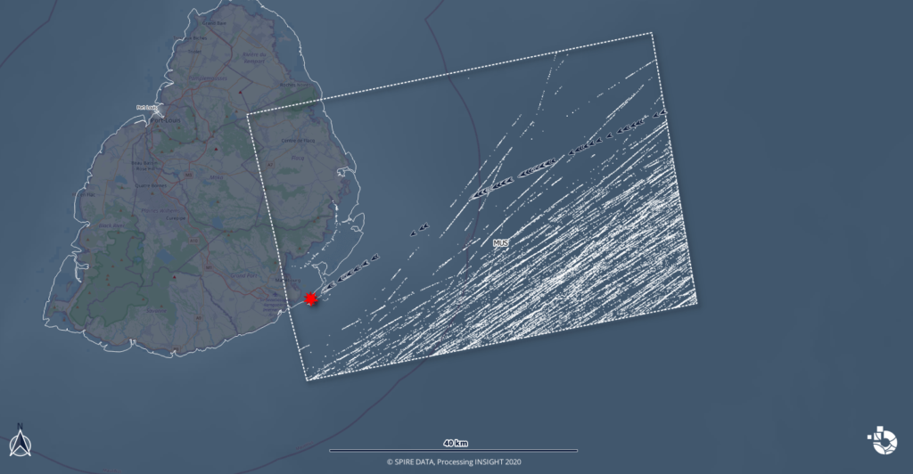
- As you can see below, this was the only ship that chose this route, despite a large amount of traffic on similar headings going around the coast.
The Collision Route

Data shows the ship had been heading for the collision for at least 40 Nm, so roughly 3 hours, source: INSIGHT using Spire AIS data
- The MV Wakashio made only one path adjustment, slightly altering course to the south (5° so portside) when entering Mauritius waters
The Environmental Factors
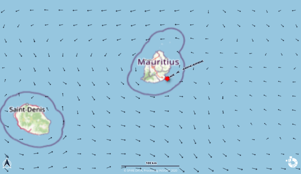
- Forecast data shows light winds at 10 knots which indicate weather was probably not a factor
- Forecasted ocean currents appear average and were not a factor in the accident.
- Maritime Weather data like surface winds and ocean currents are also important factors to consider when predicting the direction that the spilled oil will likely travel. These predictions will remain crucial to measuring the impact and scope of the incident on marine life.
Custom visualizations of ocean currents.

Spire WMS (Ocean Currents using the vector lines style, 2-Meter Wind speed using the wind barbs style).
The ship was traveling from Singapore to Brazil and the cause of the accident is still under investigation. The Mauritius government quickly received global support for the clean up including removing the remaining oil from the wreckage and lessening the environmental impacts of the shipwreck and oil spill. However the full impact on marine biodiversity is yet to be fully evaluated, as dolphins are washing up dead on the coast of Mauritius, this incident has put the country’s previously pristine reef at risk. Wind and current forecast measurements will be instrumental to continue tracking the damage path of the spill.
