Enhanced Satellite AIS
High traffic zone vessel tracking
Eliminate AIS data gaps in high traffic zones with premium ocean coverage and unprecedented frequency of position updates.
Enhanced Satellite AIS
Enhanced Satellite AIS is a next-generation solution from Spire Maritime that further augments our premium data quality and provides an additional layer of data precision and increased accuracy for highly congested and high traffic maritime zones.
Combined with Spire Maritime’s global satellite AIS tracking, all regions and vessels are covered with consistent, reliable and frequent updates.
What is Spire’s Enhanced Satellite AIS data?
Spire Maritime’s Enhanced Satellite AIS is complimentary to Standard AIS and Real-Time AIS. It offers premium global ocean coverage to track global maritime activities.
Enhanced Satellite AIS provides an unprecedented frequency of position updates in high traffic zones such as the South China Sea, busy ports, and shipping lanes. Enhanced Satellite AIS addresses gaps in traditional/other methods of collecting AIS data, delivering more unique MMSIs (up to 115K per day) and up to 67M additional AIS messages per day.
- High traffic zone coverage: +60% unique vessels in high traffic zones including in the South China Sea, Gulf of Mexico, Gulf of Persia, & more
- All active AIS devices detected with over 600K vessels, 378K active vessels/day
- Available Vessels Options: 1) All vessels, 2) All vessels of a specific type, 3) A specific fleet, 4) individual vessels with either AIS Class A or Class B transponders
- Static, positional and voyage related data
- Additional unique MMSIs: up to 115K vessels per day
- Number of messages: up to 67M additional messages per day
- Historical data available dating back to October 2018
What is Enhanced Satellite AIS useful for?
![]()
Commodity / market intelligence:
- Identify trends in trade routes, port calls, and shipping lanes to provide insights into emerging markets, shifting trade patterns, and global supply chain dynamics.
- Analyze vessel movements and trade activities to anticipate market trends, pricing fluctuations, demand-supply dynamics, and geopolitical risks to help facilitate market forecasting and risk assessment.
Discover more financial services use cases

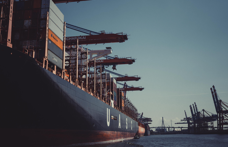
Vessel performance / Route optimization:
- Mitigate operational risks by providing complimentary information on vessel positions, traffic patterns, and maritime hazards. By monitoring vessel movements and route deviations, operators can identify potential risks, such as collisions, groundings, or adverse weather conditions, and take proactive measures to avoid or mitigate them, especially in high traffic zones.
- Optimize vessel routes by providing insights into current maritime conditions, traffic patterns, and weather forecasts.
![]()
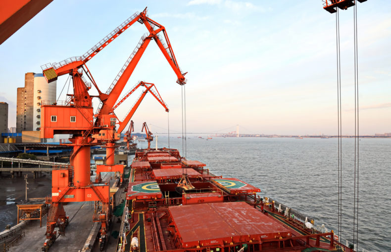
Offshore asset surveillance / protection: :
- Identify unauthorized or suspicious vessels approaching sensitive areas, enabling timely intervention and response.
- Identify patterns, trends, and anomalies in vessel activities, facilitating early detection of potential threats, such as piracy, smuggling, or illegal fishing.
- Assess security risks associated with offshore operations by providing insights into vessel movements. Used with other intelligence sources, analysts can identify potential threats, assess risk levels, and develop proactive security measures.
Discover more oil & gas use cases
Defense & security:
- Define market risks associated with geopolitical events, regulatory changes, or supply chain disruptions.
Identify potential risks, such as trade sanctions, port closures, or transportation bottlenecks to develop risk mitigation strategies.
Enhanced Satellite AIS customer testimonial
“We immediately saw vast improvements when we integrated Enhanced Satellite AIS into our products.”
Enhanced Satellite AIS
Enhanced Satellite AIS is a next-generation solution from Spire Maritime that further augments our premium data quality and provides an additional layer of data precision and increased accuracy for highly congested and high traffic maritime zones.
Combined with Spire Maritime’s global satellite AIS tracking, all regions and vessels are covered with consistent, reliable and frequent updates.
Why choose Spire?
Best in class support including:
- Continuous Support (live technical and customer support, including onboarding and developer documentation)
- Easily accessible modern APIs designed by developers, for developers
- Easy integration with support from dedicated Spire engineers
- 24/7 global satellite coverage
- Wide array of digital resources

Enhanced Satellite AIS resources
Using AIS data to solve critical national security issues and introducing Enhanced Satellite AIS
View this webinar to learn how USG customers are leveraging Spire’s AIS data to continuously monitor vessels around the globe and solve critical national security issues. Hear directly from Spire customer, Applied Ocean Sciences, on how AIS data has enabled them to address USG
How Enhanced Satellite AIS provides situational awareness of possible sanction violations
How Geollect use Enhanced Satellite AIS to provide an accurate picture of the marine environment, including possible sanction violations.
How Oceanbolt use Enhanced Satellite AIS to detect bulk trade at ports
Intelligence Platform Provider, Oceanbolt, leverages Enhanced Satellite AIS to deliver real time insights into global dry bulk trade flows.
The Enhanced Satellite AIS Difference
Achieve complete data coverage, even in remote oceans and high traffic zones.
Enhanced Satellite AIS provides an unprecedented frequency of position updates, and expanded global AIS coverage helps customers track the vessels with enhanced detection.
Enhanced Satellite AIS benefits
Expanded global AIS coverage helps customers track the vessels with enhanced detection
Increased accuracy for congested regions mitigates the high traffic zone challenges
All regions and vessels are covered with consistent, reliable and frequent updates when merged with Spire’s Satellite AIS