Operation Imagine
We hear you, Earth.
Spire is the space company focused on the future of Planet Earth
We use data and analytics from space to improve life on Earth
At Spire, we dare to imagine an Earth free of severe weather, wildfires, harmful emissions, but abundant with plentiful water, thriving ecosystems, and a healthy Earth in harmony with humans.
In this AI-assisted series, we seek to spark the imagination of how that world might feel, and how Spire’s solutions offer an unprecedented toolkit to unlock the full potential of all life on this Pale Blue Dot.
The inspiration for our inaugural-series image comes from Blue Marble, one of the first images of Earth to be generated from space in 1972, when such images were novel and often frightening. We wanted to re-cast the idea of that image through a lens of optimism for the future of our Planet Earth.
Enhanced weather models
Picture waking in the morning to a personalized weather report from your AI assistant, tailored to your location, activities, and preferences.
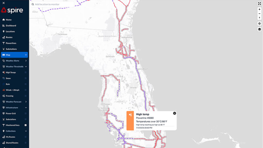
It’s a prediction model that considers your daily schedule, commute, and outdoor activities then provides detailed recommendations based on the weather forecast. It informs you of expected temperature, humidity, wind speed, the UV index, and precipitation levels that might impact your trip to work and decisions about clothing, transportation, and daily plans. It doesn’t stop there.
By enhancing our weather models with artificial intelligence to inform and predict, our understanding and preparedness for atmospheric conditions would undergo a dramatic transformation.
Spire customer
Ororatech: Observing wildfire conditions from space
Spire has built a proven intelligence platform to solve the biggest challenges facing humanity.
We empower our customers to make decisions with confidence in a rapidly changing world, reduce costs from climate and weather risks, and strengthen global security.
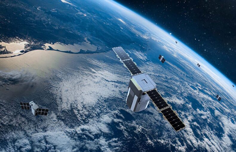
Spire provides the critical infrastructure for a space-powered future. Spire develops, builds, owns, and operates a fully deployed satellite constellation that observes the Earth in real time, day or night, rain or shine, using radio frequency technology. We enrich the data acquired by our satellites to guide customers to make valuable predictions for their organizations, the planet and humankind.
The power of listening…
The future of space is now
This is the start of a series exploring Spire’s advanced product dashboards and data, covering diverse domains like weather analysis, maritime tracking, aviation insights, radio frequency intelligence for dark shipping pattern detection and signal jamming identification, and Spire’s Space as a Service platform for construction, tasking, and monitoring of custom satellites.

Improving carbon emission estimates with space-based ADS-B data and upper wind component integration
It’s been over a hundred years since the first powered airplane soared in the skies in December 1903, revolutionizing the way humanity travels.

The role of weather data in the fight against climate change
Learn how the weather today influences the climate and your business for generations to come.
A message from our CEO
“We made our satellites multi-purpose. So that means that every single individual device is serving multiple verticals and multiple industries because it has multiple sensors tracking completely different data. They are listening satellites. They generally use radio frequency to observe previously unattainable and accurate information about the Earth.”
Explore our industry solutions
-
Maritime
We’re revolutionizing how marine data is collected, analyzed, and delivered. Get detailed information on vessel locations, weather conditions, and global shipping activity—even in remote locations on the open ocean. Our innovations around AIS data and high traffic zones solve the toughest industry challenges, while our intelligent APIs bring new insights to your maritime operations.
-
Weather & Climate
Unleash the power of cutting-edge satellite technology to enrich data on hundreds of environmental factors, enabling the creation of custom predictive models for accurate, real-time Earth monitoring and decision-making support. Spire combines detailed, real-time weather and environmental data from across the globe, utilizing both ground and satellite sources for unparalleled insight. This approach offers a comprehensive view of atmospheric conditions and weather patterns, even in the most challenging locations.
-
Aviation
Spire Aviation is a reliable source for historical flight data, ADS-B tracking and detailed weather data that makes aviation safer and more efficient.
-
Space Services
Get superior data for your initiatives without building your own space-based infrastructure from scratch. Commission custom-manufactured satellites based on our proven LEMUR 2 satellite model, launch hosted payloads to get your own hardware reliably to orbit, or simply rely on Spire’s space-to-cloud data services that collect and transform rich data about the earth, its oceans, and its atmosphere and share it via easy-to-use APIs.
-
Government
Spire government solutions provide mission-critical satellite data to drive global and US Federal government and defense initiatives. Our APIs and tailored datasets provide highly accurate maritime, aviation, and weather data, giving you actionable intelligence about Earth, its environment, and its global shipping and aviation activity.

