Why the 2024 Atlantic hurricane season could be one for the record books
Meghan Mussoline
Product Marketing Manager, Spire Weather and Climate
Business interests in the US and Caribbean should brace for an active to hyperactive peak hurricane season.
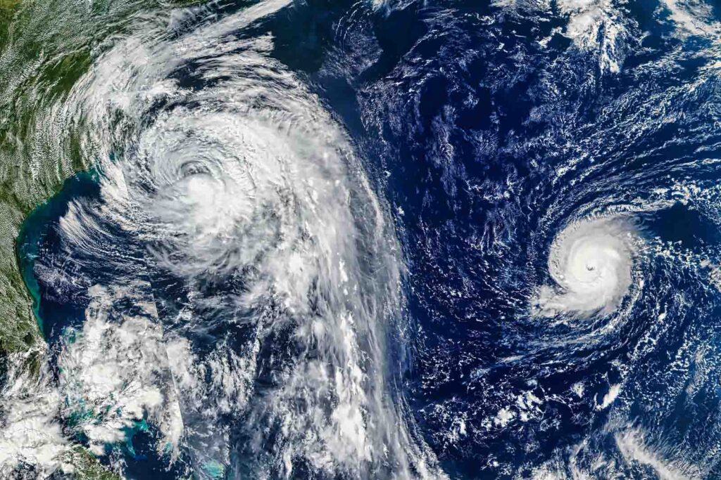
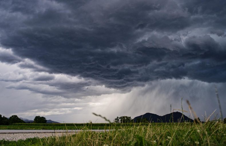
The 2024 Atlantic hurricane season wasted no time making headlines, with record-setting Hurricane Beryl impacting the Caribbean before slamming into Texas and the central United States, and the severe impacts of Debby along the Eastern Seaboard. As we approach the season’s peak — from mid-August to mid-October — all signs point to more active and intense storms ahead.
With September 10 marking the statistical peak of hurricane activity, businesses should stay vigilant and prepared for the tropical threats looming in the coming weeks.
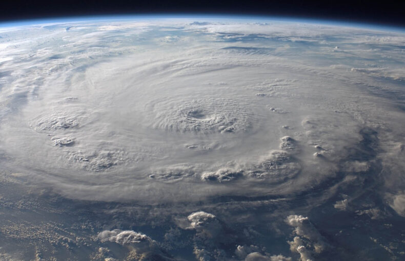
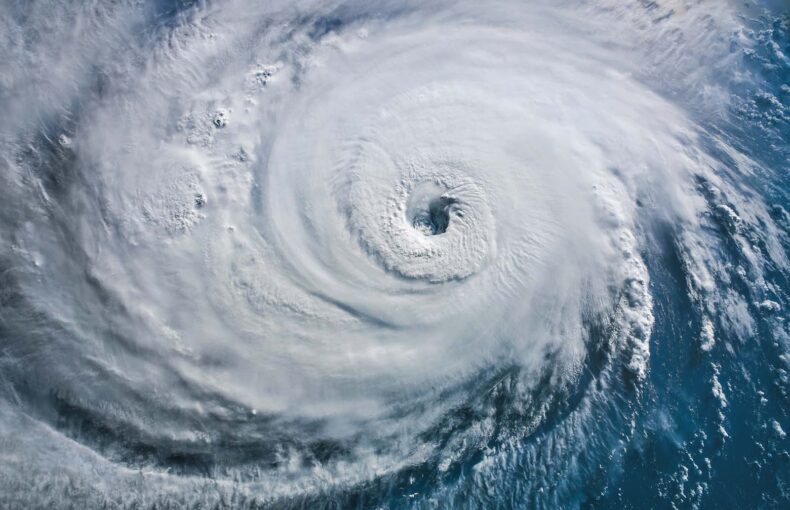
The 2024 Atlantic Accumulated Cyclone Energy (ACE), a measure of storm intensity and duration, is running about three weeks ahead of the historical climatology average, mainly due to Hurricane Beryl. This highlights that it can only take one tropical cyclone to make it an impactful season.
For example, the 1992 Atlantic hurricane season only generated six named tropical storms. However, Hurricane Andrew is still considered one of the most impactful in US history after pummeling South Florida as a Category 5 storm and central Louisiana as a Category 3 storm.
Spire Meteorologist and Weather Risk Expert Tyler Sherrod agrees it only takes one tropical system to change the entire landscape of a hurricane season.

“The US has already dealt with two such storms, Hurricane Beryl and Hurricane Debby. It is important not to let our guard down as we enter the peak of hurricane season,” Sherrod said. “More hurricanes and major hurricanes are likely to develop, and some of these systems could potentially impact the US and Caribbean.”
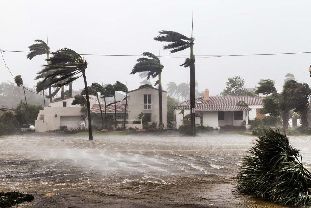
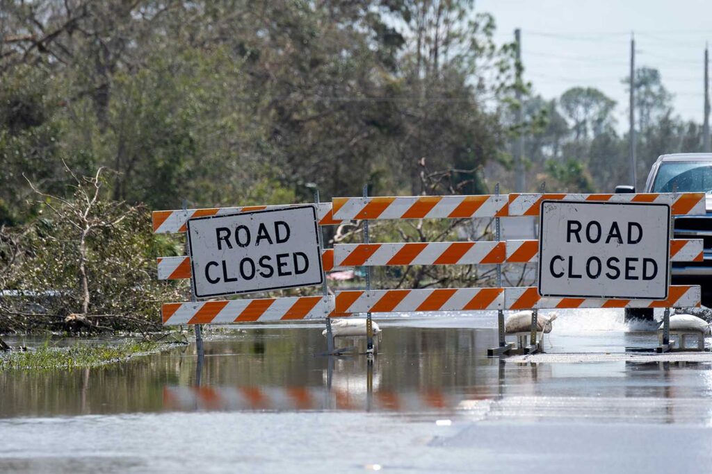
Above-average ocean temperatures indicate the potential for rapid intensification of tropical systems, but Debby put on full display that wind intensity is not the only factor to consider when it comes to risks to communities and businesses.
After striking Florida as a Category 1 hurricane, Debby lost wind intensity while moving over land. The tropical storm slowed its forward motion to a crawl and dumped historic rainfall amounts from northern Florida to Georgia and the Carolinas, resulting in significant flooding, as it spun up destructive tornadoes along its path. Debby’s impacts were far-reaching, with flooding rainfall and severe weather impacting the Northeast as the remnants of Debby accelerated northward.
What are the risks heading into peak hurricane season?
The National Weather Service Climate Prediction Center (NWS CPC) highlighted the concern for tropical cyclone development from the Gulf of Mexico to the central Atlantic during mid-to-late August. The chances will grow north of the Greater and Lesser Antilles during the middle of August and shift toward the central Atlantic by late August.
“Atmospheric and oceanic conditions have set the stage for an extremely active hurricane season that could rank among the busiest on record,” a recent NOAA Atlantic hurricane season update stated.
There are indications that tropical activity will increase heading into the heart of the season due to an uptick in tropical wave formation over Africa and the main development region of the Atlantic Ocean.
For instance, Ernesto developed from a tropical wave pressing westward across the Atlantic, becoming a tropical storm 10 days ahead of the climatological average for the fifth named storm of the season. After impacting the northeastern Caribbean islands, Ernesto is expected to continue strengthening as it nears Bermuda. It will likely lose some wind intensity before brushing Atlantic Canada with heavy rainfall.
Other systems could follow in Ernesto’s wake forming in a similar area of the tropical Atlantic, and Spire meteorologists are keeping a close eye on tropical waves emerging from Africa.
“Atlantic maritime interests should take note of the increased tropical activity potential,” Spire Meteorologist and Weather Risk Expert Jared Allen said.
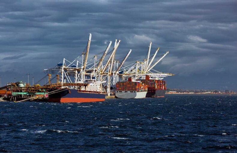
Business interests in the US and Caribbean will likely face additional landfalls and threats from tropical storms and hurricanes in the coming weeks and months.
“While above-normal ocean temperatures and low wind shear environments can aid the likelihood of rapid intensification with a favorable weather pattern expected for strengthening during the peak season, winds and storm surge are not the only hazards of concern. Inland flooding typically causes fatalities, infrastructure impacts, and supply chain interruptions,” Allen explained.
“According to the National Hurricane Center, a significant number of fatalities are caused by freshwater flooding, regardless of storm intensity and hurricane category,” Allen added. “Therefore, it is critical to know your personal and business vulnerability to flooding, even hundreds to a thousand miles inland from landfall.”
What are the factors behind peak hurricane season activity?
Sea-surface temperatures continue to run historically high across critical areas of the Atlantic basin, remaining at near-record levels from the Caribbean to the main development region of the tropics.
Above-average sea-surface temperatures can support more hurricane formation and intensification since warm ocean water fuels warm-cored tropical cyclones.
In addition to water temperatures favoring an active peak hurricane season in the coming weeks, other atmospheric conditions are likely to be primed for robust tropical cyclone behavior.
The El Niño-Southern Oscillation (ENSO) is currently neutral, known as an ENSO neutral phase, but anticipated changes during the peak season could set the stage for more hurricanes.
La Niña, defined by cooler-than-normal waters in the central and eastern Pacific near the equator, is favored to return between September and November – recently adjusted to a later timeframe than previous projections. The CPC predicted La Niña’s return within that period at a 66% chance. The climate pattern is favorable for tropical development in the Atlantic since it reduces vertical wind shear over the basin.
Vertical wind shear can inhibit the development and strengthening of tropical storms by displacing the upper-level and lower-level low-pressure centers so that they are no longer aligned vertically. Weakening circulation occurs similarly to how a top’s spin can unravel when it becomes tilted.
“Multiple dynamical model ensemble members in the medium to long range highlight the potential for a more favorable Madden-Julian Oscillation (MJO) phase aiding easterly tropical wave formation over Africa and in the main development region of the Atlantic basin,” Allen said. “However, nuanced details of easterly wave positioning, strength, and wind-shear dynamics will need to be monitored for overall impact potential to land.”
Saharan dust can inhibit or delay the development of tropical systems, especially early in the season, according to Sherrod. Pockets of dust were still visible over parts of the Atlantic in early August.
Related content
Enhancing hurricane prediction with AI: A glimpse into the future
Throughout US weather history, hurricanes have consistently been the deadliest and most destructive natural disasters.
A Spire analysis: Tracking the impacts of a hurricane using Soil Moisture Insights
As we delve into how hurricanes affect soil moisture, using Hurricane Beryl as a case study, it’s crucial to understand the transformative power of advanced weather insights.
Spire’s High-Resolution Forecast gave customers an edge on Hurricane Beryl
Customers using the Spire High-Resolution Forecast had three days of advanced notice to prepare for Hurricane Beryl’s Texas landfall location and impacts.
Historical trends and analog years
According to research complied by Colorado State University (CSU) in an August 6 update, analogous years for the 2024 hurricane season are 1886, 1926, 1933, 1995, 2005, 2010, and 2020 based on global oceanic and atmospheric patterns. These patterns were based on El Niño conditions in the previous winter with ENSO neutral or La Niña conditions during the peak of hurricane season. These years were also selected due to above-average sea-surface temperatures relative to long-term averages in the tropical Atlantic.
Based on these analog years, there was an average of nearly 20 named tropical storms per season, six above the historical average of 14. Additionally, these years averaged 5.7 major hurricanes (Category 3 storms or higher) compared to the long-term average of three major hurricanes. Lastly, the average ACE for these years was nearly 218, well above the long-term average of 123 (1991-2020 climatology).
According to CSU, additional dynamic models and statistically based output suggest that 2024 could be an active to hyperactive season. The analysis, compared to the analog years, found many predictive parameters to be even higher, thus further increasing confidence in an above-average hurricane season.
“It is noteworthy that much of CSU’s analysis uncovered higher ACE values than the hyperactive 2005 season that brought severe and devastating impacts to the US mainland,” Allen said. “While it is way too early to compare 2024 to 2005, and it would be presumptive to do so, vigilance and preparation is key, for possible maritime, landfall, and inland tropical cyclone impacts.”
“It should be noted that an active or hyperactive year does not guarantee significant land impacts, as was the case in another analogous year of 2010,” Allen explained. “There were 19 named storms, 12 hurricanes, and five major hurricanes in 2010, but no hurricane landfalls occurred in the US mainland.”
However, a couple of tropical depressions and one tropical storm impacted the US, with effects including inland flooding and tornadoes. Large and powerful Hurricane Earl unleashed damaging storm surge, near hurricane-force winds, and heavy rainfall as it passed about 100 miles east of North Carolina, but it never made a direct US hit.
What can businesses do to stay prepared during hurricane season?
Download our checklists below for ways that your business can safeguard your people, property, and profits before, during, and after a storm.
Here at Spire Weather & Climate, we’re committed to empowering businesses and traders using one of the world’s largest multi-purpose satellite constellations. We capture exclusive data and enhance its value through sophisticated assimilation, artificial intelligence, and machine learning processes.
We also leverage our proprietary data to help organizations mitigate weather risks worldwide. With DeepVision™, our premier weather risk solution, decision-makers gain 24/7 access to the Spire DeepVision™ Weather Support team ensuring timely and informed responses to any weather-related challenges during hurricane season.
Download business guides on hurricane preparation before, during, and after a storm
Discover the advantage of space-powered weather insights and comprehensive solutions