Are you getting the most out of your AIS tracking data?
 Written by
Mark Deverill
Senior Sales Engineer
Enhanced Satellite AIS in the Vessels API offers the ability to track the global fleet one ship at a time, cleanly, and efficiently
Spire Maritime offers the ability to track the global fleet one ship at a time, cleanly, and efficiently
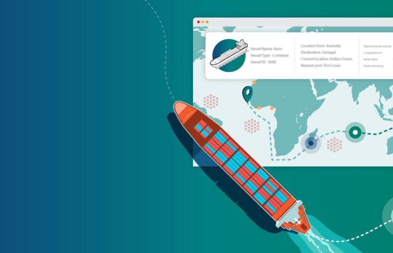
Spire Maritime adds Enhanced Satellite AIS data to its Vessels API providing customers with a comprehensive API and global data in one location. The Spire Vessels API is a service tailored to the shipping industry, it includes only legitimate vessels and allows specific vessels or vessel types to be queried. Spire Maritime launched Enhanced Satellite AIS earlier this year. The world-first innovation uses thousands of satellite-enabled AIS receivers traveling throughout the busiest shipping lanes in the world. It provides an unprecedented frequency of position updates in areas that are out of the reach of terrestrial collection and overwhelm other satellite AIS providers. This means more AIS messages, more unique MMSIs, and greater control of ship operations. From mapping the most efficient routes for fuel economy to identifying trade patterns, ship operators can fine-tune logistics and port arrivals to optimize revenue and operations.
One Place, Every Time
By combining AIS positions and voyage reports, Spire Maritime creates a service that shows the latest reports for ships. Enhanced Satellite AIS brings an advantage over satellite AIS and provides a significant number of more recent position reports for ships at lower latency. Loss of position updates and high latency in High Traffic Zones (HTZ) are a common challenge for the industry that leads to a lack of transparency and disrupts many operations from commodity tracking to port management and safety at sea. Enhanced Satellite AIS solves this challenge providing global seamless coverage.
Customers Agree
Spire Maritime customers tested the new service for three months and reported excellent results. Testing delivered a 20% uplift in the number of recognized vessels reported each hour. The data is clean, easy to access, and provides a better picture of how many vessels are in an area at one time.
“A huge improvement has been made with Spire Enhanced Satellite AIS, with visibility in the South China Sea now over 200% since the introduction of Spire Maritime’s Enhanced Satellite AIS”
Share on Facebook Share on Twitter Share on LinkedIn
High traffic zones have an impact on profit margins for anyone working in the Maritime industry. It is not uncommon for fleet managers to lose their ships for several days due to these signal collisions and overloaded channels.
The Vessels API can now combine three types of AIS collection (terrestrial, satellite, and Enhanced Satellite AIS) into one end-point. We found a consistent 20% uplift in reported vessels per hour with this combination.
Asia accounts for 40% of global seaborne exports. The South China Sea is one of the most crowded shipping routes in the world and to complicate matters there are a high number of small fishing boats that are at risk of colliding with larger vessels. These waterways are also a militarized zone which increases the need to know where ships are throughout their journey. There are many stakeholders in the shipping industry that are constantly looking for increased transparency in this region.
How it Works
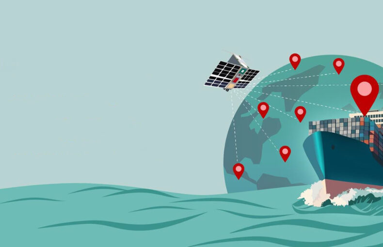
Enhanced Satellite AIS tracks vessels and the traffic within 60 nautical miles. This process occurs at least every 15 minutes. We plan on growing our satellite-enabled AIS receivers to nearly 2,000 by the end of this year.
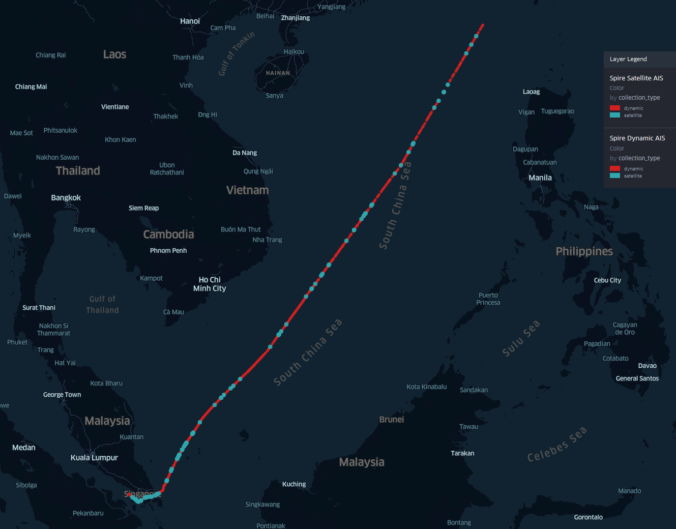
Tracking one ship across South China Sea with S-AIS and Enhanced Satellite AIS
More Updates and More Vessel Reports
Subscribing to Enhanced Satellite AIS in the Vessels API allows customers to receive more updates for more vessels at sea. For anyone wanting regular accurate updates of ship positions, commonly the case for trade monitoring or operations or fleet management, Enhanced Satellite AIS now brings a very noticeable advantage in areas where AIS volume has often been weak.
Enhanced Satellite AIS delivered a 17% average increase in global position updates which helped ship operators to monitor the global fleet more accurately and maintain complete current and historical data sets. In High Traffic Zones (HTZ) where satellite AIS is incapable of receiving all transmitted AIS messages, Enhanced Satellite AIS brings the greatest improvement to reporting.
Contact Us for a Customizable Data Set
Enhanced Satellite AIS for the Vessels API is available as an add-on to both our Standard and Premium pricing tiers, learn more here. Spire creates customizable data sets for a company’s individualized needs. Feel free to get in touch if you would like to learn more about how Enhanced Satellite AIS can help improve your business or download our free sample here.
Download a free sample
See Enhanced Satellite AIS in action in the South China Sea.