Exploring Death Valley’s ‘amazing’ migrating lake
Meghan Mussoline
Product Marketing Manager, Spire Weather and Climate
Death Valley National Park, renowned as the driest place in North America, typically attracts nearly one million tourists annually, drawn by its otherworldly landscape and breathtaking vistas.
However, in February, the park became an unexpected hotspot for an entirely different reason — an attraction born from extreme weather.
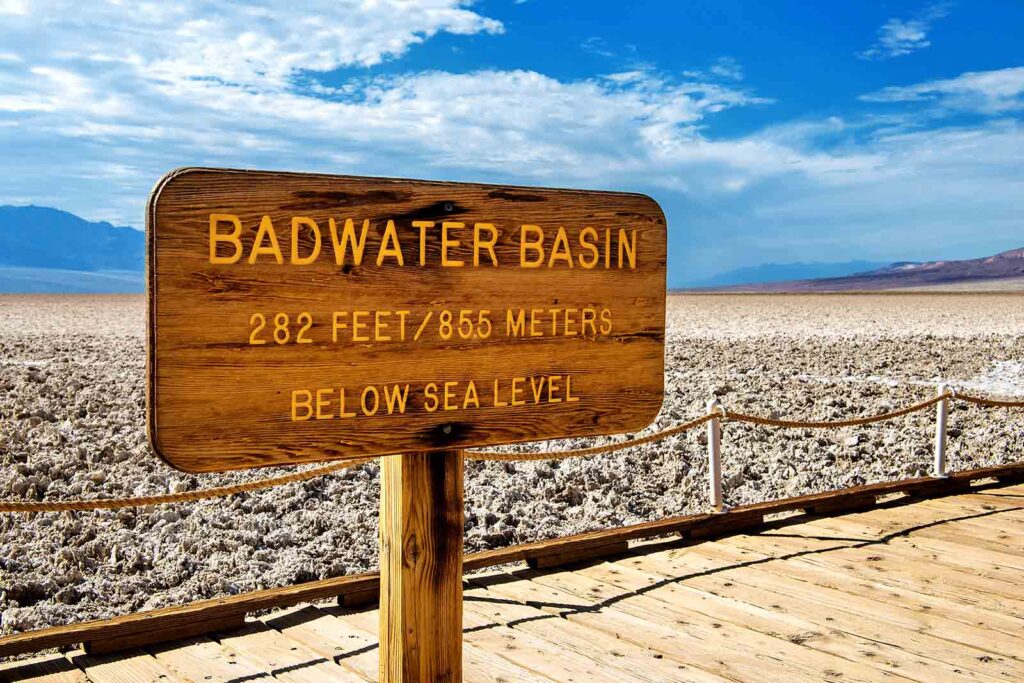
A six-mile-long and three-mile-deep lake emerged in the typically arid valley floor of Badwater Basin, North America’s lowest point, sitting 282 feet below sea level. This basin, usually characterized by vast salt flats covering nearly 200 square miles, transformed into a temporary lake, drawing kayakers and paddleboarders.
The captivating phenomenon was triggered by excessive rainfall events over six months, primarily from two major rainstorms. Between August 2023 and February 2024, the official weather gauge at Furnace Creek in Death Valley National Park recorded a remarkable 4.9 inches of rainfall, a stark contrast to the park’s average annual rainfall of around 2 inches.
Just as swiftly as the temporary lake, named Lake Manly, formed, an intense wind event from February 29 through March 2 pushed the water two miles to the north, spreading it out and causing rapid evaporation and shallower water. When the winds subsided, the water returned to its original lakebed. Due to the decreased water depth, Death Valley National Park was forced to close Lake Manly to boaters.
“It was amazing to witness an entire lake migrate!” exclaimed Superintendent Mike Reynolds in a statement on March 4. “But now, as the water recedes, wide mudflats are left behind. People have been trekking long distances, sometimes dragging their boats, leaving footprints and drag marks that will likely remain visible for years. This compelled us to halt boating activities on historic Lake Manly at this time.”
Unraveling the weather behind Death Valley’s transient lake
The significant rainfall event that helped form this attraction triggered California’s first-ever tropical storm warnings, extending from the border with Mexico to north of Los Angeles. Hurricane Hilary escalated to an intense Category 4 hurricane on the Saffir-Simpson Hurricane Wind Scale with maximum sustained winds exceeding 135 mph over the East Pacific in August, then weakened as it approached land. It made landfall as a tropical storm with sustained winds exceeding 55 mph in Baja California, Mexico, on August 20, 2023.
Although it weakened, Hurricane Hilary unleashed historic rainfall totals, causing catastrophic flooding in parts of the Baja California peninsula and the southwestern United States. Death Valley National Park measured 2.2 inches of rain, more than total annual rainfall, from this storm alone.
Hilary persisted over Southern California at tropical storm strength, an unusual occurrence for the region. The last system to maintain tropical storm status while traversing Southern California was Hurricane Nora in September 1997. NOAA’s historical hurricane tracks reveal that only five systems have been recorded passing over California at tropical storm force.
The rainfall from Tropical Storm Hilary resulted in the temporary lake in Death Valley National Park, albeit only forming a shallow reflecting pool in Badwater Basin, as noted on the park’s website.
Months later, an atmospheric river delivered another dose of heavy rain in early February, with a total of 1.66 inches being measured for the month, compared to the monthly average 0.5 of an inch of rain. An atmospheric river is a long plume of tropical moisture, which extends deep into the tropical Pacific Ocean, and can fuel significant rainfall along the West Coast.
The intense rainfall raised water levels of Lake Manly, with water depth reaching up to a foot (0.3 meters) in some spots, the park said.
The history of Lake Manly
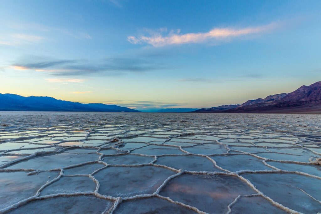
Lake Manly, an ancient inland lake that once filled the Badwater Basin, vanished through evaporation tens of thousands of years ago. Since the lake had no outlet, sediment and salt deposits remained as the lake dried up.
“Today, fascinating geometric salt polygons form on the flats as groundwater rises up through these deposits and evaporates,” the park explains on its website.
According to Death Valley National Park, sufficient rain falls in the parched park every couple of years to cover the salt flat and create a temporary lake. However, it typically remains only a couple of inches deep, unlike this year’s event.
Death Valley National Park’s notorious extreme weather
The park is known for its extreme weather conditions. It holds the title of the hottest place on Earth, alongside being the driest location in North America. On July 10, 1913, the world’s highest air temperature of 134ºF was recorded at Furnace Creek, according to the World Meteorological Organization.
During summer, monsoon thunderstorms can lead to flash flooding, while winds stirred by storms or approaching cold fronts can trigger sudden dust storms.
Death Valley’s annual average rainfall of nearly 2 inches is exceptionally dry, even by desert standards, yet it surpasses the precipitation in the world’s two driest deserts, the Atacama Desert of Chile and the McMurdo Dry Valleys of Antarctica.