Intense storm to bring destructive wind, rain, dangerous seas to UK, France, and Spain
 Written by
Nicole LoBiondo
Meteorologist and Weather Risk Communicator
A windstorm, officially named Ciarán by the Met Office in the United Kingdom, is expected to bring very strong and potentially damaging winds and waves across portions of the western European coast Wednesday night and Thursday.
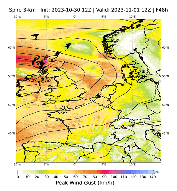
At Spire we are closely watching forecasts of Ciarán from our new operational high-res model covering Europe. Our model assimilates Spire’s proprietary radio occultation data and produces 3-km forecasts all the way out to 6 days resulting in accurate and detailed forecasts with ample lead time.
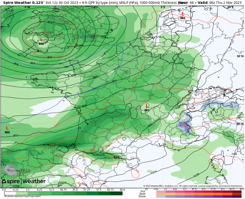
Ciarán will track across southern portions of the United Kingdom Wednesday night and into northern France before becoming stationary over the North Sea by late Thursday night.
The windstorm is expected to bring damaging wind gusts to coastal communities along the Bay of Biscay in northwestern France and along the English Channel late Wednesday night onto early Thursday morning.
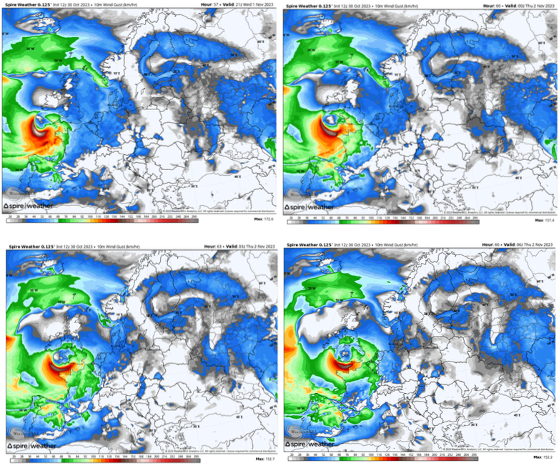
Wind gusts of 130 to 145 km/h (80 to 90 mph) may cause power outages and significant disruptions to ports, air travel and motorists throughout the region. Some locations along the English Channel could experience winds to 161 km/h (100 mph). Widespread gusts of 96 to 129 km/h (60 to 80 mph) are expected to sweep across a large portion of northern Spain, western and northern France into southern portions of the United Kingdom.
Travel by road, rail and air will be impacted along with the potential for disruption or closure of ferry services. Dangerous crosswinds threaten to overturn high-sided vehicles.
Ciarán’s powerful winds will also churn up dangerous seas across the Atlantic, as well as in the Celtic Sea, English Channel and Bay of Biscay Wednesday night into Thursday. Seas are expected to exceed 10 meters (34 feet) in the Bay of Biscay and 5 meters (18 feet) in English Channel.
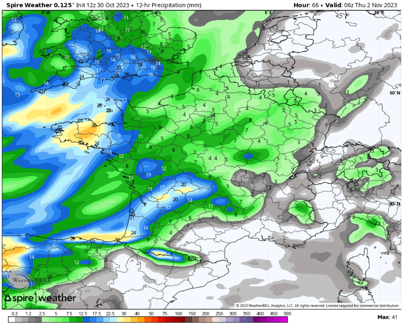
Ciarán is expected to bring heavy rainfall as well across the region where downpours can total 25-50 mm (1-2 inches) into Thursday. The storm is expected to stall and become stationary through the remainder of the week where additional rain could lead to potential road closures and dreary conditions.