Fighting wildfires with weather data
 Written by
Janie Yurechko
Senior Product Marketing Manager at Spire Federal
Weather data supports critical wildfire management from long-term planning to immediate tactical responses.
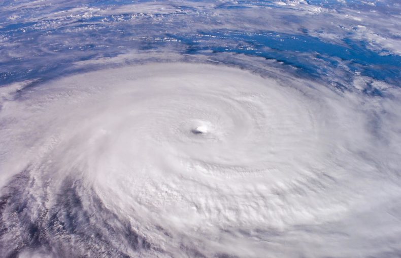
Blazes tore through four million acres on the United State’s West Coast last year, marking another record-breaking year for California’s wildfire activity. Five of the state’s six largest documented wildfires have occurred since last August, and seventeen of the top 20 since 2006. As a chief from the state’s department of forestry and fire protection said: “Fire season is not a season anymore—it’s year-round.”
The trend is not limited to the West Coast. Wildfires burned nearly twice as much land per year between 2000 and 2018 in the United States than between 1985 and 1999, according to the Union of Concerned Scientists. And the situation could deteriorate. The non-profit established a “strong connection” between wildfires and climate change, which causes conditions to become hotter and drier. While another study found that “climate change has already facilitated conditions that are increasingly conducive to wildfire activity, and that continued global warming will continue to intensify those conditions in the future.”
As the threat of wildfires has grown, population growth has pushed communities to build houses and structures closer to high-risk territories. Catastrophic losses have followed. Since 1980, the U.S. has suffered 18 billion-dollar fires, and today some 4.5 million homes are still at extreme risk of wildfire.
Across the country, experts and incident commanders are battling to protect the public from wildfires. Weather data can support their mission.
“Weather data allows an incident commander to prioritize resources and anticipate where to deploy support in advance.”
Share on Facebook Share on Twitter Share on LinkedIn
Reading wildfire risks in weather forecasts
“Of the factors that affect the daily changes in fire danger, weather data is the most significant,” explains a handbook on the U.S. fire danger rating system from the National Wildfire Coordinating Group.
Specialists consider air temperature, humidity, and wind speed and direction when they analyze fire danger and behavior. It is important to track temperature because a certain amount of heat is required for ignition and continued burning, according to material from Auburn University. Hotter fuel—grasses, needles, brush, and so on—also burns more readily and quickly. Wind heightens the danger of wildfires by drying out fuels and supplying oxygen to flames. And fires tend to ignite more easily and burn more intensely at lower relative humidities.
“Ask any wildland fire expert about the weather components that lead to difficult fire conditions, and the expert will reply with some combination of ‘hot, dry, and windy,’” wrote U.S. Forest Service experts and researchers in a paper.
If flames ignite, weather data can offer critical insight into a wildfire’s evolution and lifespan. Knowing wind speed and direction is particularly important, as they influence where and how far a fire might spread. Response teams also consider wind speeds at different flight levels to help plan how and when to deploy aerial assets like water bombers, helicopters, and drones.
“In the emergency management sector, resources are constrained,” said William Cromarty, a federal account executive at Spire Global with a background in emergency management. “Weather data allows an incident commander to prioritize resources and anticipate where to deploy support in advance, given you can never have 100% coverage.”
“It’s one of the few unifying threads that span the gap of tactical and longer-term strategic planning,” said Cromarty.
Space data supports land management
Wildfire management teams need to know that the weather data they use is as precise as possible. That is why we recommend using weather forecasts powered by radio occultation data. A leading weather organization recently identified it as a top-five data type for reducing errors in forecasting.
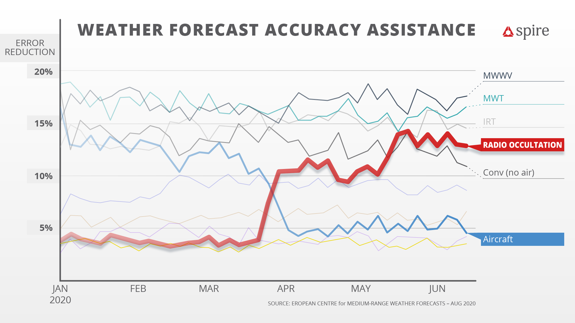
Impacts of Various Data Types on Weather Forecast Accuracy
Spire’s more than 100+ satellites use radio occultation measurements to capture detailed temperature, humidity, and pressure information across the entire planet. Taking exact measurements around the world can help improve local forecasts since weather systems connect globally. It also helps ensure that emergency management professionals and search and rescue teams can have detailed data across their operational regions.
Radio occultation measurements also generate high vertical resolution. Spire’s satellites measure conditions in thin slices of the atmosphere from sea level to the mesosphere, helping create detailed wind profiles for a range of altitudes. Furthermore, Spire also offers flight tracking information from our aviation department.
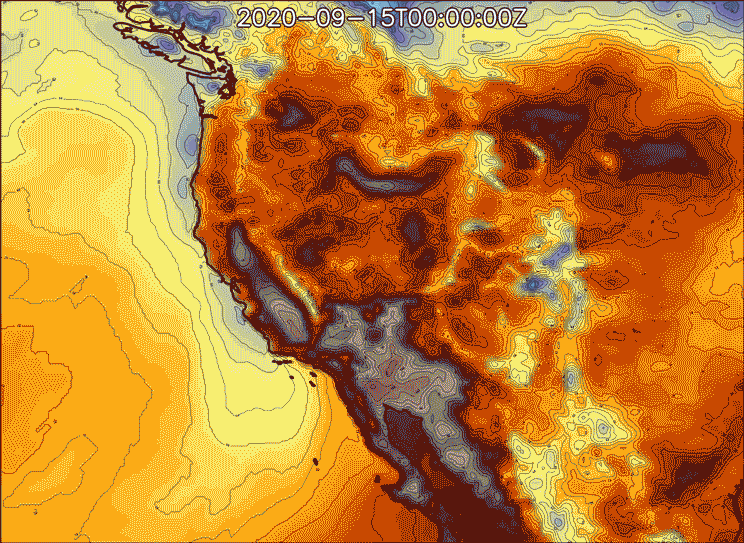
Temperature (2m AGL) and Relative Humidity (2m AGL)
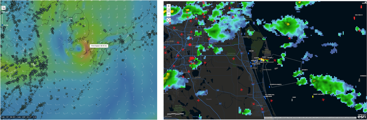
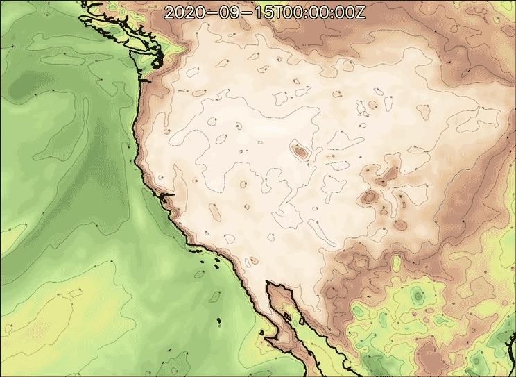
ADS-B Data and Wind Speed & ADS-B Data and Weather Radar
“Spire’s data offers an incident commander the ability to not only monitor localized weather conditions on location but also track the presence of local aviation assets via ADS-B in the affected zone for added situational awareness,” said Cromarty.
Measuring moisture underground to gauge vegetation above
Alongside weather data, fuel levels are a crucial component of gauging wildfire risks. More dry grass and brush buildup means more chance of fire ignition and spread. But until recently, there has been no simple way to estimate fuel quantity across large areas, said Cromarty, especially in remote and inaccessible wilderness areas.
Now there appears to be a method. Experts can approximate vegetative ground cover through soil moisture estimations, explained Cromarty. And they can calculate soil moisture across large, even remote areas, using GNSS reflectometry, a satellite remote sensing technique that measures how GNSS signals scatter off the Earth’s surface. It is particularly adept at evaluating broad areas where it is impractical to deploy people.
Some of Spire’s satellites already collect soil moisture measurements, and coverage will expand as Spire launches more nanosatellites, promising another tool in the wildfire management toolbox.
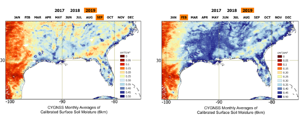
Dry season versus wet season
“Our upcoming launches will continue to improve soil moisture readings and weather forecasting,” said Cromarty, “ensuring emergency management teams will gain increased insight and detail with every successive launch.”