An increasing vantage point
Worldwide coverage from satellite-based remote sensing provides data that can help us tackle global challenges—and thrive.
In early 2020, COVID-19 travel restrictions grounded commercial jetliners around the world almost overnight. As planes sat on the tarmac, it was not just vacation dreams and business travel that evaporated. Weather forecasting suffered, too. Because weather models relied on data collected by sensors attached to commercial aircraft, forecast accuracy deteriorated when the skies emptied. But all was not lost. Meteorologists helped offset the deficit by turning to atmospheric data collected from satellites.
The forecasting setback revealed a weakness of relying wholly on Earth-bound sensors and demonstrated the growing need for data collection from satellites. More than just a backup for their terrestrial relatives, satellite remote sensing offers continuous and worldwide coverage for a range of phenomena, from climate conditions to economic indicators. A truly planetary perspective can provide critical data for tackling global issues and promoting international well-being.
“Remote sensors,” NASA said, “enable data-informed decision-making based on the current and future state of our planet.”
The satellite technology that we enjoy today traces its lineage back to 1957 and Sputnik 1. The successful launch catapulted us into the satellite era and spurred two decades of technological development driven by the Space Race. One of the earliest innovations was a weather satellite featuring an onboard camera that captured images of cloud formations. Suddenly, we could see our world from space.
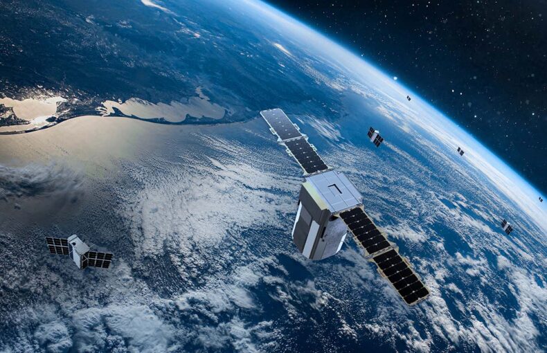
Since then, the evolution of sensors, computing power, and data storage has expanded remote sensing capabilities. The development of small satellites, along with decreasing launch costs, opened space to new players. Today, governments, research groups, and private companies can all deploy scores of satellites a year, fitting each device with multiple sensors.
Remote sensors enable data-informed decision-making based on the current and future state of our planet.
Share on Facebook Share on Twitter Share on LinkedIn
Thanks to Google Earth and spy movies, aerial pictures of cities are the most well-known examples of remote sensing from satellites. But photographs are only one type of data collected from space, and they are blind to all the rich information outside of the visible range. Other sensors fitted to satellites can detect waves across the electromagnetic spectrum, which extends from long radio waves to short gamma rays.
Studying a broad spectrum reveals nuances of the Earth’s state of affairs. Each type of wave interacts differently with our atmosphere and planet. The waves are reflected, absorbed, or bent depending on their length and what they interact with. For example, infrared bands can reveal vegetation maturity, as old or deteriorated leaves reflect less infrared than young ones.
There is also a range of ingenious ways to use the signals from communication and positioning systems to observe global phenomena.
The sensors on Spire’s nanosatellites, for example, take advantage of global navigation system signals, like those from GPS. They make a radio occultation measurement that calculates how much the signals bend as they travel through the atmosphere. Because the degree of refraction depends on physical properties like temperature and humidity, these measurements reveal precise weather-related data.
The satellites also record signals reflecting off the Earth’s surface. Measuring the signals’ distortions and delays reveals data about ocean surface height, sea ice coverage and age, wind speed, and even soil moisture. Spire’s satellites even receive location signals broadcast from ships and commercial aircraft traveling around the world, recording the vessels’ positioning, direction, and identity.
While some terrestrial receivers collect similar data, they cannot scan the planet like an orbiting satellite. Just 15 satellites in low-Earth orbit can cover the globe, according to a European Commission report.
“This explains why, when terrestrial infrastructures have not been deployed, [a] satellite is usually seen as a better economic and practical solution to bring coverage to areas that would otherwise be left completely unserved,” the report from European Commission continues.
While some terrestrial receivers collect similar data, they cannot scan the planet like an orbiting satellite.
Share on Facebook Share on Twitter Share on LinkedIn
Spire’s constellation of over 100+ nanosatellites, for instance, have the potential to revisit any point on Earth an average of 220 times a day. This degree of global coverage is more critical today than ever before as we live in a world where decisions made in one corner of the planet impact lives thousands of kilometers away.
“Sustained space-based Earth observation is critical for understanding and addressing global scale challenges, such as poverty, urbanization, water security, climate change, and epidemiological risks, to human health,” according to an article published in Nature.
The list of applications of worldwide data collection is as long as it is inspiring. Temperature measurements can support global warming studies. Soil moisture readings can aid early warnings for droughts and wildfires, even in remote areas. Air traffic data helps model how people move around the planet, which COVID-19 has shown to be a critical metric for protecting global health. And tracking ships from space even helps the international non-profit Global Fishing Watch reveal illegal fishing practices across our seas.
Then there are the commercial advantages. Aircraft and maritime traffic data are important indicators of the global economy in their own right, pointing to the state of international trade. With Spire’s solutions, clients can even uncover sector-specific insights within the data. For instance, an oil trader can receive regular updates on tankers’ activity around the world.
Combining datasets leads to further possibilities. Maritime organizations are optimizing their route planning by linking ship location tracking with weather forecasts and data about ocean conditions. The resulting fuel savings are a boon to their bottom lines and the environment. In the same way, logistic companies can analyze weather, shipping, and aircraft data to ensure the most efficient delivery of goods.
Sustained space-based Earth observation is critical for understanding and addressing global scale challenges, such as poverty, urbanization, water security, climate change, and epidemiological risks, to human health.
Share on Facebook Share on Twitter Share on LinkedIn
Another benefit of satellites is that disruptions on land—natural disasters, conflict, or unforgiving landscapes—do not interrupt data collection from space. Satellites can study locations that are either too remote or too dangerous to send humans. They can respond to immediate needs or conduct long-term monitoring. And since they are about 1,000 kilometers above the planet, they free our precious landscapes and busy cities of intrusive infrastructure.
The reliability and flexibility of satellite data collection, especially given the range of applications, is translating into market potential. Northern Sky Research estimates that “Big Data analytics via satellite will generate close to $20.7 billion in cumulative revenues by 2029.” The research and consulting firm predicts that public authorities, weather, and energy sectors will propel the early growth of the market for non-imagery data collected from space, with services and industrial verticals to follow.
While the pandemic may have emphasized a weakness of ground-based data collection, the coming years are sure to reveal the world-changing potential of satellite remote sensing. Capabilities will only multiply as companies like Spire continue to launch satellites with ever-improving sensors. By observing our planet from space, we will be better equipped to make decisions on Earth.