Illuminating global fishing activity with satellite AIS tracking
 Written by
Spire Global
How Spire Global’s AIS tracking data helps Global Fishing Watch promote ocean sustainability and expose illegal, unreported, and unregulated fishing.
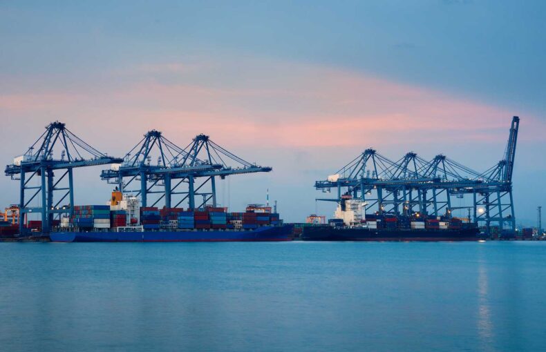
Transparency in a whole new light
In February of 2020, a Vietnamese ship entered Indonesian waters, likely fished illegally, and then returned to port without consequence. By March, it was back at sea. There were no signs to indicate that the vessel had raised suspicion, even though it had been making the same voyage since 2019. But it had in fact been spotted. Using satellite tracking data, experts at Global Fishing Watch had pieced together a history of the vessel’s every move—they’d uncovered suspicious behavior that would have otherwise continued unnoticed.
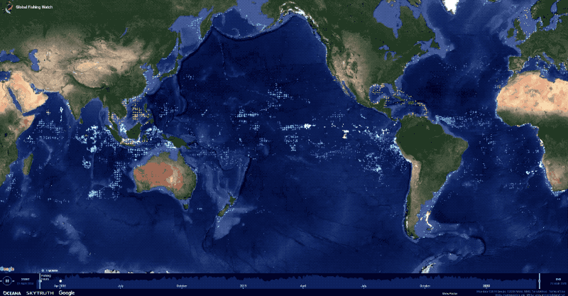
See the story come to life
Visit our data portal to see visualizations of the information from this story and download the datasets.
Global Fishing Watch (GFW)—an international, independent non-profit—has pioneered the use of technology to advance ocean sustainability through increased transparency. Its key resource for detecting illegal, unreported, and unregulated (IUU) fishing is satellite automatic identification system (AIS) tracking data collected by Spire Global. And with sophisticated data analytics, the organization is revolutionizing how fishing activity is monitored.
“Having the low-cost, global coverage that you get with the Spire satellite AIS completely transforms our ability to understand what’s going on out there,” said Paul Woods, GFW’s chief innovation officer. “We also benefit from a dynamic environment where we can interact with the data and collaborate with Spire on how we are going to use it in an open way.”
“The inspiring ways in which Global Fishing Watch uses maritime activity information fuels our enthusiasm to uncover more data-driven innovation,” said Max Abouchar, a sales engineer and data analyst at Spire.
Historically, vessels simply disappeared from oversight once they ventured far from shore and then submitted fishing logs when they returned to port. Not a good system for building trust, to say the least. GFW and Spire’s partnership, however, has helped build a comprehensive picture of commercial fishing activity around the world. A feat not possible a decade ago.
“Everybody has been so used to just not knowing,” said Mr. Woods. “When you bring this data in and actually quantify and measure all these things by directly observing it with AIS, it just completely changes the way people think about what questions to ask.”
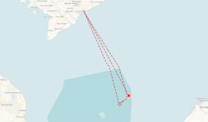
Visual AIS track of the Vietnamese fishing vessel. Explore this data
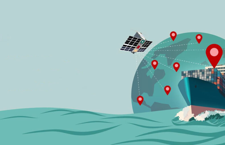
AIS uses onboard GPS-like transponders, about the size of a laptop, that regularly broadcast vessel location, identity, speed, and other critical information to nearby ships, as well as to terrestrial and satellite receivers. While the International Maritime Organization first adopted AIS to prevent collisions and boost overall sea safety, it turned out to be an invaluable system for monitoring compliance and tracking suspicious fishing behavior globally. The Vietnamese vessel, for example, transmitted its location during the weeks it spent in Indonesian waters, leaving a trail of digital breadcrumbs.
“These detailed tracking data have the potential to provide estimates of fishing activity and effort in near real-time,” according to a sweeping study published by the United Nations Food and Agriculture Organization.
Monitoring vast oceans needs big data analytics
Today, nearly three million fishing vessels operate across the seas, of which 60,000—mostly larger vessels—sail with AIS broadcasting capabilities. Before the GFW and Spire partnership, tracking this fleet outside the range of terrestrial receivers could be spotty and infrequent. To overcome these limitations and enhance visibility, GFW turned to Spire for its expansive constellation of nanosatellites and innovative solutions.
Spire’s nanosatellites, each about the size of a bread loaf, whiz around the planet collecting AIS data and observing atmospheric, sea, and earth conditions. The distributed constellation ensures satellite coverage across the oceans. And because each satellite completes a revolution in about 90 minutes, the overall group collects multiple observations of each location a day. Spire even developed Enhanced Satellite AIS coverage to improve monitoring in high-traffic zones, where individual vessel broadcasts can be lost in the noise of thousands of ships transmitting AIS data at once.
In short, Spire’s system is ideal for helping GFW collect AIS data to identify fishing activity and promote transparency. It’s particularly effective for tracking vessels that operate in the high seas, which account for over 60 percent of the world’s oceans.
Share on Facebook Share on Twitter Share on LinkedIn
“The satellite AIS fills in coverage and turns it into a comprehensive solution instead of this niche, spotty little thing,” said Mr. Woods.
The two organizations partnered in 2017, and GFW started consuming Spire’s total AIS feed. When it uploaded the data to its interactive, public map, which visualizes the world’s fishing activity, the chart lit up.
“It was pretty spectacular, it filled right in. Some of the areas where we had the greatest problems showed the greatest benefit,” said Mr. Woods. “It made everything twice as good, instantly.”
Continuing the success, the two organizations grew together. As Spire launched more satellites, GFW received additional information. Today, GFW processes up to 60 million data points a day from over 300,000 fishing and non-fishing vessels, up from about 3 million data points and 100,000 ships in 2012.
By channeling this data into advanced data analytics, GFW has been able to develop powerful monitoring tools. More specifically, it used machine learning to build two models for identifying patterns within the large datasets. One classifies fishing vessels and the gear they use, which is regulated. The other identifies when and where a ship fished, not just where it traveled.
The combined system can automatically spot fishing vessels within the vast volume of data, estimate their fishing history, and flag suspicious behavior. With it, GFW has created an extensive record of global fishing operations. Monitoring has come a long way from self-reported logs lingering in filing cabinets.
These analytics quickly created impacts. In 2019, for example, GFW helped the United States Coast Guard identify eight times as many violations during IUU fishing patrols compared to the previous year, 25 of which were grave enough to “severely impact fisheries.”
Charting a course to complete transparency
“Once we got the data feed going in and it got better and better, the next thing we wanted to do was start to use the data for more operations,” said Mr. Woods.
This GFW’s map reveals where and when thousands of vessels are involved in close encounters at sea.
To gain even greater transparency, GFW extended its use of AIS data to study the supply network of fishing vessels. Carrier ships often resupply fishing vessels and also offload catch at sea, a process known as transshipment. This allows some fishing vessels to stay at sea for months or years. But it’s also exploited by criminal operators to hide slave labor and illegal catches.
“It’s a way for them to get around reporting and do nefarious things,” said David Kroodsma, GFW’s director of research and innovation, “so it’s important for it to be transparent and tracked.”
By studying AIS tracks of supply network ships, GFW created models to identify transshipment encounters and collect data on a practice that has long avoided oversight. “Already it has been used to identify vessels potentially involved in catching sharks that were illegally transported through the Galapagos,” wrote Nate Miller, a data scientist who works with GFW.
The solutions kept coming.
Some ships broadcast false location data to avoid policing, making it look like they are far from their actual position, a practice known as location spoofing. But because Spire can provide a complete data history, including the locations of its satellites collecting AIS information, GFW has been able to reveal this masking behavior.
The solution works by looking for discrepancies between AIS data transmitted from ships and the location of the receiving satellite. If a satellite over the Bay of Bengal, for example, captures AIS data from a ship reporting a location in the Bering Sea, it’s possible the ship is concealing its real position.
Pushing the bounds of possibility even further, GFW is now using AIS to help model the total sound emitted by ships around the world to create a noise map of the ocean.
All of these cutting-edge solutions were born from the combined power of AIS transponders and nanosatellite receivers—significant results from such small devices—but it took more than technology to cultivate their success.
Going farther together
“Global Fishing Watch was one of our first customers,” said Simon van den Dries, senior sales director of global data services at Spire. “It immediately recognized the possibilities that maritime data possesses.”
Since then, the pair have enjoyed a flexible and nimble partnership that fosters innovation. GFW’s experts approach Spire’s engineers with ideas and ambitions, and together the teams design practical solutions that help ensure sustainability across our oceans.
“With the new space approach that Spire takes and the rapid growth of their constellation, and coverage that comes from it, we’ve been able to discover much more potential,” said Mr. Woods. “It’s been eye-opening for us, we keep being amazed at the scope of the potential. There are so many things that are obvious to us now that we never thought of three or four years ago.”
And more is still to come.
“With the new space approach that Spire takes and the rapid growth of their constellation, and coverage that comes from it, we’ve been able to discover much more potential. It’s been eye-opening for us, we keep being amazed at the scope of the potential. There are so many things that are obvious to us now that we never thought of three or four years ago.”
Paul Woods
CIO, Global Fishing Watch
Share on Facebook Share on Twitter Share on LinkedIn
“Our employees are fascinated by the level of transparency Global Fishing Watch has been able to achieve by applying advanced analytics to our satellite AIS tracking data,” said John Lusk, Spire’s vice president and general manager of global data services. “We look forward to collaborating and growing together, and shaping our world for the better.”