Maritime AIS tracking data is more complicated than you might think
 Written by
Mark Deverill
Senior Sales Engineer
AIS tracking is more than finding a dot on a map. It’s having the equipment to capture a signal, so that the dot can even exist.
It can be difficult to sort through a massive collection of maritime AIS tracking data and then extract trustworthy, useful insights. This is particularly true in remote regions and areas of high vessel density, where AIS coverage is inconsistent or disrupted. In this blog, you’ll learn about game-changing technology that’s improving AIS data collection and analysis for the maritime transport industry.
High traffic in more ways than one
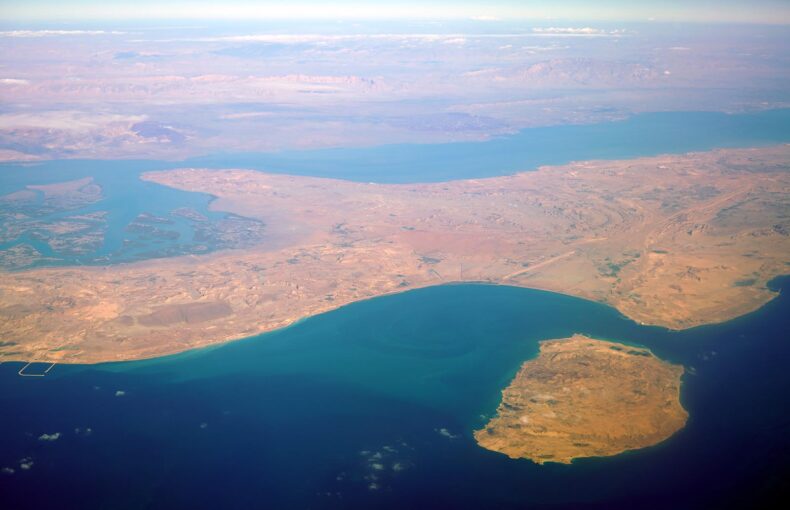
If you’ve ever been to Singapore’s balmy East Coast Park, you’ll know that a mass of ships blocks the view of Batam Island. Since the Port of Singapore is one of the busiest in the world, the number of vessels waiting to dock is staggering.
Each of these ships is fitted with an Automatic Identification System, which tracks vessels and helps maritime authorities ensure safety at sea. The system provides crews a clear picture of the locations and routes of nearby ships so they can avoid collisions.
But in both remote areas and regions of high vessel density, like outside the Port of Singapore, AIS coverage can be inadequate.
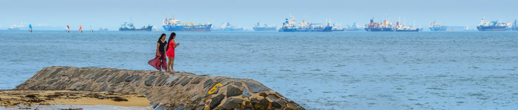
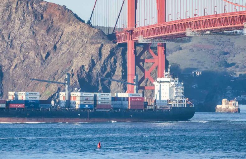
Ocean view from East Coast Park, Singapore.
A communication bottleneck
AIS messages are transmitted over two VHF channels, which poses particular challenges to accurately tracking ships at sea.
For starters, VHF radio waves are limited by line-of-sight, about 30 to 40 miles from a coastal antenna, depending on topology. Weather and the atmosphere also affect transmissions, so range and signal reach can vary significantly. Satellites orbiting the Earth can help, but these receivers can’t pick up AIS signals as often as terrestrial receivers due to their orbital trajectories.
In high-traffic areas, VHF bandwidth is limited by the competing signals from the vessels crowded together. Disruptions and interference occur when hundreds and thousands of messages bombard a single receiver all at once. Because satellites and ground-based antennas can only process so much information at a time, some signals are lost in the noise. When this happens, it’s as if ships vanish.
Here’s just how loud it can be. Global Fishing Watch, a long-time customer of Spire Maritime, observed more than 127,000 ships broadcasting over 24 hours and found that AIS signals from the vessels refreshed every five seconds, resulting in billions of data points and terabytes of data.
Some remote areas, on the other hand, lack comprehensive satellite and terrestrial coverage, leaving significant omissions in maritime information.
It’s no wonder, then, that tracking vessels in busy and remote areas is challenging.
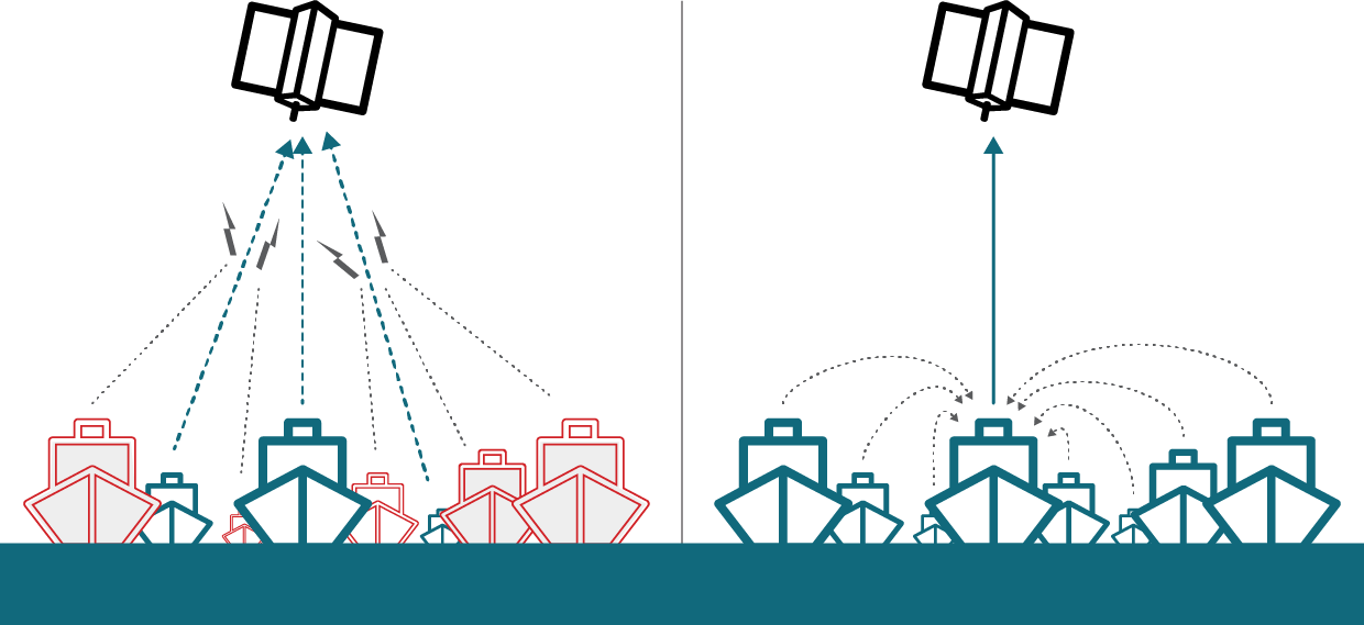
Left: Too many competing signals disrupt service.
Right: Spire Maritime’s Enhanced Satellite AIS significantly improves data capture of vessels in high traffic zones by signal consolidation.
Where to begin
Because of these challenges and disruptions, it’s essential to ask yourself if you can trust your maritime data. What if the location data of vessels in a high-traffic zone is incomplete? Or what if a vital piece of route data goes unrecorded altogether?
As you think about the trustworthiness of your data, also consider its coverage, frequency, and cleanliness. How much of the globe does it cover? And how often is it updated? Coverage and frequency will depend on how many satellites are available. And as for cleanliness, we saw how AIS data from remote or crowded regions can be messy and riddled with gaps.
These are key problems the maritime transport industry faces, an issue highlighted by Maksim Tsvetova, author of the book “Social Network Analysis for Startups,” states:
There has to be a discernible signal in the noise that you can detect, and sometimes there just isn’t one. Once we’ve done our intelligence on the data, sometimes we have to come back and say we just didn’t measure this right or measured the wrong variables because there’s nothing we can detect here.
At the end of the day, you need to be sure your data is trustworthy before you can successfully mine it for useful and actionable insights.
Solving The High-Traffic-Zone Problem
Unlike other satellite AIS providers, we combined three types of AIS collection (terrestrial, satellite, and Enhanced Satellite AIS) into one service.
We have the technology
New technologies are coming online that overcome some of the real-world challenges of collecting accurate, decluttered, and timely maritime data. They’ll help restore your trust in AIS data.
Nanosatellites, for example, are an increasingly common tool for tracking maritime data. These wine box-sized devices, also called CubeSats, are designed for low Earth orbit and offer forward-thinking maritime companies a low-cost alternative to remote sensing.
The nanosatellites’ small size allows for quick systems upgrades, much faster than dealing with standard satellites. Moreover, deploying constellations of CubeSats helps broaden satellite coverage for AIS data collection, making it easier for vessels to communicate critical signals in both crowded and remote areas.
Another promising solution, which Spire launched this year, is Enhanced Satellite AIS. By installing receivers on thousands of ships that can interface with both terrestrial and satellite antennas, Spire is making it easier to track vessels through the world’s busiest shipping lanes. In fact, Enhanced Satellite AIS has already achieved a 17 percent increase in global position updates.
Building the future
The maritime industry has been slow to take advantage of big data, according to Trelleborg Marine Systems, tremendous opportunities await those willing to invest in the right technology and data partners.
If you’re looking for intelligent vessel tracking and monitoring, we invite you to read more about Enhanced Satellite AIS and Spire Sense Cloud. We use a constellation of nanosatellites in low Earth orbit, and combine this system with curated data sets, like Enhanced Vessel Data and weather intelligence, for full maritime awareness from high-traffic zones to remote corners of the world.
You can learn more about this next-generation solution in our white paper.
New, Premium Data Samples
Spire also offers industry-focused, premium data set downloads. These data sets are tailored to specific industries – oil, fishing, dry bulk, container, and liquid gas vessel tracking. Our premium data sets are an easy way to experiment with our data and see first-hand the impacts data and predictive analytics can have on your business. Contact us for more information about our data, services, and resources, we’re always happy to help.