How Spire technology is helping Ororatech speed up fire detection
 Written by
Monika Lebkowska
Product Marketing Manager - Space Services & Earth Intelligence
At Spire, our mission has always been to use space-based data and analytics to improve life here on Earth.
That’s why we’re proud to team up with organisations at the forefront of mitigating the catastrophic impact of climate change on communities, populations and habitats. One such partner is OroraTech – a Munich-based satellite wildfire monitoring specialist.
In the first of our two-part blog series, we’ll look at how Spire technology is helping OroraTech to launch a satellite equipped with its proprietary thermal infrared cameras, known as FOREST (Forest Observation and Recognition Experimental Smallsat Thermal Detector).
With the impact of climate change being felt across the world, innovations in early detection and real-time monitoring are becoming critical to the preservation of communities, populations and habitats. While it might not always be possible to prevent a natural disaster from occurring, a deeper understanding of the risk allows authorities and businesses to prepare for it, both now and in the future.
The severity of hurricanes, droughts and floods are all thought to be worsening due to climate change, as is the risk and intensity of wildfires.
A growing threat
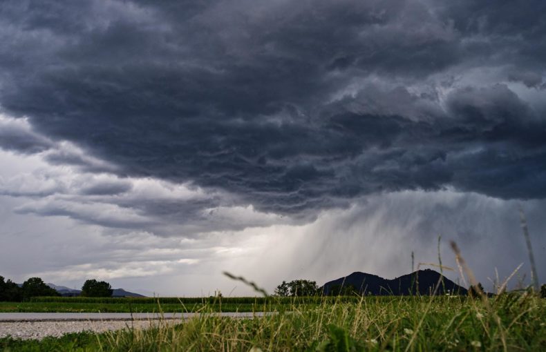
Apocalyptic scenes of flames engulfing parts of the Mediterranean and Western North America this year were a sobering reminder of just how vulnerable parts of the world are.
During southern Europe’s extreme heatwave, when temperatures soared to as high as 113F, fires ravaged Italy, Greece, Turkey and Albania and resources were brought in from France, Spain, and Romania. More than 2,000 people had to be evacuated from the Greek island of Evia, as the entire northern area smouldered.
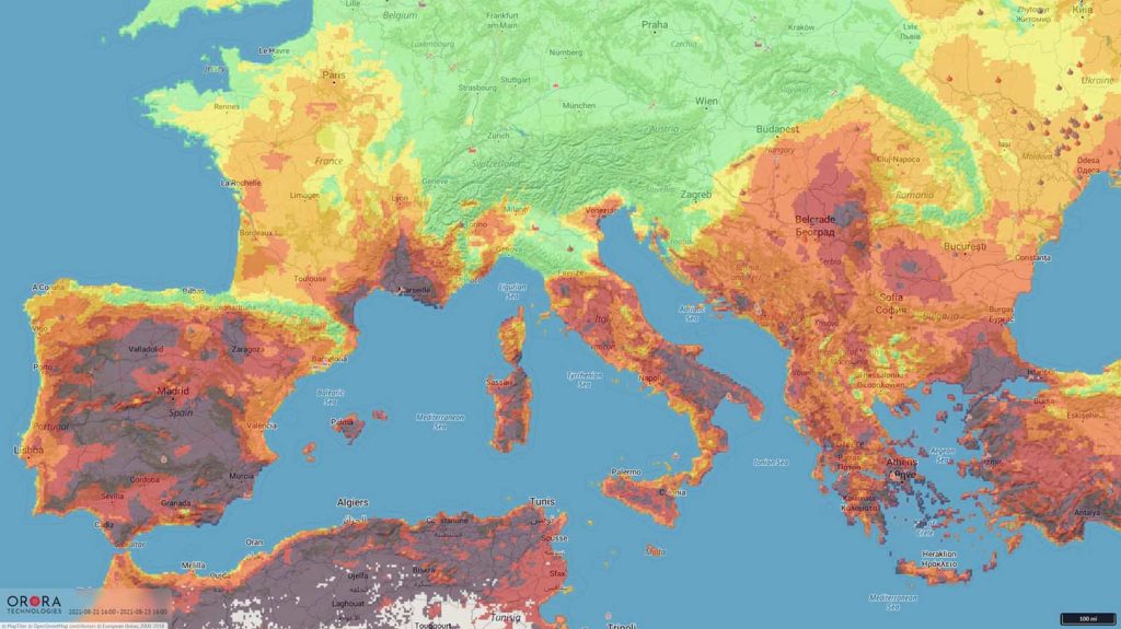
A heat map of Southern Europe on August 23rd during the 2021 summer heatwave. Data provided by OroraTech.
Elsewhere in the world, support from Australia and Mexico flew into British Columbia, which at one point, had almost 250 active wildfires. In northern California, the Dixie Fire has ravaged almost one million acres within the three months, while the Caldor Fire spread to Lake Tahoe, burning over 200,000 acres. Another region impacted is Siberia, where wildfires in the Sahka Republic caused smoke plumes to reach the North Pole.
A time-lapse from the first ten days of the Caldor Fire in Eldorado County, California, where over 220k acres were burned during the 8 weeks of fire activity. Data provided by OroraTech.
With soaring temperatures and bone-dry vegetation, it wouldn’t have taken much for the fragile forests to ignite. These fires could have been down to natural phenomena such as lightning or human behaviour – a discarded cigarette, barbecue or out-of-control campfire, for instance.
Early detection
Given how quickly wildfires spread during extreme heat waves, data from early detection and real-time monitoring systems is becoming critical for governments, local authorities and emergency services. The insights they gain gives them time to step up preventative measures, such as deploying more forestry patrols in at-risk areas, put evacuation plans into action and ensure firefighters have the right support, while also introducing targeted public awareness campaigns.
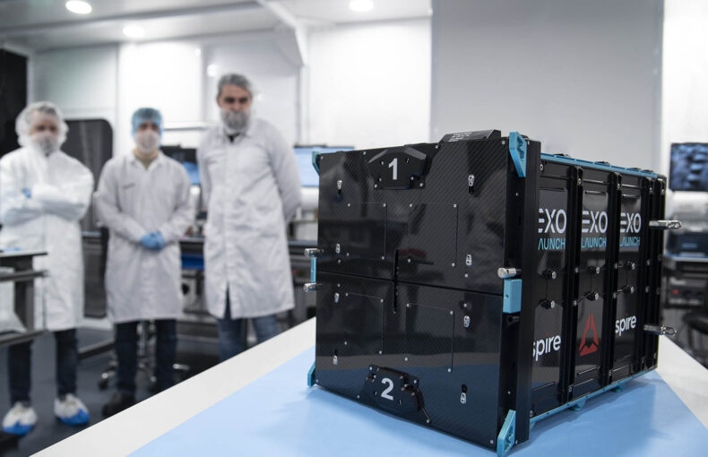
Satellite wildfire monitoring specialist OroraTech has been making great strides in this area, and is using Spire’s nanosatellite technology to help speed up fire detection.
Spire will carry OroraTech’s first payload on our 6U nanosatellite. This satellite is set to carry OroraTech’s proprietary and ground-breaking thermal-infrared camera and data processing unit, designed to detect fires and transmit the data via Spire’s satellite and ground network.
Firmly part of the NewSpace movement, it’s no surprise that OroraTech has maximised efficiency and performance at every step. The CubeSat satellites are built with off-the-shelf components and are more cost-effective to build compared to larger ones of the past. OroraTech’s patent-pending multispectral thermal infrared imager module has been optimized to meet the volumetric constraints of CubeSats (nanosatellites). Able to detect both mid-wave and long-wave infrared radiation, it’s ideal for identifying high-temperature events such as wildfires.
OroraTech’s sensor will be hosted alongside other Spire payloads on a LEMUR 6U satellite, planned for launch in January 2022. As well as the launch, Spire is also providing the global ground station network and provision of sensor data via API.
If wildfires are an inevitable consequence of climate change, then innovations like these are going to be one of our best defences.
You can read about how this idea became a reality in OroraTech’s blog.