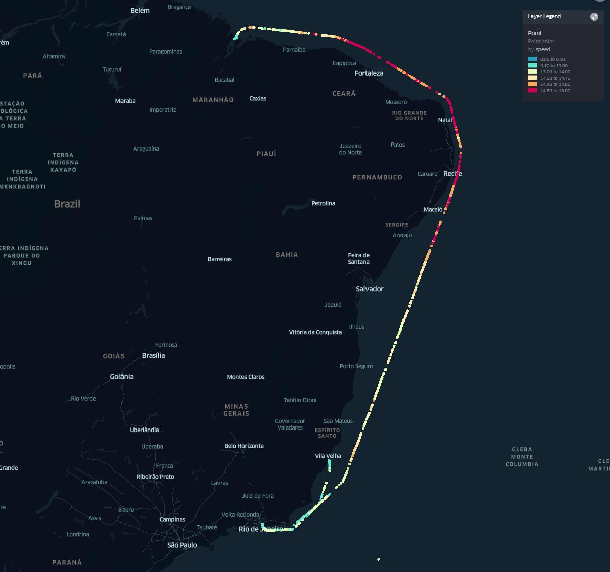
Single Ship Track along the Brazilian coast
Interested in this FREE data set?
This is a track of a single ship. It shows how complete satellite AIS tracking of ships can be, particularly when operating in remote regions that are out of the range of terrestrial AIS.
Data statistics
Plot of position reports by source. 99% Satellite AIS – 8901 and 1% from terrestrial AIS – 90
as the ship was operating outside of Spire’s terrestrial AIS network, along the coast of Brazil away from port areas.
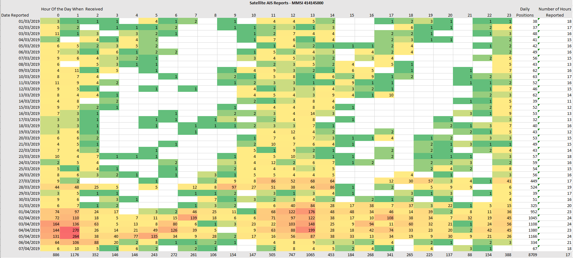
On average the ship was picked up in 17 hour periods every day showing a high level of refresh for the ship’s position.
The chart below shows how many position reports were received by Satellite AIS each hour over the duration of the sample period.
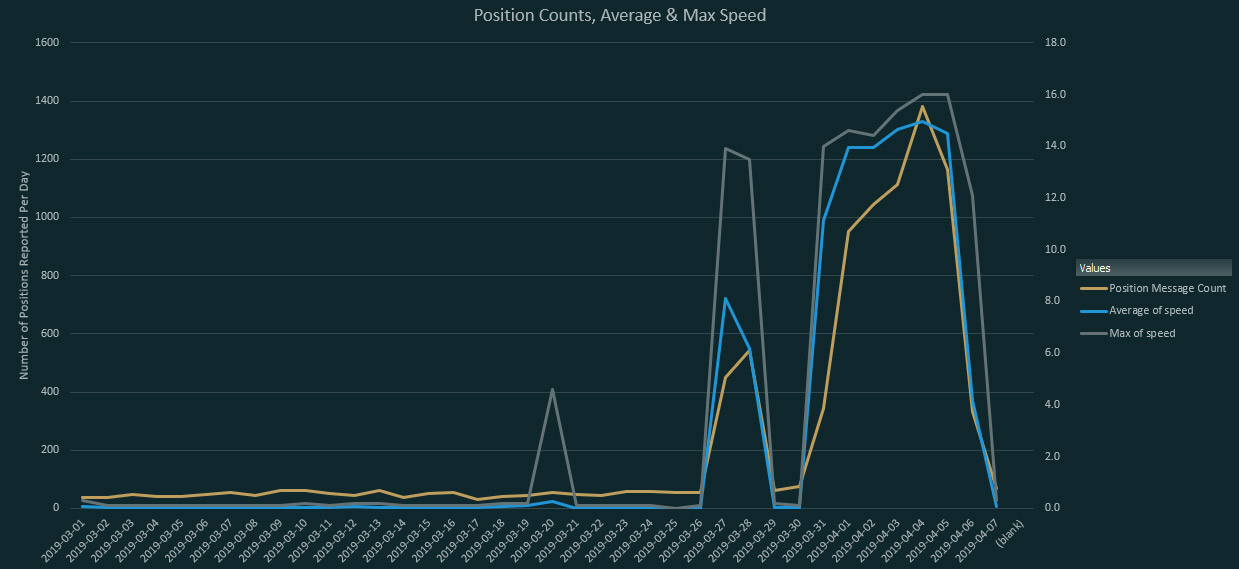
The chart below shows the number of position messages per day, average and maximum speed.
Note the speed during the port to port voyages
This chart shows the volume of messages received by source each day
