Geospatial intelligence goes global with air traffic data
 Written by
Pragati Basu
Digital Marketing Manager, Spire Aviation
Flight tracking data is a valuable resource that helps reveal insights about the global movement of people and cargo.
Air traffic data collected from ADS-B contains detailed location information that is valuable for governments and businesses. In particular, analyzing this data can support:
- Airline carriers and airport operators looking to boost operational efficiency.
- Supply chain managers and logistics companies that want to expand their view of critical networks and track assets globally
- Health experts that monitor disease outbreaks and global and regional travel patterns
See the benefits of satellite+ terrestrial coverage for yourself
The old adage “location, location, location” started as advice for the real estate and retail industries. Today, it is an apt reminder for businesses to capitalize on data with geospatial intelligence.
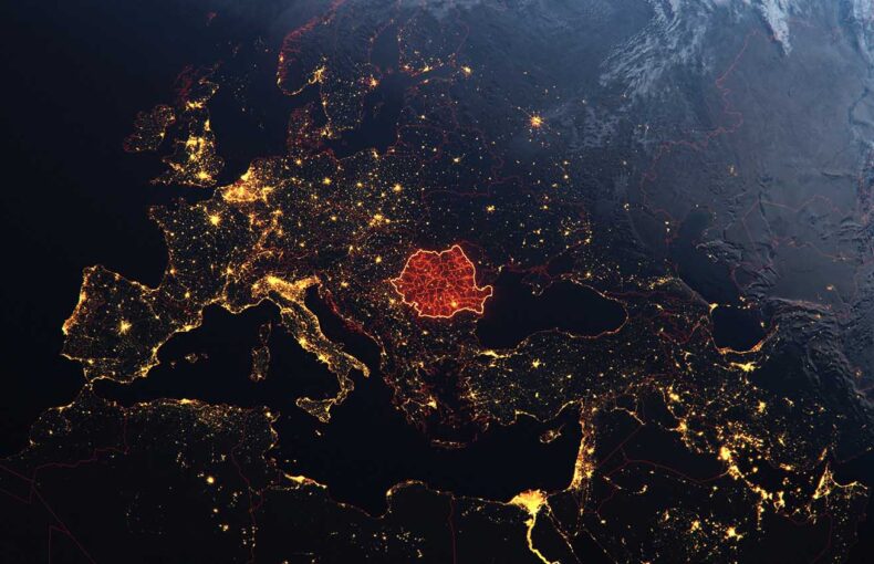
Organizations everywhere are using geospatial information to transform operations and generate new opportunities. Now businesses and governments can add continuous air traffic data to their geospatial intelligence. It is a powerful resource that helps reveal insights about the global movement of people and cargo.

“The world of geospatial data is larger than just maps,” explained Shay Har-Noy, general manager of Spire Aviation. “It includes a wide range of data that is organized by geography.”
Traditional types of geospatial data include descriptions of a location’s physical features, like land type, topography, infrastructure, weather conditions, and environmental characteristics. Demographic data or descriptions of human behavior are standard components. We are also seeing new data produced in a range of use cases that contains location information. For example, credit card transactions include location tags, as does data from connected devices and social media.
One of the first modern uses of geospatial intelligence sciences was Canada’s Department of Forestry and Rural Development efforts in the 1960s to map the country’s natural resources. Since then, its public applications have spread to touch many parts of our lives. You see it in election maps that depict voting tendencies. It reveals insights into the evolution of climate change. And even before Covid-19, geospatial intelligence helped doctors track disease outbreaks.
Commercial industries are also capitalizing on the resource. In particular, supply chain management, insurance, forestry, banking, and health services can all benefit greatly from geospatial intelligence, according to the Spatial Sciences Institute at the University of Southern California.
“Businesses everywhere are identifying relevant experiences and ways of making their products more relevant for their customers based on this location data,” said Har-Noy.
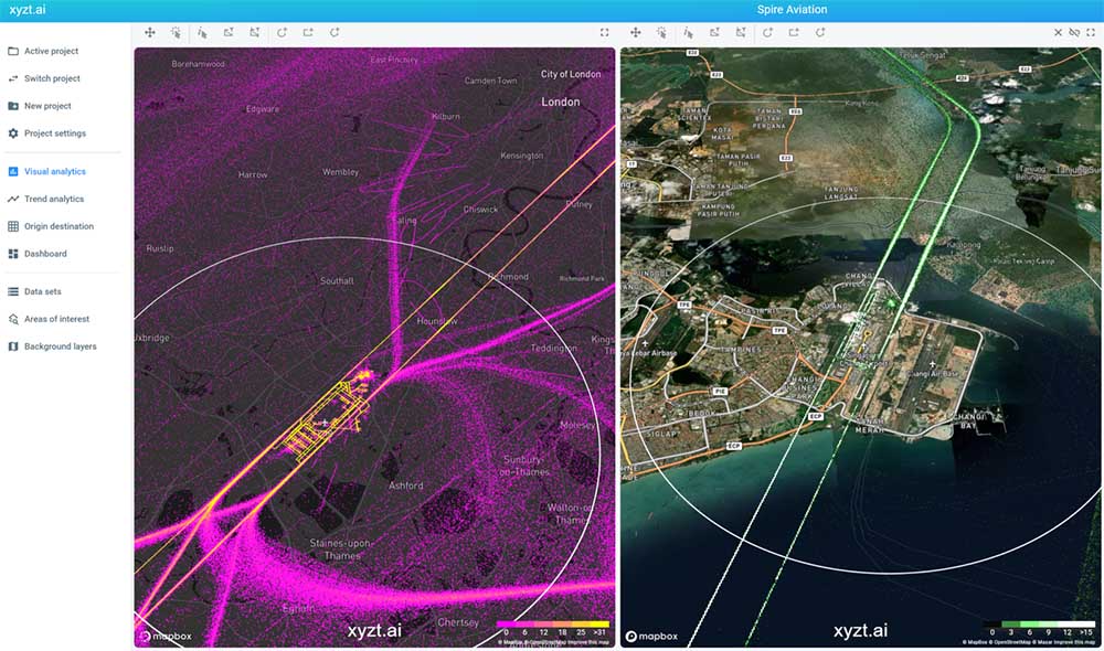 Air traffic data around cities – London and Singapore
Geospatial information has many applications partly because satellites have vastly expanded what we can study at scale. Advancing satellite technology, coupled with a range of powerful sensors, has allowed experts to gather highly detailed information about our world that would have been unattainable only a few years ago. A prime example is air traffic monitoring.
The backbone of modern aircraft tracking is Automatic Dependent Surveillance-Broadcast. ADS-B is an industry-standard technology for enhancing air safety and navigation. Aircraft use ADS-B transponders to regularly broadcast their airspeed, location, and other critical information to nearby planes, ground stations, and satellites. Satellites are a crucial part of the network because they extend coverage into areas inaccessible to ground-based surveillance technologies. While building stations across the Pacific Ocean or Himalayas would be absurd, satellites orbiting overhead can receive signals broadcast from aircraft in remote areas.
ADS-B may have been designed to aid surveillance, but it turned out to be a rich source of geospatial information packed with insights about commerce and society. Better yet, satellite coverage helps ensure the data collected worldwide is relevant, consistent, and timely.
“It can help us understand economic activity and about how people interact with their environment,” said Har-Noy. “You can look at the volume of traffic going into airports. You can look at the changes in the type of aircraft. You can also look at the number of airports in an area and their growth. There are so many questions you can answer by understanding the pulse of the world.”
“You can look at the volume of traffic going into airports. You can look at the changes in the type of aircraft. You can also look at the number of airports in an area and their growth. There are so many questions you can answer by understanding the pulse of the world.”
Dr. Shay Har Noy
GM, Spire Aviation
Share on Facebook Share on Twitter Share on LinkedIn
Here are three examples of how flight tracking data can support businesses and governments:
Streamlining the airline industry
For airline carriers, operational efficiency is key to profitability. They want to make sure that their planes spend as much time as possible ferrying passengers or cargo through the air, not stuck on the tarmac or circling above an airport. But with operations that span the globe and change by the minute, a minor setback in one location can ripple downstream and suddenly appear as a significant delay somewhere else.
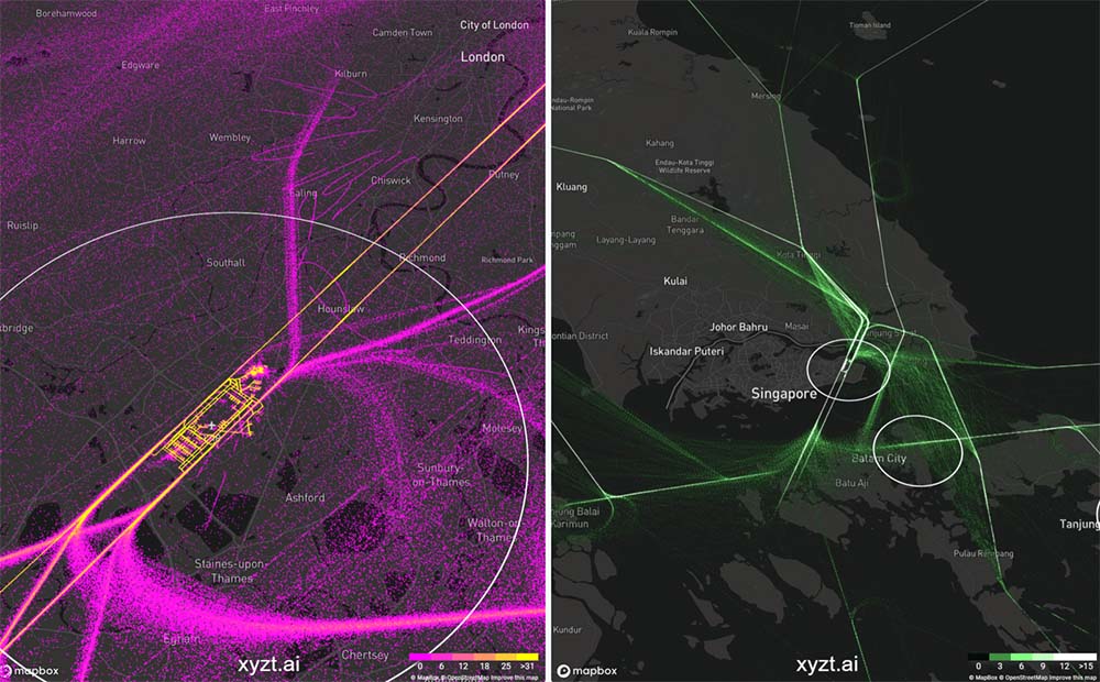 Air traffic data around airports – London Heathrow and Changi Airport
ADS-B data collected by satellites can help carriers monitor their far-flung networks, Har-Noy explained. With consistent and accurate information, carriers can better see what is happening to their fleet and where events are taking place. That means fewer surprises and more opportunities to optimize flight and crew scheduling. The geospatial data can even help find efficient routes.
Airport operators can also benefit from ADS-B information as they manage the complicated dance of preparing gates and dispatching ground crews. Information about worldwide flight activity can help airports identify events in distant regions that might affect operations on their runways.
From global networks to local planning with geospatial intelligence
Logistics and supply chain managers can also leverage geospatial information to streamline operations. Their need for data has rarely been greater. As Covid-19 demonstrated, the world’s supply chains are intertwined and at risk of sudden disruption.
“Flight tracking data can help logistics and supply chain managers enhance their view of operational networks, particularly when paired with maritime information,” explained Johan Alex Varghese, senior product marketing manager at Spire Aviation. For day-to-day operations, ADS-B data can help logistics companies that focus on air cargo to track and trace freight, stay abreast of disruptions, and build contingency plans. And for long-term strategies, the analysis of flight traffic can help supply chain managers identify patterns in the movement of people and goods.
“Local governments and urban planners would also do well to include ADS-B into their geospatial intelligence,” suggested Varghese. He pointed out that flight paths are important when studying noise levels and zoning neighborhoods. And the datasets can help illustrate trends in travel and tourism, a vital industry for any city.
“Flight tracking data can help logistics and supply chain managers enhance their view of operational networks, particularly when paired with maritime information”
Johan Alex Varghese
Senior Product Marketing Manager, Spire Aviation
Share on Facebook Share on Twitter Share on LinkedIn
Protecting the world
Epidemiologists and health experts have long included air travel in outbreak modeling and monitoring. Their responses to Covid-19 were no different. For example, in 2020, the RAND Corporation developed an analytical tool to predict the risk of importing Covid-19 that combines infection rates and air traffic data. And the International Society for Infectious Diseases plans to incorporate flight data into its next tool for infectious disease outbreak forecasting.
“With this in mind, ADS-B from satellites can be a rich resource for health experts studying the spread of diseases,” said Varghese. It offers nuanced and reliable data about the movement of people around the world. The high temporal resolution makes it ideal for monitoring evolving dangers and feeding threat matrixes. Meanwhile, the rich historical datasets are prime for research or training models.
In fact, United Kingdom-based SATAVIA uses Spire aircraft tracking data in its model for forecasting Covid-19 transmission risks along air bridges. The solution helps experts estimate the impact of opening and maintaining travel corridors.

“SATAVIA uses aircraft tracking data from Spire Aviation to enable live and historical analysis of aircraft movements,” said the company’s CEO, Dr. Adam Durant.
Spire’s constellation has geospatial data covered
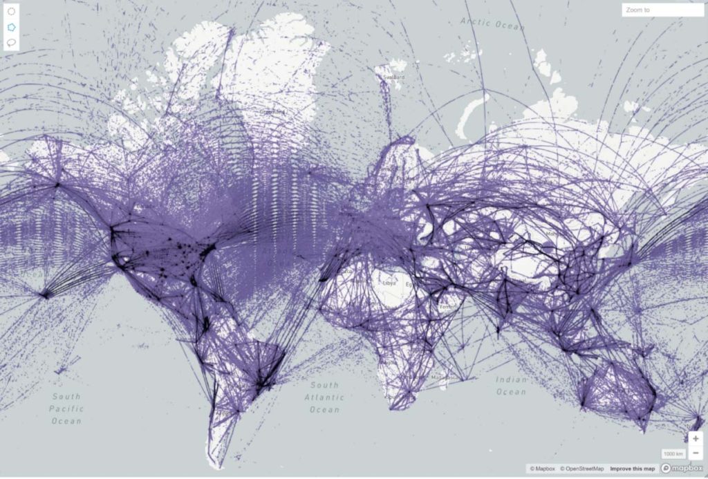
Spire operates a constellation of over 100+ nanosatellites fitted with advanced sensors. This space-based network captures ADS-B signals across the planet, tracking aircraft even while they cross oceans, deserts, and mountains. On average, Spire’s combination of satellite and terrestrial-based data captures over 200 million positional updates and tracks over 150,000 flights per day.
The data logs more than an aircraft’s position and status. It includes aircraft type and airline data, flight and airport records, gate and terminal details, and more. All of this information is delivered on real-time and historical APIs that integrate with workflows, helping customers build advanced products.
“We are just scratching the surface of what you can do by analyzing ADS-B data,” said Har-Noy.