Forecasting space weather’s impact on technology
We are heading into the sun’s stormy season.
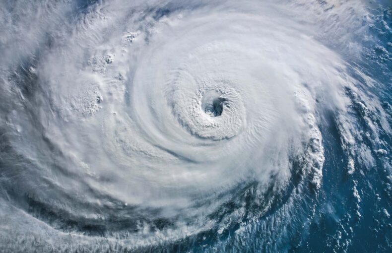
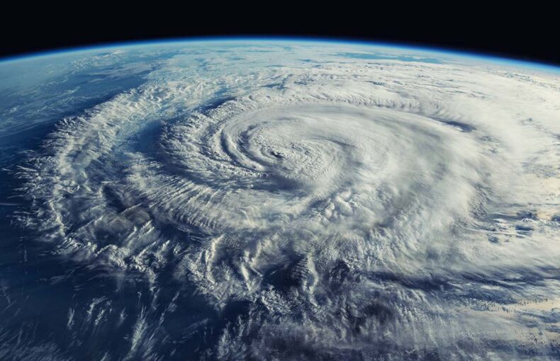
The sun may look the same every day, but activity on its surface waxes and wanes over an 11-year cycle that has consequences for life on Earth. Our star emerged from its most recent quiet period in 2019 and is heading towards its next peak in around 2025, when its magnetic poles will flip and conditions will become volatile and stormy. The resulting eruptions some 150 million kilometers away will create heavy space weather that affects our planet.
Space weather includes all conditions from the sun’s surface into our upper atmosphere that impact the performance of technology or threaten health. Solar activity accounts for most space weather conditions. The storms on the sun release waves of radiation and plasma that travel to Earth on the solar wind.
The most massive solar events can wreak havoc on Earth by knocking out power grids. But even daily and seasonal fluctuations can impact modern life, mainly by altering our ionosphere. Variations in ionospheric density interfere with GPS systems and satellite communication. They also cause the ethereal auroras that snake across night skies in the poles.
Monitoring and modeling the ionosphere’s changes can help account for space weather’s effect on critical technologies. Federal agencies and commercial organizations with a presence in space can use data and models to reduce variabilities and ultimately improve services.
“We collect data about the ionosphere 24/7,” said Mark Carhart, Spire Global’s director of intelligence community sales. “The data feeds our model, as well as models from other organizations, to create a more accurate assessment of what is going on.”
This awareness will be particularly valuable as we head into the stormy season of this solar cycle—the 25th since the first officially numbered cycle in 1755.
Hot with a chance of sunspots, solar flares, and coronal mass ejections
Experts disagree about how severe this solar cycle will be. The official Solar Cycle 25 Prediction Panel forecasts below-average activity, while other scientists suggest this could be one of the stormiest cycles ever. Scientists gauge conditions by counting the number of sunspots—the dark patches that appear on the sun’s surface in areas with high magnetic flux.
“Sunspots are a metric of solar activity,” said Matthew Angling, Spire’s director of space weather. “When there are no sunspots, the sun is really quiet. And at the top of the sun cycle, there are lots of sunspots.”
The presence of sunspots indicates a higher chance of extreme events like solar flares. Twisted magnetic fields in sunspots release energy and cause these sudden eruptions, which emit X-rays and ultraviolet light. Flares are often associated with increases in the density of energetic particles around the Earth, which can affect the operation of satellites or harm astronauts.
Other violent explosions, known as coronal mass ejections, hurl billions of tons of plasma away from the sun. These outbursts carry a magnetic field and travel as fast as 3000 kilometers per second. One of the most infamous coronal mass ejections occurred in March 1989 when a cloud of plasma 36-times the size of Earth catapulted into our magnetic field. It sparked a geomagnetic storm that shut down Quebec’s power grid, plunging the province into a 12-hour blackout.
A storm of similar magnitude could be even more devastating today. Fortunately, most solar events miss the Earth, and our magnetic field protects us from the brunt of the ones that do hit. Nonetheless, the effects of minor incidents and daily space weather continually impact modern life by manipulating our ionosphere.
Spire Global collects data about the world from the ultimate vantage point—space. And our solutions offer insights about the Earth, oceans, and atmosphere that can help power cutting-edge initiatives.
GPS signals sail through space weather
The ionosphere has up to four layers. It begins in the atmosphere’s upper levels at an altitude of about 80 kilometers and reaches into space some 1500 kilometers above the Earth’s surface. These layers contain charged particles created when X-rays and ultraviolet radiation from the sun collide with atmospheric gasses and break atoms into ions and electrons.
Because the amount of X-rays and ultraviolet radiation hitting the planet fluctuates, so does the density and elevation of the ionosphere’s layers. The amount of energy varies from day to night and can increase ten-fold over the sun’s 11-year cycle, NASA explained. Experts recently discovered that weather on Earth also alters the ionosphere, as atmospheric waves from storm systems can propagate up into the charged layers. So, just as the sea swells with regular tides and seasonal storms, the ionosphere is constantly in flux.
The ionosphere’s ebb and flow influence radio frequencies critical for communication and global navigation systems. The density of charged particles affects how signals reflect off and pass through the ionosphere, adding variability into military and commercial operations. In what is known as ionospheric scintillation, signals distort as they travel through pockets of ionospheric turbulence.
Severe scintillation can make it impossible for a GPS receiver to lock onto a signal and determine its precise location, NOAA explained. Even minor scintillation can reduce the accuracy of navigation systems, which not only contribute to critical technologies like cell phones and airplanes, but also transmit time data that underpins vital infrastructures like power grids and financial markets.
With so much relying on these systems, it pays to know what is happening in the ionosphere.
Keeping an eye on the ionosphere
Spire Global monitors the ionosphere using nanosatellites fitted with sensors that receive global navigation satellite system (GNSS) signals. The measurement technique takes advantage of the physics of how the GNSS signals travel through the ionosphere and produces invaluable results.
In general, signals travel slowly through high-density pockets of the ionosphere—just like it is slower to walk through water than on land. The magnitude of a signal’s delay also depends on its frequency. Because navigation systems broadcast more than one frequency, Spire can use its nanosatellites to measure the difference between the delays of various GNSS frequencies and then estimate ionospheric density. The measurements are called radio occultation, and Spire uses a similar technique to monitor weather conditions from the upper levels of the atmosphere down to the surface of the sea.
Ground-based sensors can also measure the ionosphere, but only for areas above land. Also, these observations fail to capture the nuances of how conditions change with altitude. In contrast, orbiting satellites provide both global coverage and vertical measurements through different layers of the ionosphere, which makes it possible to build highly detailed three-dimensional models of conditions, Angling explained.
To better understand the distinction, it helps to think of the difference between standard X-ray imaging and CT scans. A standard X-ray machine is fixed and creates a two-dimensional picture of a bone or organ. This is similar to ground-based sensors. On the other hand, a CT scanner uses a rotating X-ray device to build a three-dimensional representation of the body, much like orbiting satellites that monitor the ionosphere.
Moreover, satellites can continuously monitor the ionosphere while orbiting, helping to ensure observations of the ever-changing environment are up-to-date.
“In a dynamic model, you are constantly collecting data and revising the model based on real observations,” said Carhart.
There is a range of applications for a dynamic model of the ionosphere. For defense users, it can help account for disruptions in navigation systems, correct errors of radar images, improve space situational awareness, and help to pinpoint the location of high-frequency radio transmissions. It is also beneficial for commercial organizations with services that rely on GPS—like autonomous vehicle operators and global logistic companies—or satellite communications.
Researchers can access our unique space weather data now. In 2020, Spire received a contract award for commercial operational Earth observation data from NASA. Through this contract, Spire provides GNSS radio occultation atmospheric profiles, space weather measurements, grazing angle reflectometry used in sea ice measurements, and more. Spire’s contract with NASA was renewed in May 2021, and this data is currently available to support environmental research efforts.
Spire will continue to launch new satellites and ramp up data collection as the sun heads into what could be a record-setting period of activity. And Spire will further hone its space weather solutions so its partners can see the impact of solar events as clear as day.
“We are building the best possible representation of the ionosphere, one that can provide solutions to meet the needs of many different customers,” said Angling.
Learn more about the rich environmental data sets that Spire’s nanosatellites collect and the solutions they support around the world.