The secret to successful e-navigation
 Written by
George Facaeru
Maritime Sales Director at Spire Global
The continued development of AI-powered e-navigation tools is an inevitable component of the digitalization of the maritime industry and autonomous shipping.
The continued development of AI-powered e-navigation tools is an inevitable component of the digitalization of the maritime industry and autonomous shipping.
Digital routing services and optimization have been running for the last 50 years, and today there are already some quite advanced providers. But the full potential of big data and machine learning in these technologies has not yet been realized.
When it comes to driving cars, we’re accustomed to entering our destination into our phones and letting intelligent apps, like Google Maps or Waze, parse numerous factors and find the optimal route. But a simple, automatic Waze-like app for maritime vessels is still not here yet. Why is that?
One reason this kind of app is much more challenging to create for the maritime industry: weather.
The weather doesn’t affect navigation on land nearly as much as it does at sea. In the ocean, weather and sea conditions can significantly alter a ship’s journey and operational costs. Also, the weather at sea involves several variables, like winds, currents, waves, temperature, and ice. And weather is dynamic, it moves and changes.
In short, weather data adds complexity to maritime route calculations.
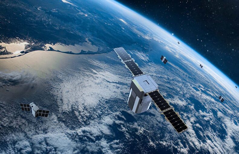
“These shoe-boxed sized satellites are tapping one of the most promising (and least-known) new technologies for weather sensing in the past 20 years: GPS radio occultation (GPSRO).”
Share on Facebook Share on Twitter Share on LinkedIn
Return to the present
It’s clear that advanced maritime e-navigation systems like this are coming, and they will revolutionize the maritime industry.
Let’s take a closer look at some of the technologies that will contribute to advanced e-navigation systems. Understanding some basics about the state of weather routing technology may help give you some ideas on how to improve your products and prepare for the future.
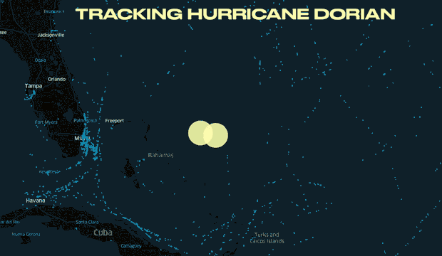
Spire data tracking of hurricane Dorian
Avoiding extreme weather
One significant value of high-quality weather forecasts is being able to avoid extreme weather conditions, and therefore minimize fuel use, downtime, and risks. On a long voyage, avoiding extreme weather and planning strategically according to weather forecasts might save you days of time, thousands of gallons of fuel, and many staff-hours.
Radio-occultation GPS data, also known as GPS-RO or GNSS-RO, is changing how we make weather predictions. First applied in a weather context in 1995, this technology analyzes how radio waves change as they pass through Earth’s atmosphere. This provides detailed data about the state of the atmosphere, which can be used to make predictions.
As the technology has evolved, it is now possible, using a constellation of smallsats, to cover the planet and get this data in remote regions too.
Aside from forecast predictions, GNSS-R (reflectometry) can also be leveraged for winds over sea/ocean and soil moisture—an application that will continue to improve. And there will likely be many more uses for GPS-RO in the maritime industry.
Machine learning is also enabling the advancement of weather predictions. Neural networks, coupled with ever-growing computing power, have allowed us to analyze and discover patterns in large, historical data sets, a feat that wouldn’t have been possible a few years ago. Machine learning also brings value to other maritime calculations, such as plotting optimal routes and schedules when considering a vast number of factors.
“You can begin to understand this seamless information environment by combining weather and other environmental content in The Living Atlas.”
Guy Noll
Maritime Consultant – ESRI
Share on Facebook Share on Twitter Share on LinkedIn
Increasing efficiencies for everyday travel
Avoiding extreme weather is maybe the most obvious use for integrating weather predictions in your applications. But it’s likely that, in the long term, the most significant efficiencies and sources of savings will come from optimizations for voyages in non-extreme weather.
Even on everyday voyages, the combination of waves, currents, and winds can generate a lot of fluid resistance for a vessel. Better weather and ocean-state data, combined with machine learning, will result in e-navigation systems that choose routes of least resistance and also continuously make small adjustments throughout a trip. This might seem like a relatively minor optimization. But when you consider that winds, waves, and currents are often slowing down vessels, it’s easy to imagine how these small changes can add up to significant savings.
Here’s one example of how this could work. A routing system might see that a current several miles away offers less resistance than the vessel’s present path. The system calculates that choosing the lower-resistance path more than makes up for the extra travel time and fuel costs.
These systems will also use more peer-to-peer, localized data. For example, a ship transmits data to nearby vessels about a localized weather event, such as a passing cold front bringing strong broadside winds. Nearby ships can use this data immediately, and it can also be incorporated into a centralized navigation system for future reference to seasonality, satellite imagery, and time of day.
Esri’s Maritime Consultant, Guy Noll, adds that “you can begin to understand this seamless information environment by combining weather and other environmental content in The Living Atlas.”
Improvements in satellite AIS data will also help analyze resistance and determine optimal routes. Applications may take into account the real-time speed and acceleration of all ships in an area to establish more efficient paths.
“NAVTOR has leveraged new GPS RO measurements, and we are looking forward to further validation of the increased benefit of these observations in the analysis. We hope and believe this will lead to an improvement in MetOcean forecasting, which in turn will benefit all e-navigation customers.”
Bjørn Åge Hjøllo
Senior Project Manager e-Nav. / M.Sc. Meteorology – NAVTOR
Share on Facebook Share on Twitter Share on LinkedIn
More accurate weather forecasts will benefit e-navigation users
Insight from Bjørn Åge Hjøllo, Senior Project Manager e-Nav. / M.Sc. Meteorology at NAVTOR
Weather forecasting can help improve the safety and efficiency of e-navigation route planning. And while atmospheric models have certainly advanced over the last decade, there are still some sticking points to be aware of.
One difficulty with forecasting is that minor mistakes in initial atmospheric readings can quickly mushroom into major errors in final predictions. This can result in, among other miscalculations, misplaced air pressure lows and highs. Accurate models, therefore, are critical.
Next steps
Groundbreaking advancements in maritime weather routing aren’t science fiction. They’re happening now. If maritime software makers want to survive and thrive, they’ll want to pay attention to how reliable and accurate weather can help build sophisticated navigation engines. They’ll need to look for ways to incorporate new state-of-the-art solutions in their offerings, so they’re not left behind.
About Spire Weather
Spire weather data is powered by a unique technology called Radio Occultation. The radio occultation profiles collected by Spire’s satellites bring a unique understanding of the global weather conditions and are the foundation of a highly valuable weather forecast. Spire Weather for Maritime includes a service level agreement so you can benefit from accurate and reliable forecasts with no risk of outages.