The Importance of Marine Protected Areas and How Maritime AIS Data Can Help Preserve Them
 Written by
Peter Letzelter-Smith
The accountability demanded of the shipping industry to responsibly use the world’s waterways has been steadily growing.
Societal expectations are that the long-term health of not just humans but all inhabitants of the oceans and the marine biomes where salt and freshwater meet must be respected and protected. And since most ports are near such estuaries, it is incumbent that their management and the broader practices of ships in transit be safety-conscious and operationally cautious.
Advocates around the world, including the Biden Administration in the United States, have embraced the 30 by 30 movement, which seeks to protect 30% of land and ocean resources by 2030. One vital tool in doing so is Marine Protected Areas (MPAs), which are designated zones where industrial activity is restricted to protect the habitat. Currently, less than 3% of the “… global ocean is protected in marine protected areas that have strong enough regulations to safeguard biodiversity.”
Clearly, the 30% goal represents a rapid expansion of such designated areas. This will require significant adaptation by the shipping industry to maneuver around quite literally.
Thankfully, there are technological solutions that can be brought to bear. They will enable the industry to tackle its issues and support the protection of areas that are vital repositories of biodiversity.
From Concern to Action
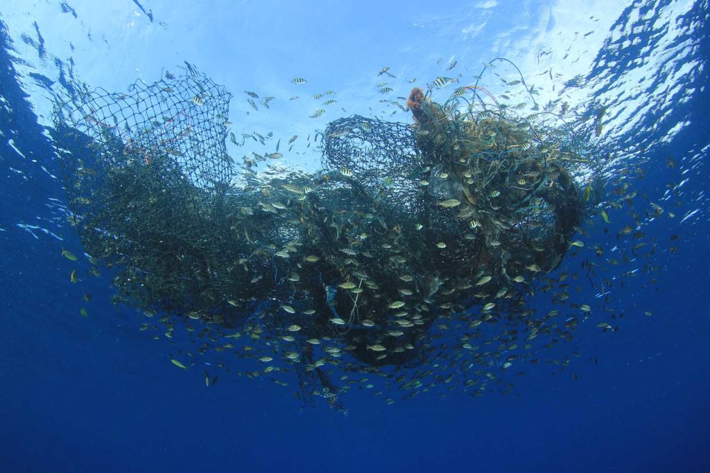
The impact of the shipping industry on marine ecosystems can be a grinding, long-term erosion of habitat and the introduction of invasive species. But occasionally it is a sudden, profound despoiling that captures the world’s attention.
A Spectacular Failure
Perhaps the most famous of such incidents was the wreck of the Exxon Valdez on March 24, 1989. While traversing Alaska’s ecologically rich Prince William Sound, the oil tanker ran aground due to simple navigational negligence. It eventually spilled over 11 million gallons of oil, which led directly to the death of at least 250,000 seabirds, thousands of sea otters, hundreds of harbor seals, and millions of salmon and herring.
Over 30 years later the area is still being impacted by what a modern ship can do to a marine ecosystem. The Exxon Valdez spill was one of the worst environmental disasters in the history of the United States, leading directly to the Oil Pollution Act of 1990—which among other things required that oil tankers be double-hulled—and the expansion of marine protected areas in the Prince William Sound region.
The incident was a catalyst for significant changes to the oil industry, including Exxon and other major companies modifying tanker routes to avoid sensitive marine areas and seeking out technological solutions to improve ship navigation.
Unfortunately, it is harder to galvanize public attention and legislative action towards the less high-profile impacts of non-disastrous shipping over the long term, but that is beginning to change.
All Is Not Well
As with Alaska, the coastline of Canada is vital to the biodiversity and health of the Northern Hemisphere’s oceans. Canada has been aggressive in the 21st century, creating 14 Oceans Act Marine Protected Areas (MPAs) that represent 6% of the nation’s marine and coastal areas (over 350,000 square kilometers). There is a national commitment to protect 30% by 2030.
But just because areas have been designated as protected does not mean they are not threatened by pollution.
The recent World Wildlife Fund-Canada report “National Vessel Dumping Assessment: Quantifying the Threat of Ship Waste to Canada’s Marine Protected Areas” found that “… ships produce, and potentially dump, 147 billion liters of harmful waste each year while in Canadian waters—the equivalent of 59,000 Olympic-sized swimming pools. Dumping threatens wildlife even in the protected parts of our oceans, with roughly 10 per cent of waste, or 14.7 billion liters, generated annually in these sensitive habitats. The vast majority of this waste is dumped as it’s created.”
The WWF-Canada found that Canadian waters are threatened by many practices that are currently routine in ship operations when traveling between ports. Bilgewater, greywater, scrubber wash water, and sewage—created by exhaust gas cleaning systems, showers, toilets, kitchens, and routine operations—unleash a toxic stew into protected areas.
Unlike the aftermath of the Exxon Valdez, which required and inspired immediate action, the challenge today is to incorporate into the daily processes of the shipping industry a series of operational enhancements that will, cumulatively, have a deep impact on marine protected areas. Just as the expansion of such zones is meant to trigger carryover effects that will improve the health of the world’s oceans, the fine-tuning of shipping protocols will reinforce the vitality of marine protected areas.
Good Data Means Better Outcomes
Luckily, there are solutions—from smart ship data collection to improved analytics via artificial intelligence—that can squeeze the shipping industry for increased efficiency and decreased environmental impact.
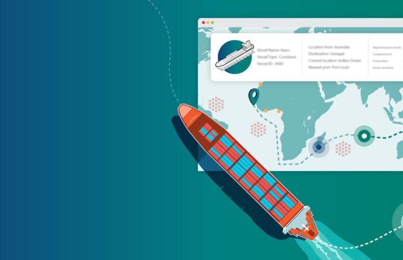
The ability to track the locations of ships continuously and in detail is an especially important aspect of safeguarding marine protected areas.
Avoiding Protected Areas in the First Place
The most obvious way to prevent ships from impacting ecologically sensitive zones is to keep ships well away from them. As the number of protected areas expands this will only become more challenging.
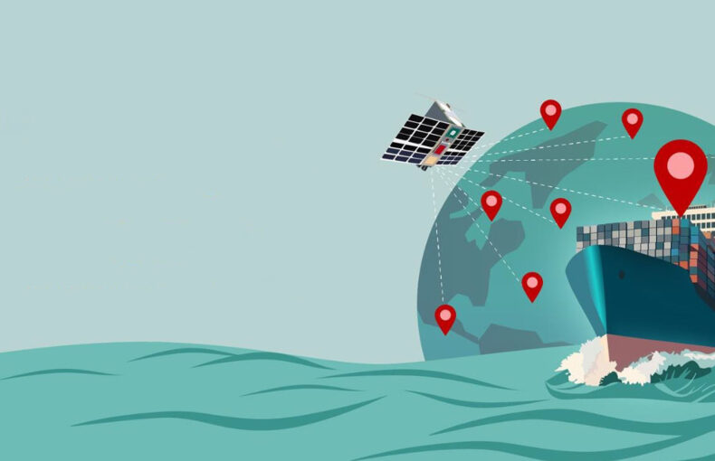
Using Satellite Automatic Identification Systems (S-AIS), vessel identification and location can be tracked at all times and maritime domain awareness and environmental monitoring maintained. The course and speed of ships can be scrutinized, which can be especially important when in or near protected areas, so that interference with the migratory routes of whales and other large sea life is curtailed.
In real-time, established geo-fences can send warnings to ships to alter their behavior when deviating from mandatory routing and speed restrictions. This can include automated alert systems for vessels entering an MPA or other areas that present navigation hazards. Retroactively, thanks to the archiving of the ship’s course and speed data, violators can receive fines that will encourage better behavior in the future.
Preventing Collisions of Any Kind
As with the Exxon Valdez, collisions—even with the earth—are the most grievous maritime accidents and can lead to catastrophic results. With S-AIS, individual vessels and their ship management firms can have specific real-time information regarding location and course, making the kind of grounding that doomed the Prince William Sound far less likely.
The same holds for ship-to-ship collisions, both in real-time and with the development of safer shipping routes.
Density maps can be especially helpful in this regard and are an effective tool to understand a specific area quickly and see where vessel traffic patterns differ throughout the world. Delivering in-depth vessel pattern analysis by transforming millions of AIS messages into individual actionable map data, density maps provide a complete view of the world’s shipping. With data on shipping patterns, assessments can be made regarding ship strike risk and routing can be developed to mitigate it while also analyzing the efficiency of alternative shipping routes. This is especially helpful for MPAs that are in close proximity to major ports and are at greater risk from higher volumes of traffic.
Finally, monitoring speed in areas known to be migratory routes can alleviate one of the greatest risks to whales and other large animals: being hit by ships. Studies suggest that vessel strikes are one of the primary ways that human activity kills whales. As outlined in an article published in Frontiers in Marine Science, “Where possible, it is ideal to move vessel traffic away from high-density whale areas by establishing or modifying official shipping lanes (also known as traffic separation schemes, TSSs) or defining areas-to-be-avoided (ATBA) by vessel traffic. Where vessel traffic and whales necessarily overlap in time and space, adding mandatory speed restrictions to decrease vessel speeds in high-risk areas has been successful at lowering deaths.”
Such findings have been put into practice. Since 2008, mandatory NOAA Fisheries speed limits for ships over a certain length have been in place on the eastern coast of the United States during times when North Atlantic right whales are most likely to be present. Similar protocols are now being pursued for the west coast. Using such tools as Spire’s Shipview allows areas with speed limitations to be monitored and alerts sent out when violations occur, in addition to preventive measures like reminders to crew when approaching such protected zones.
Even more granular data about ships—not just speed and course—can be tracked and gathered. Alerts can be fine-tuned for when ships that meet certain criteria, such as length, are entering areas with speed limit regulations in place. The precision with which data about ship types can be collected and correlated is an important level of insight to harness.
Monitoring ship speeds through protected zones can help enforcement agencies increase awareness while also aiding pilots to be more aware of threats. With data about the migratory movement of whales, pilots have more information than they would when just depending on their immediate readings. Many whale strikes go unrecorded because it is hard to even notice collisions in large ships.
Modeling With Historic Trend Databases
The modeling that such solutions are based upon is also dependent on the data that AIS provides. As the article quoted above—”Modeling Whale Deaths From Vessel Strikes to Reduce the Risk of Fatality to Endangered Whales”—points out, it “… employed a ship strike model using whale density data and automatic identification system (AIS) vessel data to estimate mortality under several management scenarios. To assess the effect of the VSR [vessel speed reductions] on strike mortality, we bootstrapped speeds from vessels greater than 19 m long that transited when no VSR was in place. Finally, we calculated the predicted mortality for hypothetical cooperation scenarios by artificially adding speed caps post-hoc to real vessel transits.”
Having a complete historical record of all global shipping movements helps with the preservation of MPAs. The ability to maintain historical AIS tracking information for vessels and easily break this data down into subcategories based on characteristics like boat length and specific geo-fenced areas is a powerful tool. It opens up investigative reporting opportunities that can be used in a wide range of research, such as developing the safest shipping routes and speeds within environmentally sensitive areas. Additionally, it can be focused on regulatory scenarios, such as detecting and identifying the sources of oil spills and marine pollution violations.
Tracking Illegal Operations
Another use for AIS maritime data in safeguarding marine protected areas is monitoring fishing activities. Since protected areas tend to be resource-rich, they are naturally targeted by illegal fishing operations. And unlike gargantuan supertankers or container ships, fishing vessels are much smaller and harder to identify by national maritime regulatory services that are stretched thin.
Solutions like exactTrax make catching boats that are fishing illegally in protected waters—or anywhere—much easier. Organizations like Global Fishing Watch (GFW) are using maritime AIS to increase the transparency of an industry that has long operated with a degree of anonymity. The use of AIS tracking data and subsequent analytical procedures make the illegal, unreported, and unregulated (IUU) fishing much harder to pull off.
Likewise, pollution discharges can be traced to the ships responsible by using tracking data that, in concert with evaluating when a spill occurred, can backtrack to the vessels that were in the area at the time. For example, the European CleanSeaNet uses satellite data to monitor oil spills and other pollution incidents and coordinate follow-up actions. These kinds of programs will be important in enforcing the actions called for in the WWF-Canada report and ensuring that marine protected areas are free from the persistent dumping of pollutants.
Moving Forward More Intelligently
The interconnectedness and failing health of the world’s oceans is becoming better understood as scientific monitoring moves forward. In response, it’s imperative that those who use our waterways operate more efficiently and less recklessly. Tools like Satellite Automatic Identification Systems are a powerful force in making this transition faster and more effective.