COP 27: 4 ways AIS and weather data can be used to reduce maritime carbon emissions
 Written by
Kevin Nakao
Contributor
More decisive actions and commitments are expected at the Conference of the Parties to the United Nations (COP27): 2022 is the ‘Super Year of the Ocean’ and the UN-Ocean Conference reached a collective agreement earlier this year among governments to implement “science-based, innovative” solutions to curb ocean warming.
More decisive actions and commitments are expected at the Conference of the Parties to the United Nations (COP27): 2022 is the ‘Super Year of the Ocean’ and the UN-Ocean Conference reached a collective agreement earlier this year among governments to implement “science-based, innovative” solutions to curb ocean warming.
Indeed, without mitigation, by the year 2050, the maritime industry’s carbon emissions are expected to increase as much as 50% from 2018 levels, making curbing greenhouse gases a priority for the sector.
Before explaining how Automated Identification System (AIS) vessel tracking and weather data can be used to reduce shipping impact, let’s cut to the chase with a little Occam’s razor, the principle that states the simplest explanation is preferable to one that is more complex.
The best way to reduce carbon emissions in the shipping industry is to simply buy less stuff.
That said, there are clearly crucial situations where shipping plays a critical role, from sending Ukrainian grain to drought-stricken countries to carefully controlled refrigerated ships that were used to safely and quickly distribute Coronavirus vaccines across the world.
Even a “right-sized” reduction in demand will require some version of shipping while offering the “cheapest mode of transport per ton.”
Still, efforts to reduce the carbon footprint in shipping are still important, and AIS and Weather data can help:
1. Just in time arrivals
Having a ship arrive when a terminal or berth is open, rather than waiting in an anchorage, reduces emissions by reducing the bottleneck of numerous ships waiting in port. AIS data provides more accurate predictions of arrival times, so ships can optimize their voyage by adjusting their speed, in order to arrive at the right time while reducing fuel consumption.
Another critical building block for supply chain efficiency is port events: These detailed geo-fences and polygons can help track the movement of ships while they are in a port, from arrival to departure. Measuring this velocity can inform port traffic congestion models and help plan just in time arrivals.
Spire Maritime COO John Lusk recently shared a presentation detailing how satellite data can reduce the environmental impact of the shipping industry:
Reducing environmental impacts
Actionable data insights can improve both supply chain performance and reduce harmful environmental impacts
- Historical vessel ETAs off by up to 40-60 hours
- Logjam at ports leads to higher emissions impact
- Accurate ETAs critical to reducing emissions and environmental impact
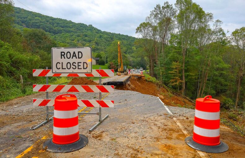
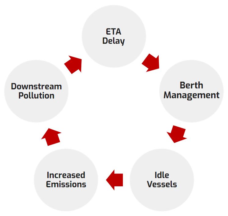
Optimizing port operations, as in identifying the right open berth for the right ship, is critical not only for securing the supply chain but also for reducing the environmental impact of shipping vessels. A ship that is delayed at port creates downstream supply chain disruption and increases pollution near urban centers.
A study published by Singapore’s Nanyang Technological University estimated that emissions from ships at the port of Los Angeles doubled between July 2020 and 2021, and increased by 123% in Singapore. Historically, port optimization has been difficult because the ETA provided by a ship is often off by up to 40-60 hours.
Spire Maritime works with many customers like Vesselbot to provide more accurate, objective, and data-driven approaches to predicting a ship’s arrival through our real-time satellite tracking data and over 11 years of historical data to help train machine learning models.
Connecting actionable data insights can improve both supply chain performance and reduce harmful environmental impacts. The best way to solve the last-mile delivery problem is to start tracking and taking action from the first mile.
2. Protecting wind farms and tidal turbines
While AIS was launched to protect ships from colliding with each other, both offshore and onshore assets needed to be protected. Using AIS data can determine the optimal location of offshore assets by recognizing shipping patterns.
More companies are focusing on renewable, green energy; reducing emissions; and developing methods for carbon transport and storage. Location data for shipping vessels, routes, and trade lanes are even more vital for the safe installation of clean energy alternatives like wind farms and tidal turbines.
Luana Duffé, Executive Vice President, New Energy Ventures at TechnicFMC plc says:
“We strongly believe that the energy transition will need to go offshore to reach its ambitious targets. For example, deep water wind farms will be needed to meet electricity demand. And then there’s safety – one of the safest and most efficient places to keep sequestered CO2 is offshore, and the same goes for generating and storing hydrogen.”
Luana Duffé
Executive Vice President, New Energy Ventures
Share on Facebook Share on Twitter Share on LinkedIn
Tidal turbines, vessels anchored in a moving body of water, such as a river, lake or bay are connected by subsea cable to the local electricity grid. The turbine converts the kinetic energy of the water’s current into electricity for local communities. Floating wind farms increase generating capacity; location data is crucial in order to keep them far from sea lanes and coastlines.
3. Measure what matters
Ship emission regulation is approached differently, and complimentarily, by the International Marine Organization (IMO) and the European Union (EU).
As a United Nations specialized agency, the IMO adopted new measures to take effect in November 2022, requiring all ships to calculate their current energy efficiencies (Energy Efficiency Existing Ship Index, or EEXI), improve their energy efficiency, and then establish their annual operational Carbon Intensity Indicator (CII) and CII rating, effective January 2023. The CII measurements correlate greenhouse gas (GHG) emissions to the distance the cargo has traveled.
Ships will get a rating of their energy efficiency (A through E, with A being the best). Governments, port authorities, and other stakeholders can incentivize ships with A or B ratings. This also signals to markets and financial sectors that top energy ratings are good business. If a ship has a D rating after three consecutive years, or E for one, the ship owner must submit a plan to remedy and demonstrate how they will improve to reach a preferred rating of C or higher.
The first annual report will be completed in 2023, with the first rating given in 2024. Additionally, heavy fuel oil (HFO) will be prohibited by ships in Arctic waters as of July 2024.
The goal is to reduce member countries’ net greenhouse gas emissions by at least 55% by 2030 and for Europe to become the world’s first climate-neutral continent by 2050, while simultaneously promoting alternative fuel adoption in the maritime industry.
The European Union’s approach reduces both bureaucracy and maritime greenhouse gas emissions, while being cognizant of the guidelines set by the IMO, and aiming to deliver the European Green Deal:
- Monitor, record, and verify carbon dioxide emissions from large ships in EU ports;
- Establish greenhouse gas reduction targets while continually reviewing IMO proposals;
- Additional measures, including market-based measures, in the medium to long term.
AIS historical ship tracking data, along with vessel characteristics, can also be used as part of these compliance efforts, to track time, routes, and nautical miles.
4. Earth, wind, and fire
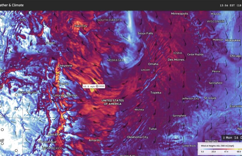
Another critical measurement to consider is weather and wave optimization on both voyages and routes traveled. By using weather data, shipping operators can evaluate sea conditions like waves and currents that could require more fuel usage and affect carbon emissions.
Wave heights and wind speeds across the world’s oceans have been on the rise over the past 25 years; the wind determines the roughness of the ocean’s surface, which affects travel times and speeds, and therefore fuel usage and emission levels.
Most historical weather data has been captured by buoys, yet nearly 80% of the ocean surface areas are not mapped, and it’s impractical and inefficient to gather enough substantive, actionable data from the surface buoys. Spire employs satellite and radio occultation technology to capture more reliable weather data.
Shipping companies can map more efficient water trajectories based on reliable, up-to-date information on waves and sea currents. Advanced weather data also assists captains and navigators in determining optimal routes, while troubleshooting potentially difficult weather conditions, thus reducing additional fuel usage and carbon emissions.
Download the case study: How maritime decarbonization can impact climate change
Internalize success
Free-market economics can’t solve this issue alone until the environmental impacts are borne by the drivers of emissions or what economists refer to as recognizing the externalities.
Companies that successfully reduce their emissions may, in fact, be better underwriting risks. Significantly, some insurance experts are advising the industry to utilize their expertise in risk and climate change to temper the effects for their clients and own businesses. Additionally, insurers are using exclusion: that is, removing clients with high carbon emissions from the underwriting portfolio, or engagement: helping clients move to a greener business model.
Earlier this year, the U.S. Securities and Exchange Commission (SEC) proposed guidelines for public companies to disclose their environmental impact.
Under the proposal, companies would be compelled to disclose the greenhouse gas emissions they generate, and the indirect emissions produced by a company’s supply chain. This analysis of climate impact parallels the methodology of climate scientists’ assessment of the environmental impact of business activity.
The carbon-polluting free ride is about to end, creating a strong business case for maritime decarbonization and the deployment of data-driven strategies to drive accountability and reduce emissions.
We hear you, Earth: At Spire we are driven by our mission as the space company focused on the future of Planet Earth.