Five ocean weather trends to follow in 2021
 Written by
Maureen Thom
Contributing editor
With maritime traffic growing and extreme weather events on the rise, weather data has quickly become a critical element for maritime businesses looking to streamline their operations and optimize planning. Here are five trends we’re following.
Collecting weather data over open oceans is a challenging task and the more data you collect, the more accurate your weather forecasts become. With maritime traffic growing and extreme weather events on the rise, weather data has quickly become a critical element for maritime businesses looking to streamline their operations and optimize planning. Here are five trends we’re following:
Satellites are Key to Open Ocean Data Collection
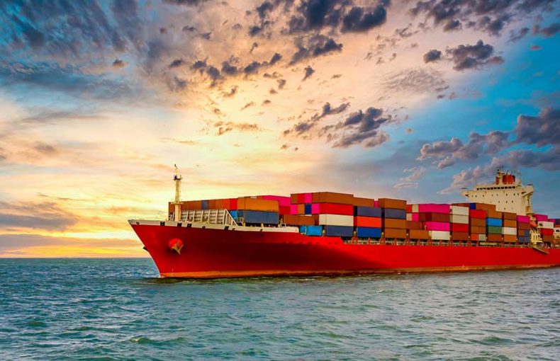
Satellite constellations capture more data over oceans and across remote areas. Open ocean weather data is vital for comprehensive tracking of ships and planes.
Collecting weather data at sea involves aggregating observations from a multitude of sources including buoys, weather balloons, and flyover planes. Each of these present challenges and contribute to a lack of data in open oceans. Satellites, however, continuously scan the earth, including open oceans and remote areas, and are able to collect temperature, humidity, and pressure data using radio-occultation (RO).
Space news reports “In early 2020, radio occultation data helped reduce errors in 24-hour forecasts by about four percent. With the addition of COSMIC-2 and Spire Global data, radio occultation accounted for a forecast error reduction of close to 14%.
This RO data integrated into a forecast model delivers a higher level of accuracy for open ocean forecasts. This improved precision and accuracy enables seafarers to make informed decisions based on weather conditions and can transform decision making for maritime enterprises.
Advanced weather forecasts in open oceans are key when planning shipping routes, monitoring and optimizing vessel performance, emissions/bunker planning, estimating arrival times, scheduling port services, and ensuring crew and cargo safety.
“Assimilating radio occultation data from Spire in addition to the current operational network brings substantial benefits to forecast performance.’’
DR. NEILL E. BOWLER
SENIOR SCIENTIST AT THE UK MET OFFICE
Share on Facebook Share on Twitter Share on LinkedIn

Wave Forecasts
The increased number of severe storms this year highlighted the value of wind and wave data. Wave data is crucial to maritime operators looking to save costs and improve operational efficiency and safety. Waves also push against vessels and create various ship movements that make travel less efficient. Waves can also cause damage to cargo by causing containers to slide around and, in extreme situations, can knock containers overboard.
Areas like the Black Sea or the South China Sea are known for large waves, the type that damage vessels and equipment and pose serious hazards to crew members. Up-to-date ocean/sea state forecasts, including wave forecasts, are being used to adjust routes and can be incorporated into digital e-navigation algorithms to adjust and optimize ship course and speed based on predicted conditions over several hours, days, or weeks into the future.
When it comes to navigation, certain measurements in weather forecasting data can be used to apply small changes to direction and speed to optimize fuel usage and reduce emissions. Wave data has proven particularly useful to train machine learning models, which is why we recently added a dedicated bundle to our offerings. Our Maritime Wave Forecast, provides a specialized wave forecast with detailed wind and swell information.
Port Weather Forecasts – Localized Data for More Precise Decision Making
Data that is focused on a precise location is proving to be beneficial especially around ports. Ports and their surrounding areas can be congested as maritime operations are often delayed due to weather and unexpected traffic.
An international port industry survey in 2018 on “Climate Change Impacts and Adaptations by UNCTAD (United Nations Conference on Trade and Development) found that “70% of respondents confirmed that their port had been impacted by weather or climate related events…with around 45% of the respondents having also experienced some or significant physical damage. The climatic stressors identified by the respondents as responsible for these impacts included… strong winds; heavy precipitation; storm surges; fog; wave penetration; extreme river flows; mean sea level rise; and temperature extremes.”
The survey goes on to reveal important gaps in data that could potentially help mitigate some of the risks and solve these challenges for ports and their customers.
Scheduling a vessel’s arrival at port and organizing port services is a major cost factor for maritime operations, and in maritime a still ship equals lost money.
In a recent article discussing how weather models have improved with RO data, Mike Farrar, Air Force Chief Scientist for Weather Operations notes: The impact on forecasts might be even greater”, he said, with hourly observations “over a regional box.”
Localized forecasts on top of global forecasts could help help operators mitigate disruptions when scheduling not only port services and docking, but also loading cargo that can only be unloaded in dry weather. Planning port arrivals has become a coordinated effort that includes weather forecast information and AIS data.
Ports aren’t the only maritime area that benefit from localized weather forecasts. A growing number of maritime organizations are utilizing optimized weather forecasts to improve operations. Optimized forecasts use a combination of live weather conditions, current and past weather forecasts, and machine-learning techniques to optimize forecasts for locations and solve for specific use cases, such as offshore rigs.
The result of optimized forecasts is a more accurate and customized weather prediction for a specific area of interest. More maritime operations are tapping these customized forecasts to make more accurate data-driven decisions, better predict ETAs and berthing, and save costs related to port services.
A Key Tool for Compliance and Conflict Resolution
Compliance and conflict resolution are two unexpected areas that are using weather forecasts to their advantage. Look for the number of charter companies using weather forecasts to increase in 2021. Claims are often related to speed and fuel consumption and weather data is being used to avoid arbitration and settle or even avoid claims in these areas.
Charterparty agreements typically require the use of a type of data. The specified type of data is what is used to resolve arbitration disputes. A ship’s log is also considered in disputes, but adding a second source of data works to solidify facts that can move an arbitration forward more quickly. Without data, arbitrators are left to rely on English contract law which analyzes if each party delivered what they agreed to.
Weather is often at the center of charterparty agreements and data can help set a clear direction for arbitrators. Defining “good weather” and agreeing on acceptable weather conditions or ocean currents at the beginning of the agreement can help make it clear who is in the right or the wrong.
Weather routing can also be a factor in disputes. Ship captains have ultimate authority to decide the route they take, but routing data with weather as a factor can be helpful when a charter loses money due to poor vessel performance.
Vessel Performance and Carbon-Offsetting
When the IMO passed regulations to improve sustainability in the industry (IMO 2020), bunker planning and carbon emissions became a key issue for maritime operations. Beyond routing choices, weather is the second largest factor impacting fuel economy. Storms have a major impact on fuel economy as vessels sometimes need to take longer routes to get to their destination, but wind and wave data are becoming more valuable to data-savvy maritime operations. Ocean weather conditions impact fuel consumption when high winds and waves are present and a detailed weather forecast helps visualize these conditions allowing vessel owners and operators to make adjustments.
Ocean current information, as well as wind and wave data, can be combined to fuel machine learning models, select the most efficient vessel type, and determine the optimal path and speed to travel. All maritime operations consider weather data prior to a journey, but now enterprises are fine-tuning their operations with help from these added data sources and the results are better fuel economy, improved vessel performance, and greater, crew and cargo safety.
“Spire data improves the short-range forecast fit to radiosonde data. So that means, that gives us clear confidence that Spire’s data is producing a better analysis and better short-range forecasts”
“It’s been a great year for radio occultation […] It’s probably been the best year since 2006.”DR SEAN HEALY
EUROPEAN CENTRE FOR MEDIUM-RANGE WEATHER FORECASTS (ECMWF)
Share on Facebook Share on Twitter Share on LinkedIn

How to Get Started with Weather Data
As the potential for maritime weather forecasts continues to grow, Spire Maritime Weather is expanding its offerings. Solving specific use cases with data is vital for maritime operations to maintain safety standards and improve profitability. We are always interested in discussing industry trends you are seeing.
Our 100+ Spire satellites capture detailed temperature, humidity, and pressure data across the planet – including open oceans and under-observed areas. This satellite radio occultation information creates accurate weather predictions that are critical for reducing risks and maximizing profits. Contact us to learn more about how our data can impact your business.